|
|
|
|
|
This page last updated March 3, 2024 |
Below are historical photos of Austin Highway — including the old highway to New Braunfels — along with a brief history of the route. The photos were sourced from the TxDOT photo library and the San Antonio TxDOT district office.
Locations are given using the present-day roadway names. The photos are arranged generally from south to north. Click on each photo for an enlarged view.
Click here to return to the historical photo galleries page.
|
ADVERTISEMENT |
Route history


This road has an extensive history and has continuously been one of the most important and busiest roads in the state. Parts of this route were on the El Camino Real that ran from Mexico via San Antonio to Nacogdoches, Texas and on to Natchitoches, Louisiana. Later, most of this road was part of the Meridian Highway, a network of north-south roads stretching from Mexico and the Gulf of Mexico to Canada delineated around 1910.
Around 1915, the US Post Office appropriated money to improve the road between San Antonio and Austin in order to speed mail delivery. The resulting 16-foot wide, macadam "post road" was considered the finest road in the state for several years. You can still find segments of this route named "Post Road" in New Braunfels and San Marcos.
When the state highway system was first developed in 1917, this road was designated State Highway 2. With the implementation of the US Highway System in 1927, it was numbered US 81. Eventually, this corridor was replaced with I‑35.
In San Antonio, the early routes to New Braunfels took several paths through the city. The first route made its way from downtown to New Braunfels Ave., then through and around Ft. Sam Houston along present-day Harry Wurzbach Rd. and Corinne Dr. to Austin Hwy., then along the present-day Randolph Blvd. and I‑35 corridors. In 1934, a new road connecting Austin Hwy. at Salado Creek to Broadway in Alamo Heights opened, and US 81 was rerouted from downtown up Broadway. That route was replaced by I‑35 in 1962 and was renumbered as Loop 368, although it was signed as Business US 81 until around 1991.
A more detailed route history is available here.
|
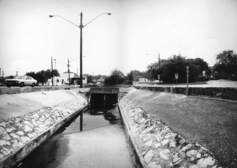
Austin Highway at Broadway looking southwest (ca. 1980) This drainage ditch has since been covered over. (TxDOT) |
|
Austin Highway at Broadway looking southwest (ca. 1980) This drainage ditch has since been covered over. (TxDOT) |
|
|
|
|
|
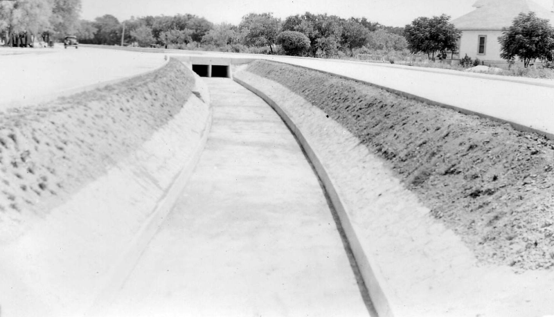
Austin Highway in Alamo Heights (ca. 1935) This seems to be just east of Broadway looking northeast. This was shortly before this road opened to provide a new route for US 81 and SH 2 to bypass the route through Fort Sam Houston. (TxDOT) |
|
Austin Highway in Alamo Heights (ca. 1935) This seems to be just east of Broadway looking northeast. This was shortly before this road opened to provide a new route for US 81 and SH 2 to bypass the route through Fort Sam Houston. (TxDOT) |
|
|
|
|
|
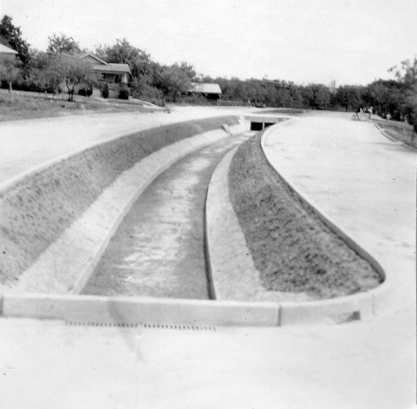
Austin Highway in Alamo Heights (ca. 1935) This could be at Routt St. looking northeast. It appears the road ends a couple of blocks ahead — that might be at New Braunfels Ave. and could be because this section was completed before the section from there to Salado Creek. (TxDOT) |
|
Austin Highway in Alamo Heights (ca. 1935) This could be at Routt St. looking northeast. It appears the road ends a couple of blocks ahead — that might be at New Braunfels Ave. and could be because this section was completed before the section from there to Salado Creek. (TxDOT) |
|
|
|
|
|
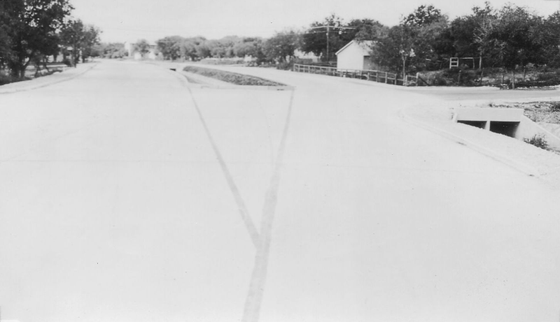
Austin Highway in Alamo Heights (ca. 1935) This could be at New Braunfels Ave. looking west after the section from there to Salado Creek was completed. (TxDOT) |
|
Austin Highway in Alamo Heights (ca. 1935) This could be at New Braunfels Ave. looking west after the section from there to Salado Creek was completed. (TxDOT) |
|
|
|
|
|
Austin Highway at Salado Creek looking northeast (1919) This is where the original SH 2 (and later US 81) curved onto today's Corinne Dr. The concrete low-water bridge near the middle of the photo is still in existance today below the current Austin Highway bridge. (TxDOT) |
|
Austin Highway at Salado Creek looking northeast (1919) This is where the original SH 2 (and later US 81) curved onto today's Corinne Dr. The concrete low-water bridge near the middle of the photo is still in existance today below the current Austin Highway bridge. (TxDOT) |
|
|
|
|
|
SH 2 in Bexar County (ca. 1925) This is likely on today's Sherri Ann Rd. near Crestway looking southwest at the old town of Fratt. (TxDOT) |
|
SH 2 in Bexar County (ca. 1925) This is likely on today's Sherri Ann Rd. near Crestway looking southwest at the old town of Fratt. (TxDOT) |
|
|
|
|
|
Old Austin Road at Cibolo Creek in Selma looking west (1919) This is about where the northbound I-35 access road is today. The photo shows an improvised repair after flooding undermined the roadway. (TxDOT) |
|
Old Austin Road at Cibolo Creek in Selma looking west (1919) This is about where the northbound I-35 access road is today. The photo shows an improvised repair after flooding undermined the roadway. (TxDOT) |
|
|
|
|

|
New US 81 bridge over Cibolo Creek in Selma looking northwest (ca. 1935) This is the location of the I-35 bridge today. The old low-water bridge can be seen in the foreground. (TxDOT) |
|
New US 81 bridge over Cibolo Creek in Selma looking northwest (ca. 1935) This is the location of the I-35 bridge today. The old low-water bridge can be seen in the foreground. (TxDOT) |
|
|
|
|
|
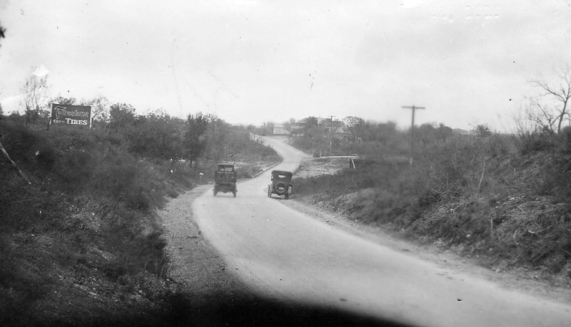
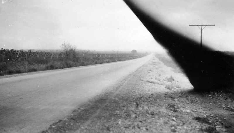
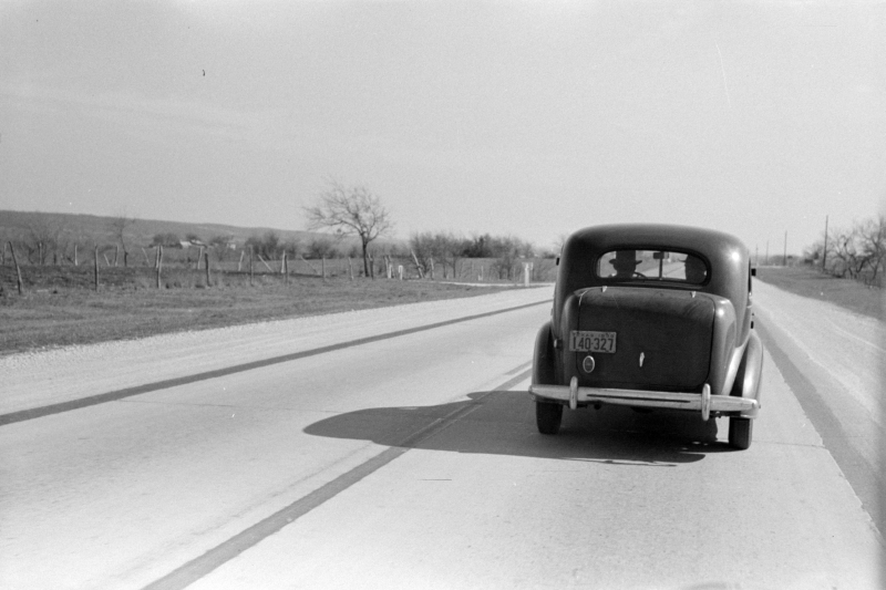
Old Austin Road between San Antonio and New Braunfels (ca. 1935) Exact location unknown. (TxDOT) |
|
Old Austin Road between San Antonio and New Braunfels (ca. 1935) Exact location unknown. (TxDOT) |
|
|
|
|
|
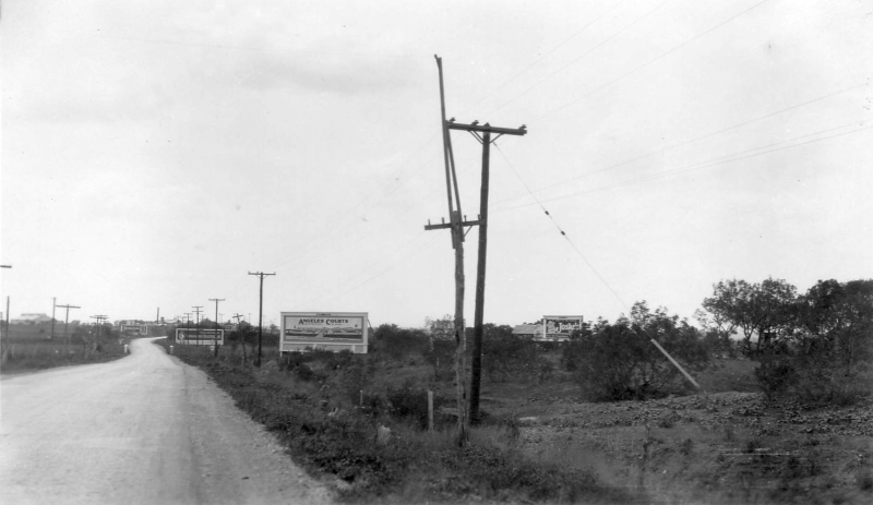
Old Austin Road between San Antonio and New Braunfels (ca. 1935) Exact location unknown. (TxDOT) |
|
Old Austin Road between San Antonio and New Braunfels (ca. 1935) Exact location unknown. (TxDOT) |
|
|
|
|

|
Old Austin Road between San Antonio and New Braunfels (ca. 1935) Exact location unknown. (TxDOT) |
|
Old Austin Road between San Antonio and New Braunfels (ca. 1935) Exact location unknown. (TxDOT) |
|
|
|
|
|
Old Austin Road (1919) The original caption described this as near the southern end. Based on that, this is almost certainly somewhere in Bexar County. (TxDOT) |
|
Old Austin Road (1919) The original caption described this as near the southern end. Based on that, this is almost certainly somewhere in Bexar County. (TxDOT) |
|
|
|
|
|
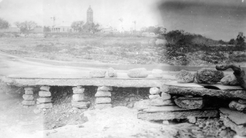
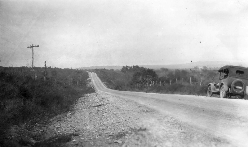
Old Austin Road (1919) The original caption described this as "midway", presumably midway between San Antonio and Austin. (TxDOT) |
|
Old Austin Road (1919) The original caption described this as "midway", presumably midway between San Antonio and Austin. (TxDOT) |
|
|
|
|
|
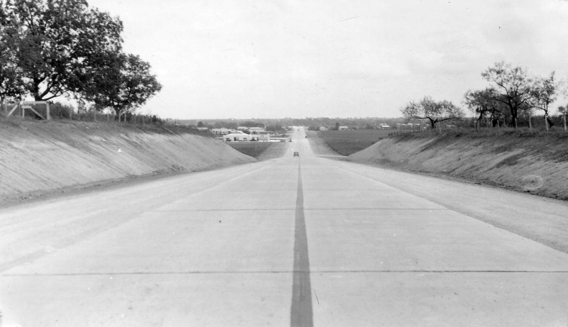
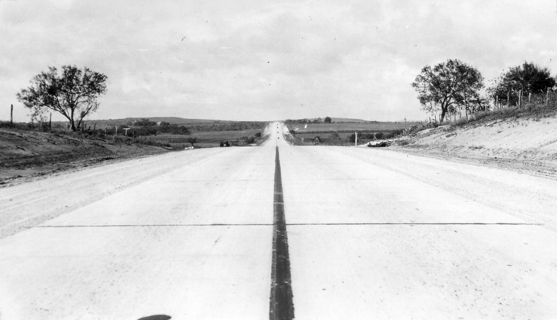
Old Austin Road (1940) The caption for this photo was "scene on the highway north of San Antonio"; given the terrain, this would seem to be on the Austin Road between San Antonio and New Braunfels. (Library of Congress) |
|
Old Austin Road (1940) The caption for this photo was "scene on the highway north of San Antonio"; given the terrain, this would seem to be on the Austin Road between San Antonio and New Braunfels. (Library of Congress) |
|
|
|
|
|
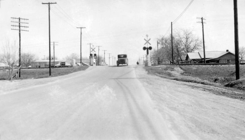
Seguin Ave railroad crossing in New Braunfels looking southeast (ca. 1930) This photo was before an underpass was built there. (TxDOT) |
|
Seguin Ave railroad crossing in New Braunfels looking southeast (ca. 1930) This photo was before an underpass was built there. (TxDOT) |
|
|
|
|

|
Seguin Ave railroad crossing in New Braunfels looking northwest (ca. 1936) This photo shows the completed underpass. (TxDOT) |
|
Seguin Ave railroad crossing in New Braunfels looking northwest (ca. 1936) This photo shows the completed underpass. (TxDOT) |
|
|
|
|
|
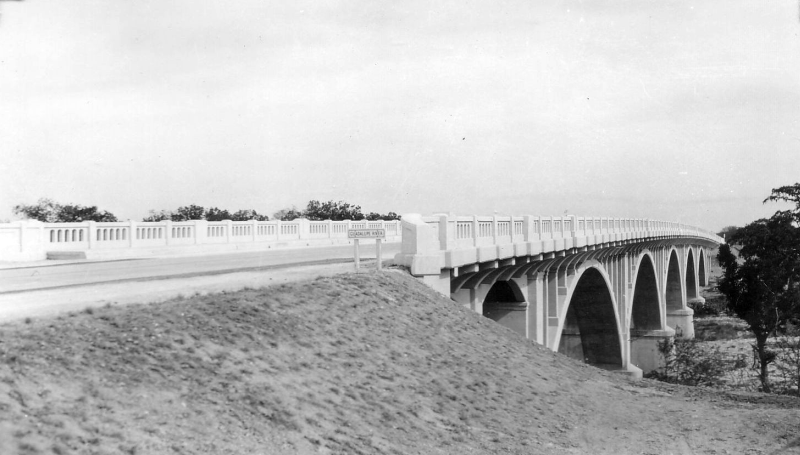
Business 35 bridge over the Guadalupe River in New Braunfels looking east-northeast (ca. 1934) This photo was taken just after the bridge was completed. It replaced the Faust St. bridge as the route for US 81. (TxDOT) |
|
Business 35 bridge over the Guadalupe River in New Braunfels looking east-northeast (ca. 1934) This photo was taken just after the bridge was completed. It replaced the Faust St. bridge as the route for US 81. (TxDOT) |
|
|
|
|
|
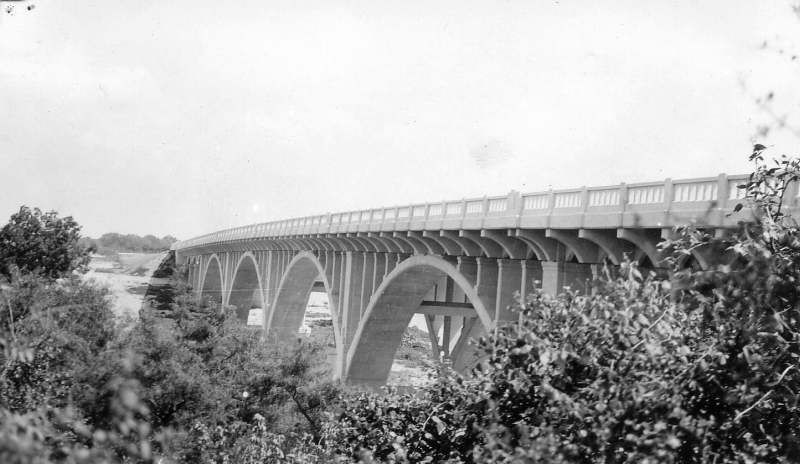
Business 35 bridge over the Guadalupe River in New Braunfels looking east-southeast (ca. 1934) (TxDOT) |
|
Business 35 bridge over the Guadalupe River in New Braunfels looking east-southeast (ca. 1934) (TxDOT) |
|
|
|
|