|
|
|
|
|
This page last updated March 6, 2024 |
Below are historical photos of Loop 410 along with a brief history of the route. The photos were sourced from the TxDOT photo library, the San Antonio TxDOT district office, and the author of this website.
Locations are given using the present-day roadway names. The photos are arranged generally counter-clockwise from Fredericksburg Road around the South Side and back to I‑35 North near FM 78. Click on each photo for an enlarged view.
For the rest of Loop 410, see Part 1.
Click here to return to the historical photo galleries page.
|
ADVERTISEMENT |
Route history


In 1932, engineer Edwin Arneson released his plan for local state highways which included the first proposal for a loop around San Antonio. The state established the first sections of Loop 13 on the South Side in the late '30s to connect Kelly Field and Brooks Field; that road is now Military Dr.
The first section of Loop 13 on the North Side was designated around 1950 and was a two-lane road from San Pedro Ave. east to US 81 (Austin Hwy.) that mostly appropriated existing roadways — namely, part of the Harry Wurzbach Military Hwy. and Zercher Rd. Around 1952, Loop 13 was extended north from FM 78 to US 81.
Work started on the section from US 90 West northward and eastward to NW Military Hwy. in the mid '50s with the first section, from Culebra Rd. to Bandera Rd., opening in 1956, and entire northwestern arc open by 1958. Work then progressed southward from US 90 to I‑35 and eastward from NW Military Hwy. to Wetmore Rd. (upgrading the existing two-lane roadway there) with those segments opening between 1959 and 1961.
In the early '60s, work to complete the upgrade of the existing road east of Wetmore Rd. to I‑35 was completed as was construction of the route between I‑35 South to near I‑37 and from I‑35 at Rittiman Rd. south to New Sulphur Springs Rd. The section of Loop 13 between Rittiman Rd. and Randolph Blvd. was upgraded to a freeway and incorporated into I‑35 during this period as well. The final section, from New Sulphur Springs Rd. to S Presa St. was opened with a ceremony in early 1966.
Interstate 410 was designated in 1959, and the recently-built sections of Loop 13 on the Northwest Side were renumbered accordingly. However, the section on the North Side between I‑10 and I‑35 was actually not included in the original Interstate 410 designation and therefore was designated and signed as State Loop 410 until it was finally officially designated Interstate 410 in July 1969. It was reported that the Interstate designation was delayed because there was a disagreement between the state and federal highway officials over that section's design.
More details on the history of Loop 410 is available here.

|
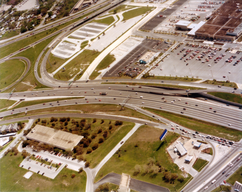
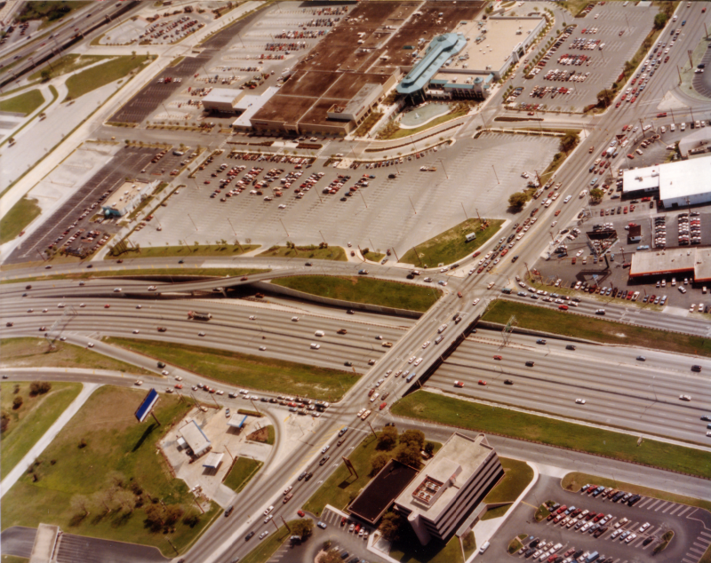
Loop 410 at I‑10 looking southeast (ca. 1986) The large parking lot next to I‑10 near the top center is the fomer VIA Park & Ride; the new one is under construction at the top right. The building with the saw-tooth roof near the right center is the old Wonder movie theater which was torn-down around 1987. (TxDOT) |
|
|
Loop 410 at I‑10 looking southeast (ca. 1986) The large parking lot next to I‑10 near the top center is the fomer VIA Park & Ride; the new one is under construction at the top right. The building with the saw-tooth roof near the right center is the old Wonder movie theater which was torn-down around 1987. (TxDOT) |
||
|
|
||
|
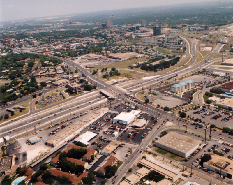
Loop 410 at Fredericksburg Rd. looking southeast (ca. 1992) (TxDOT) |
|
|
Loop 410 at Fredericksburg Rd. looking southeast (ca. 1992) (TxDOT) |
||
|
|
||
|
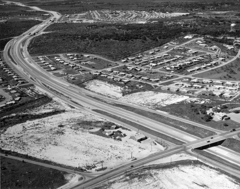
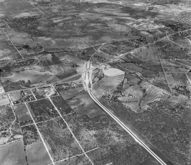
Loop 410 at Fredericksburg Rd. looking northwest (ca. 1960) In the immediate foreground, work to clear the land for the future Wonderland Mall had started. (TxDOT) |
|
|
Loop 410 at Fredericksburg Rd. looking northwest (ca. 1960) In the immediate foreground, work to clear the land for the future Wonderland Mall had started. (TxDOT) |
||
|
|
||
|
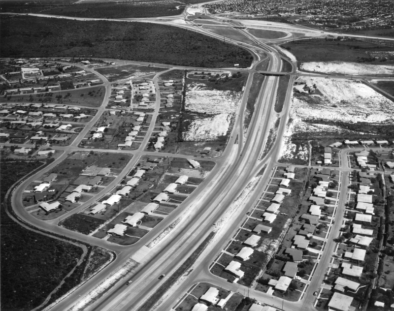
Loop 410 at Fredericksburg Rd. looking east (ca. 1960) The I‑10/Loop 410 interchange is at the top center. (TxDOT) |
|
|
Loop 410 at Fredericksburg Rd. looking east (ca. 1960) The I‑10/Loop 410 interchange is at the top center. (TxDOT) |
||
|
|
||
|
Loop 410 at Fredericksburg Rd. (ca. 1961) (TxDOT) |
|
|
Loop 410 at Fredericksburg Rd. (ca. 1961) (TxDOT) |
||
|
|
||

|
Loop 410 at Fredericksburg Rd. looking south (ca. 1986) The Palm Pavilion expansion at Wonderland Mall (then Crossroads Mall) was underway. (TxDOT) |
|
|
Loop 410 at Fredericksburg Rd. looking south (ca. 1986) The Palm Pavilion expansion at Wonderland Mall (then Crossroads Mall) was underway. (TxDOT) |
||
|
|
||
|
Loop 410 at Fredericksburg Rd. looking southeast (ca. 1992) (TxDOT) |
|
|
Loop 410 at Fredericksburg Rd. looking southeast (ca. 1992) (TxDOT) |
||
|
|
||
|
Loop 410 at Fredericksburg Rd. looking northeast (ca. 1997) (TxDOT) |
|
|
Loop 410 at Fredericksburg Rd. looking northeast (ca. 1997) (TxDOT) |
||
|
|
||
|
Loop 410 at Fredericksburg Rd. looking southwest (ca. 1960) (TxDOT) |
|
|
Loop 410 at Fredericksburg Rd. looking southwest (ca. 1960) (TxDOT) |
||
|
|
||
|
Loop 410 at Fredericksburg Rd. looking west (ca. 1960) (TxDOT) |
|
|
Loop 410 at Fredericksburg Rd. looking west (ca. 1960) (TxDOT) |
||
|
|
||
|
Loop 410 at Fredericksburg Rd. looking west (ca. 1990) (TxDOT) |
|
|
Loop 410 at Fredericksburg Rd. looking west (ca. 1990) (TxDOT) |
||
|
|
||
|
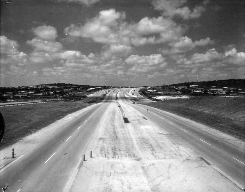
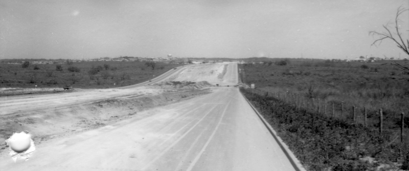
Loop 410 near Fredericksburg Rd. looking west (ca. 1960) (TxDOT) |
|
|
Loop 410 near Fredericksburg Rd. looking west (ca. 1960) (TxDOT) |
||
|
|
||

|
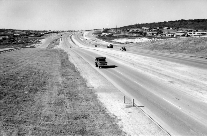
Loop 410 near Babcock Rd. looking east (ca. 1960) (TxDOT) |
|
|
Loop 410 near Babcock Rd. looking east (ca. 1960) (TxDOT) |
||
|
|
||
|
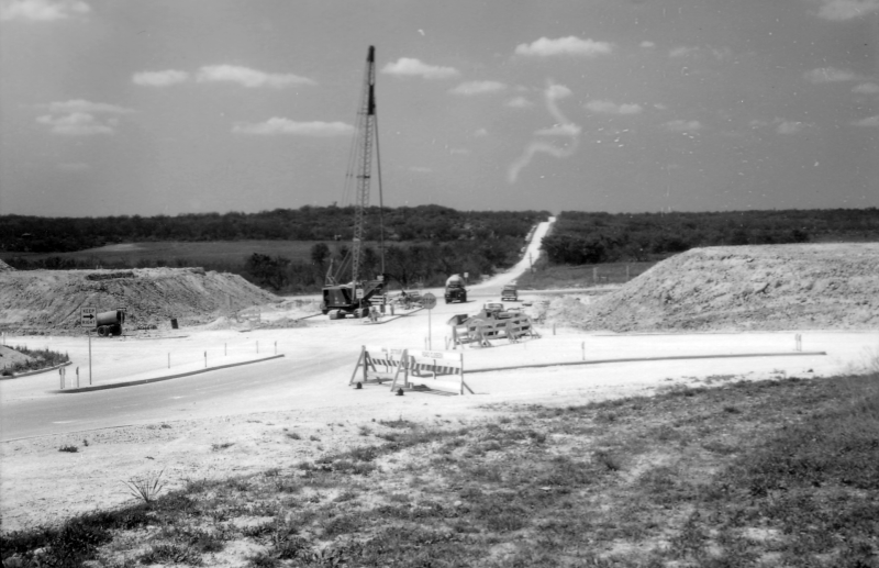
Loop 410 at Babcock Rd. looking east (ca. 1959) (TxDOT) |
|
|
Loop 410 at Babcock Rd. looking east (ca. 1959) (TxDOT) |
||
|
|
||
|
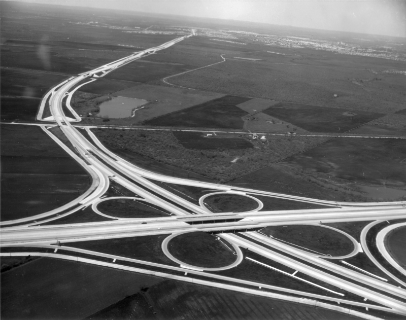
Loop 410 at Callaghan Rd./Babcock Rd. (1961) This photo is oriented with north at the bottom. Callaghan is the road running from the bottom left to the top right. (TxDOT) |
|
|
Loop 410 at Callaghan Rd./Babcock Rd. (1961) This photo is oriented with north at the bottom. Callaghan is the road running from the bottom left to the top right. (TxDOT) |
||
|
|
||
|
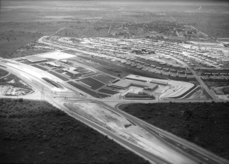
Loop 410 at Callaghan Rd. (1959) The campus of buildings in the center of the photo is TxDOT's San Antonio district headquarters, which had just been completed at this time. (TxDOT) |
|
|
Loop 410 at Callaghan Rd. (1959) The campus of buildings in the center of the photo is TxDOT's San Antonio district headquarters, which had just been completed at this time. (TxDOT) |
||
|
|
||
|
Loop 410 at Callaghan Rd. looking east (1959) Traffic is using what's now the westbound frontage road. (TxDOT) |
|
|
Loop 410 at Callaghan Rd. looking east (1959) Traffic is using what's now the westbound frontage road. (TxDOT) |
||
|
|
||
|
Loop 410 at Callaghan Rd. looking northwest (1959) (TxDOT) |
|
|
Loop 410 at Callaghan Rd. looking northwest (1959) (TxDOT) |
||
|
|
||

|
Loop 410 at Callaghan Rd. looking southeast (1959) Downtown is visible in the distance. (TxDOT) |
|
|
Loop 410 at Callaghan Rd. looking southeast (1959) Downtown is visible in the distance. (TxDOT) |
||
|
|
||
|
Loop 410 at Callaghan Rd. looking south (1959) (TxDOT) |
|
|
Loop 410 at Callaghan Rd. looking south (1959) (TxDOT) |
||
|
|
||
|
Loop 410 at Callaghan Rd. looking west (1959) (TxDOT) |
|
|
Loop 410 at Callaghan Rd. looking west (1959) (TxDOT) |
||
|
|
||

|
Loop 410 at Callaghan Rd. looking northwest (ca. 1960) Note the highway route sign in the center of the photo; it reads "Loop 13". (TxDOT) |
|
|
Loop 410 at Callaghan Rd. looking northwest (ca. 1960) Note the highway route sign in the center of the photo; it reads "Loop 13". (TxDOT) |
||
|
|
||
|
Loop 410 at Callaghan Rd. looking northwest (1961) The large open area at the top of the photo with the two roads intersecting in the middle of it is now the Medical Center; that intersection is the Medical Dr./Wurzbach Rd. intersection. The large white area near the top center is the construction site for what would become Methodist Hospital. (TxDOT) |
|
|
Loop 410 at Callaghan Rd. looking northwest (1961) The large open area at the top of the photo with the two roads intersecting in the middle of it is now the Medical Center; that intersection is the Medical Dr./Wurzbach Rd. intersection. The large white area near the top center is the construction site for what would become Methodist Hospital. (TxDOT) |
||
|
|
||
|
Loop 410 at Callaghan Rd. looking southwest (ca. 1964) (TxDOT) |
|
|
Loop 410 at Callaghan Rd. looking southwest (ca. 1964) (TxDOT) |
||
|
|
||
|
Loop 410 at Callaghan Rd. looking southwest (ca. 1965) (TxDOT) |
|
|
Loop 410 at Callaghan Rd. looking southwest (ca. 1965) (TxDOT) |
||
|
|
||
|
Loop 410 at Evers Rd. looking east (1959) (TxDOT) |
|
|
Loop 410 at Evers Rd. looking east (1959) (TxDOT) |
||
|
|
||
|
Loop 410 at Evers Rd. looking northwest (1959) (TxDOT) |
|
|
Loop 410 at Evers Rd. looking northwest (1959) (TxDOT) |
||
|
|
||
|
Loop 410 at Evers Rd. looking east-northeast (1959) (TxDOT) |
|
|
Loop 410 at Evers Rd. looking east-northeast (1959) (TxDOT) |
||
|
|
||
|
Loop 410 at Evers Rd. (1961) This photo is oriented with north at the bottom. The building at the left-center is Pat Neff Middle School. Bandera Road cuts diagonally across the top right. (TxDOT) |
|
|
Loop 410 at Evers Rd. (1961) This photo is oriented with north at the bottom. The building at the left-center is Pat Neff Middle School. Bandera Road cuts diagonally across the top right. (TxDOT) |
||
|
|
||
|
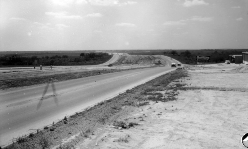
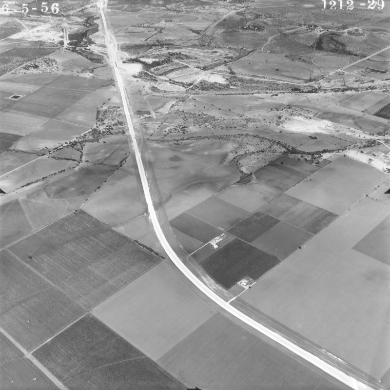
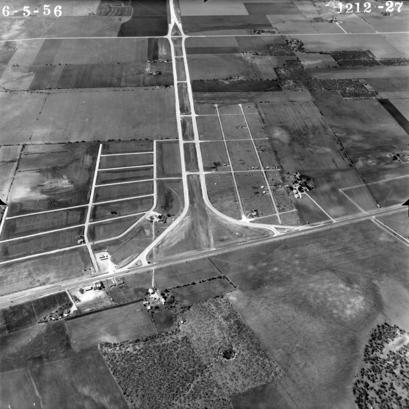
Loop 410 at Bandera Rd. looking northeast (1956) Bandera is the road running roughly left to right across the center of the photo. Loop 410 (then Loop 13) was under construction from Bandera south at this time; this was the first section of Loop 410 to be built. (TxDOT/Jack Amann) |
|
|
Loop 410 at Bandera Rd. looking northeast (1956) Bandera is the road running roughly left to right across the center of the photo. Loop 410 (then Loop 13) was under construction from Bandera south at this time; this was the first section of Loop 410 to be built. (TxDOT/Jack Amann) |
||
|
|
||
|
Loop 410 at Bandera Rd. looking east (1958) (TxDOT/Les Guthrie) |
|
|
Loop 410 at Bandera Rd. looking east (1958) (TxDOT/Les Guthrie) |
||
|
|
||

|
Loop 410 at Bandera Rd. looking northeast (ca. 1959) (TxDOT) |
|
|
Loop 410 at Bandera Rd. looking northeast (ca. 1959) (TxDOT) |
||
|
|
||
|
Loop 410 at Bandera Rd. (1961) This photo is oriented with north at the bottom. The large tapered white area near the center is the old Bandera drive-in theater. The road that branches off of Bandera at Wurzbach (lower right side of the photo) and connects to Loop 410 was the original path of Bandera Rd. (TxDOT) |
|
|
Loop 410 at Bandera Rd. (1961) This photo is oriented with north at the bottom. The large tapered white area near the center is the old Bandera drive-in theater. The road that branches off of Bandera at Wurzbach (lower right side of the photo) and connects to Loop 410 was the original path of Bandera Rd. (TxDOT) |
||
|
|
||
|
Loop 410 at Bandera Rd. looking east (ca. 1998) (TxDOT) |
|
|
Loop 410 at Bandera Rd. looking east (ca. 1998) (TxDOT) |
||
|
|
||

|
Loop 410 at Bandera Rd. looking southwest (2001) The large parking lot on the southwest corner of Bandera and Loop 410 is a former VIA Park & Ride; it was removed sometime in the mid aughts. (TxDOT) |
|
|
Loop 410 at Bandera Rd. looking southwest (2001) The large parking lot on the southwest corner of Bandera and Loop 410 is a former VIA Park & Ride; it was removed sometime in the mid aughts. (TxDOT) |
||
|
|
||
|
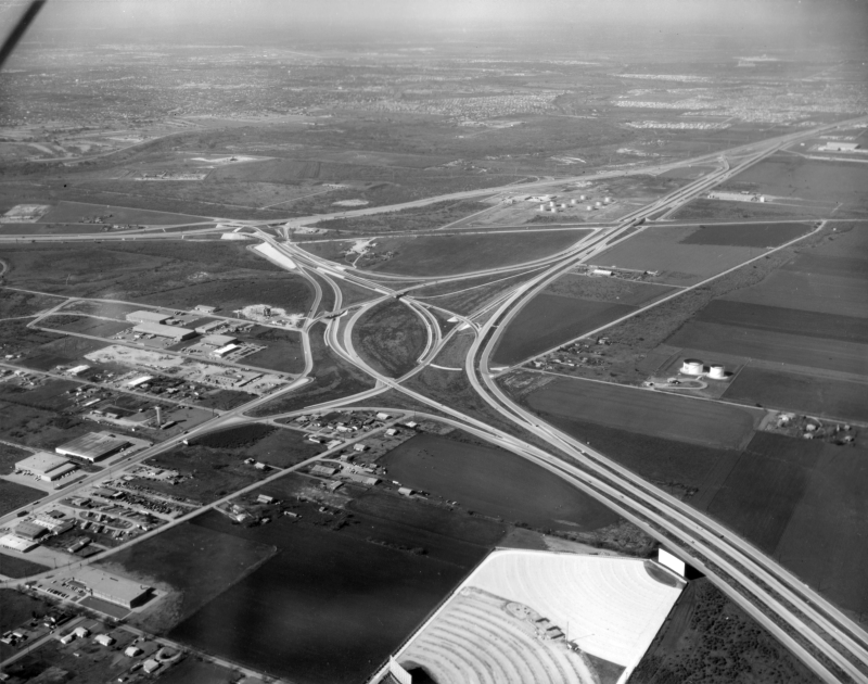
Loop 410 at SH 151 looking northeast (1956) This was, of course, long before SH 151 was built; it now crosses just above the curve in Loop 410 (then Loop 13) in the bottom-center. The interchange at Culebra Rd. is visible near the top, and the interchange at Ingram Rd. at the very top. (TxDOT/Jack Amann) |
|
|
Loop 410 at SH 151 looking northeast (1956) This was, of course, long before SH 151 was built; it now crosses just above the curve in Loop 410 (then Loop 13) in the bottom-center. The interchange at Culebra Rd. is visible near the top, and the interchange at Ingram Rd. at the very top. (TxDOT/Jack Amann) |
||
|
|
||
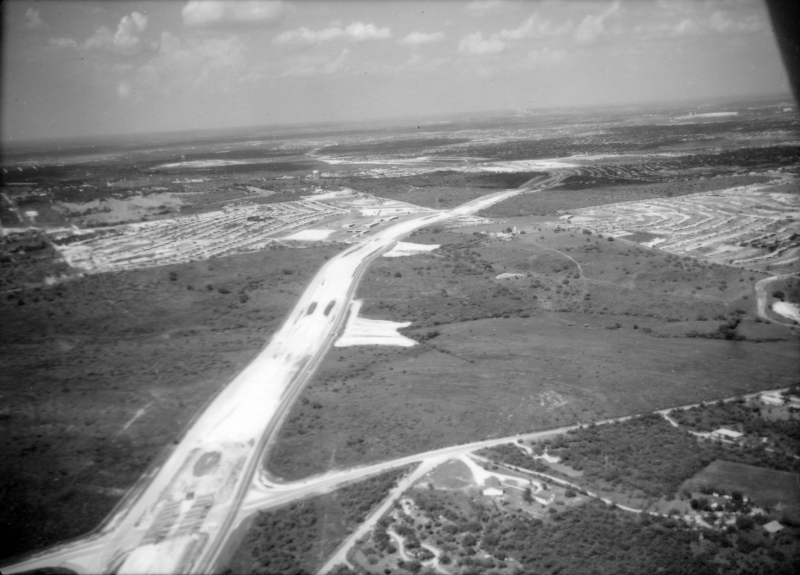
|
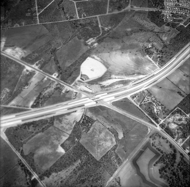
Loop 410 at SH 151 looking north-northwest (1988) This was just before the section of 151 inside Loop 410 opened. (TxDOT) |
|
|
Loop 410 at SH 151 looking north-northwest (1988) This was just before the section of 151 inside Loop 410 opened. (TxDOT) |
||
|
|
||
|
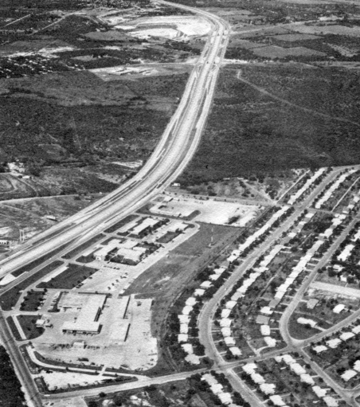
Loop 410 at SH 151 looking northeast (ca. 1998) (TxDOT) |
|
|
Loop 410 at SH 151 looking northeast (ca. 1998) (TxDOT) |
||
|
|
||
|
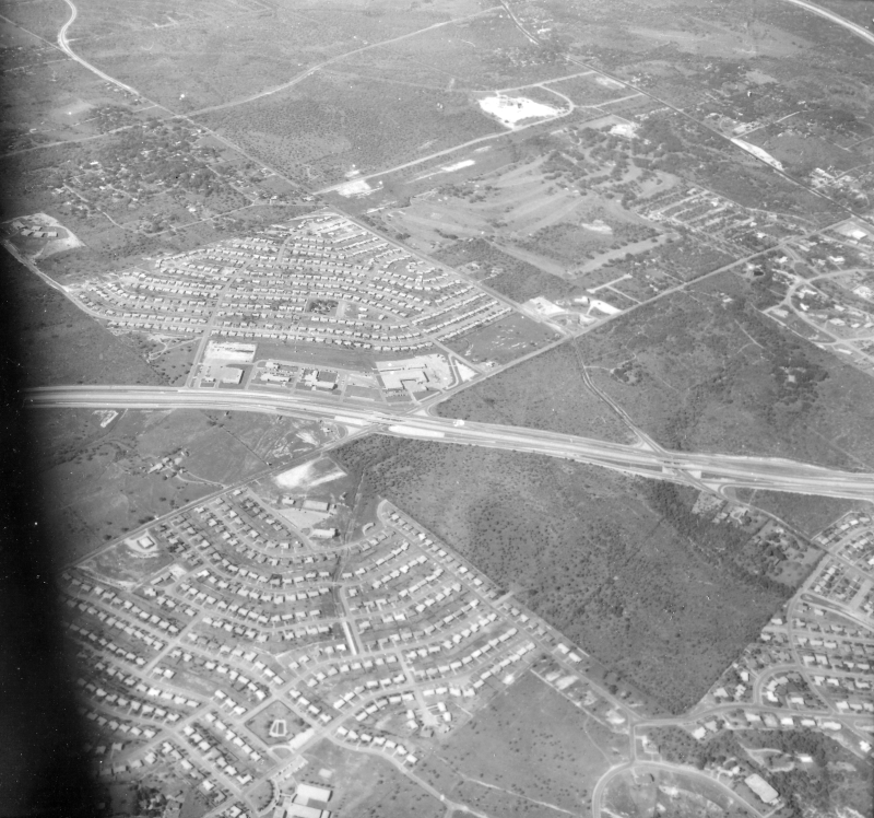
Loop 410 at SH 151 looking northwest (ca. 1998) (TxDOT) |
|
|
Loop 410 at SH 151 looking northwest (ca. 1998) (TxDOT) |
||
|
|
||

|
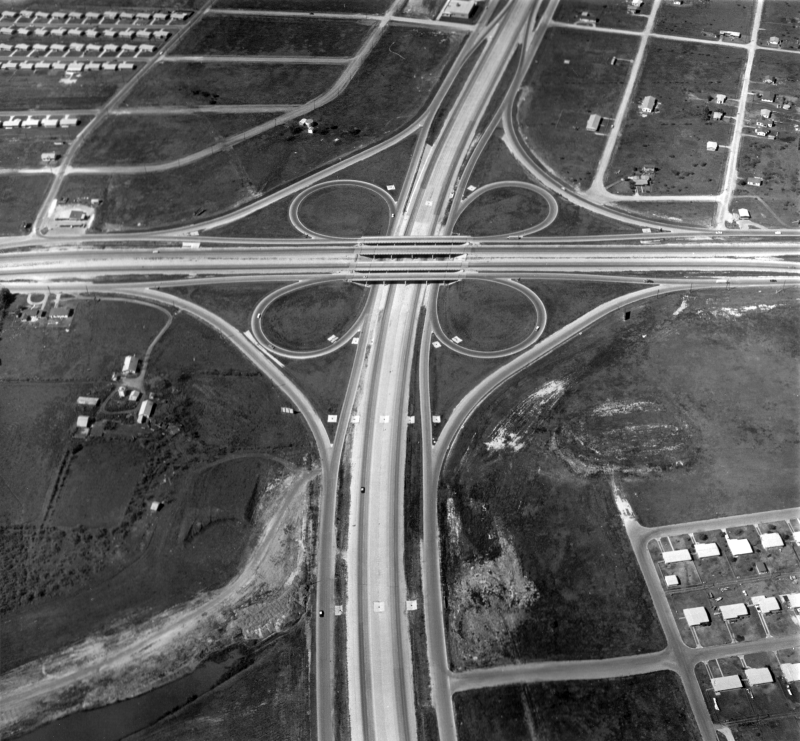
Loop 410 at SH 151 looking southeast (2003) (Brian Purcell) |
|
|
Loop 410 at SH 151 looking southeast (2003) (Brian Purcell) |
||
|
|
||
|
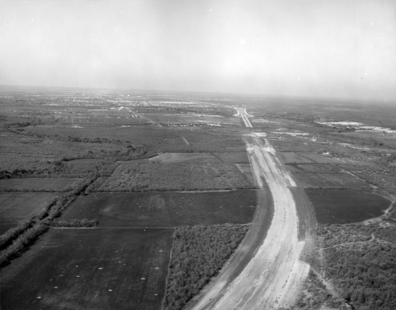
Loop 410 at US 90 West looking north (1956) Marbach Road crosses across the top of the photo. (TxDOT/Jack Amann) |
|
|
Loop 410 at US 90 West looking north (1956) Marbach Road crosses across the top of the photo. (TxDOT/Jack Amann) |
||
|
|
||
|
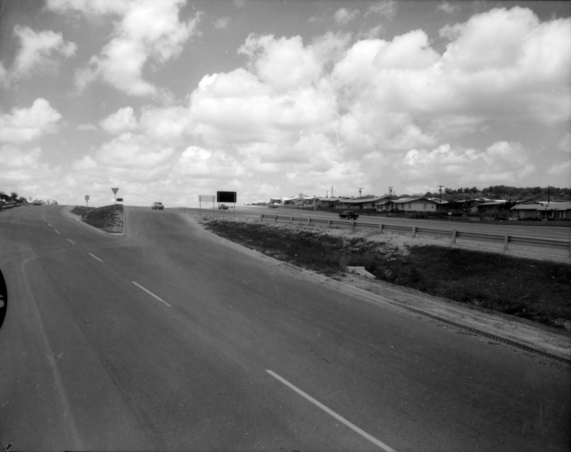
Loop 410 at US 90 West looking north (1961) (TxDOT) |
|
|
Loop 410 at US 90 West looking north (1961) (TxDOT) |
||
|
|
||
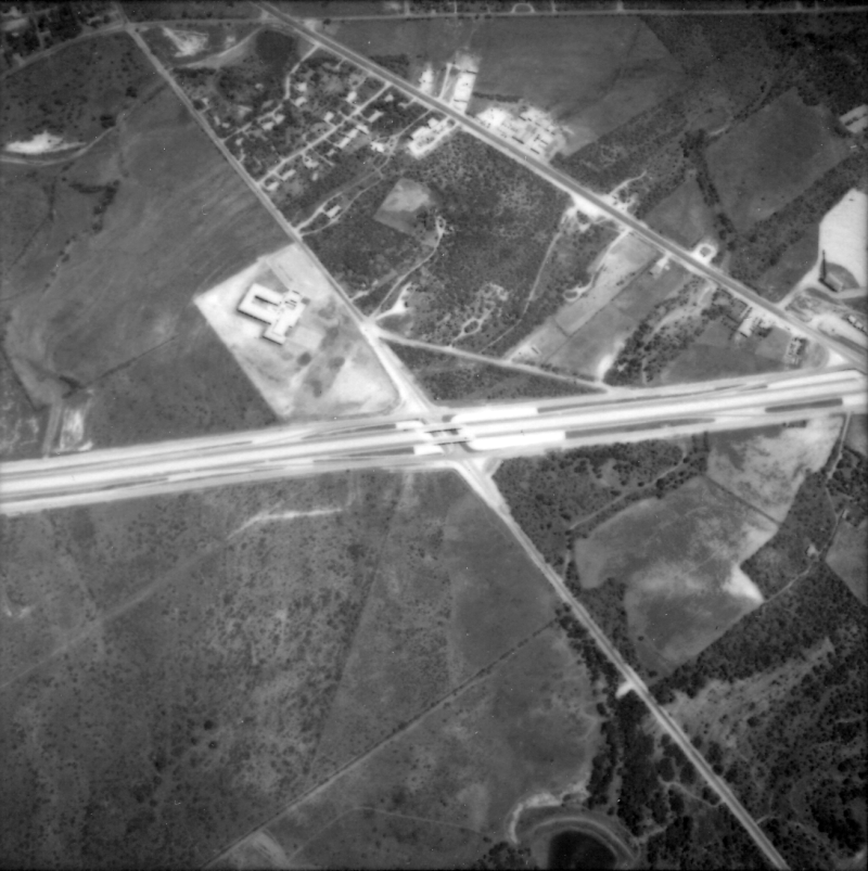
|
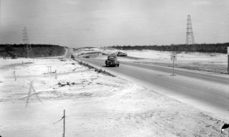
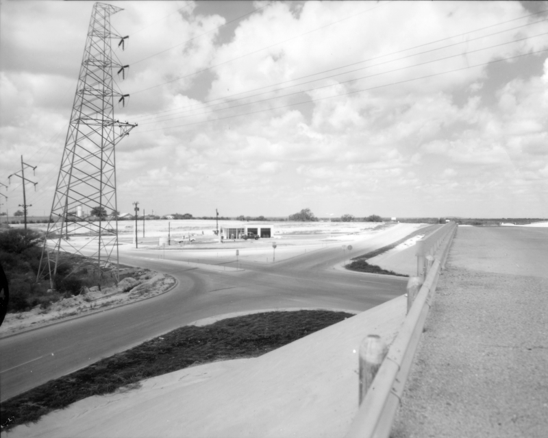
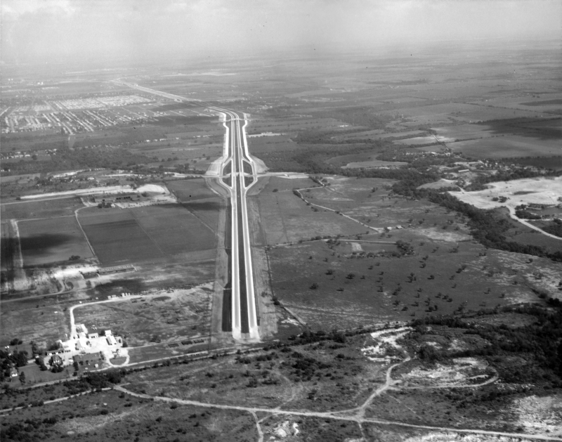
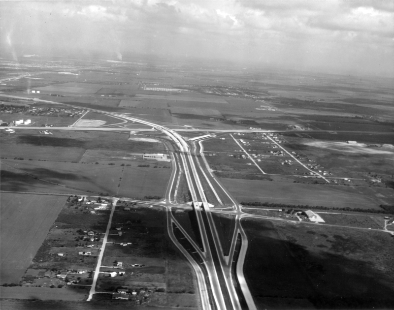
Loop 410 at Medina Base Rd. looking northwest (1961) If you look closely, you'll notice there was no access to Medina Base Road from Loop 410 at this time. Medina Base Road was built to provide a direct connection from Kelly AFB to Medina Base and was used to transport weapons that were stored at Medina to and from the airfield at Kelly. Given this traffic, an intersection at Loop 410 may have been considered unnecessary or undesired. An interchange was finally built in the early '70s. (TxDOT) |
|
|
Loop 410 at Medina Base Rd. looking northwest (1961) If you look closely, you'll notice there was no access to Medina Base Road from Loop 410 at this time. Medina Base Road was built to provide a direct connection from Kelly AFB to Medina Base and was used to transport weapons that were stored at Medina to and from the airfield at Kelly. Given this traffic, an intersection at Loop 410 may have been considered unnecessary or undesired. An interchange was finally built in the early '70s. (TxDOT) |
||
|
|
||
|
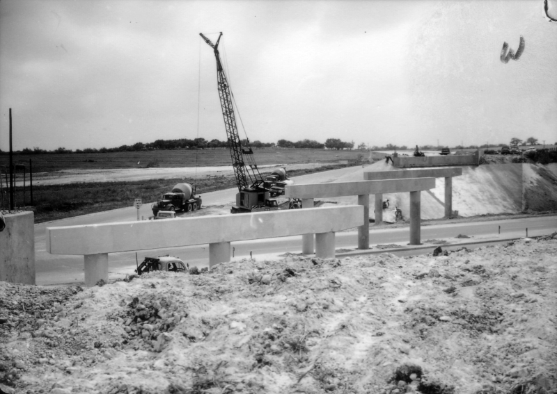
Loop 410 at I‑35 South looking east (ca. 1965) (TxDOT) |
|
|
Loop 410 at I‑35 South looking east (ca. 1965) (TxDOT) |
||
|
|
||
|
Loop 410 at I‑35 South looking northwest (ca. 1965) (TxDOT) |
|
|
Loop 410 at I‑35 South looking northwest (ca. 1965) (TxDOT) |
||
|
|
||

|
Loop 410 at Goliad Rd. (near I‑37) looking northeast (ca. 2001) (Brian Purcell) |
|
|
Loop 410 at Goliad Rd. (near I‑37) looking northeast (ca. 2001) (Brian Purcell) |
||
|
|
||
|
Loop 410 at Salado Creek (near I‑37) looking southwest (ca. 2001) (Brian Purcell) |
|
|
Loop 410 at Salado Creek (near I‑37) looking southwest (ca. 2001) (Brian Purcell) |
||
|
|
||
|
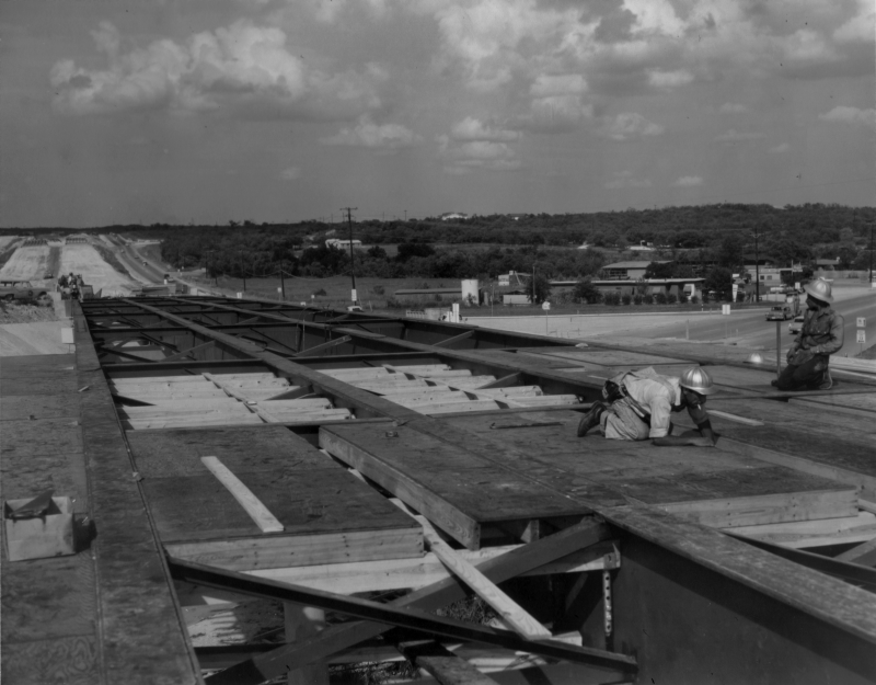
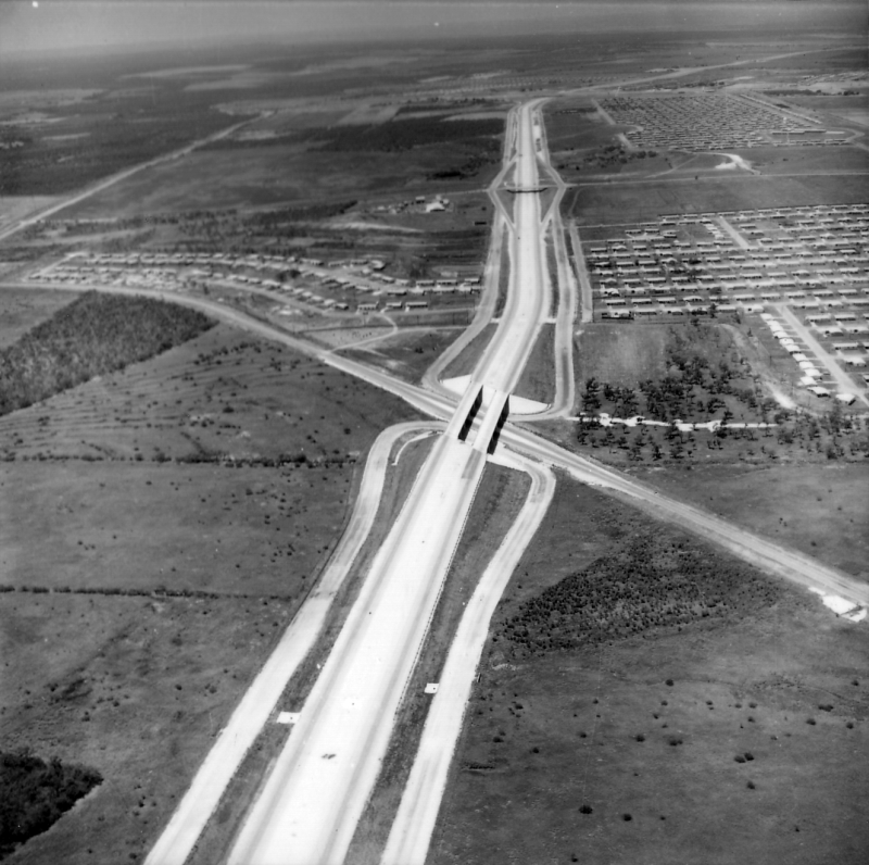
Loop 410 near I‑37 looking north (ca. 1965) This was the last section of Loop 410 to be built; it opened in 1966. (TxDOT) |
|
|
Loop 410 near I‑37 looking north (ca. 1965) This was the last section of Loop 410 to be built; it opened in 1966. (TxDOT) |
||
|
|
||
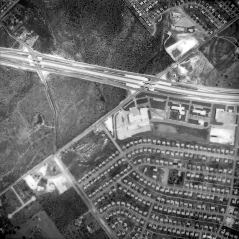
|
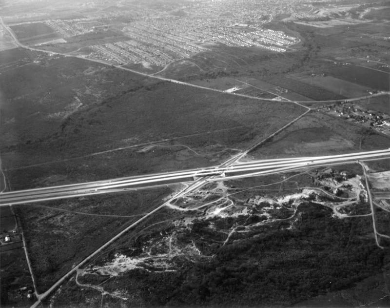
Loop 410 at S WW White Rd. looking northeast (ca. 1963) This photo was taken over S WW White Road. The first interchange visible is Loop 410 at Southcross Blvd./New Sulfur Springs Rd. The section south of here would not be built until 1966. (TxDOT) |
|
|
Loop 410 at S WW White Rd. looking northeast (ca. 1963) This photo was taken over S WW White Road. The first interchange visible is Loop 410 at Southcross Blvd./New Sulfur Springs Rd. The section south of here would not be built until 1966. (TxDOT) |
||
|
|
||
|
Loop 410 at S WW White Rd. looking northwest (ca. 1966) (TxDOT) |
|
|
Loop 410 at S WW White Rd. looking northwest (ca. 1966) (TxDOT) |
||
|
|
||

|
Loop 410 at Sinclair Rd. looking northeast (ca. 1965) (TxDOT) |
|
|
Loop 410 at Sinclair Rd. looking northeast (ca. 1965) (TxDOT) |
||
|
|
||
|
Loop 410 at Rigsby Ave. looking west-northwest (ca. 1965) (TxDOT) |
|
|
Loop 410 at Rigsby Ave. looking west-northwest (ca. 1965) (TxDOT) |
||
|
|
||
|
Loop 410 at E Houston St. looking north (ca. 1965) (TxDOT) |
|
|
Loop 410 at E Houston St. looking north (ca. 1965) (TxDOT) |
||
|
|
||
|
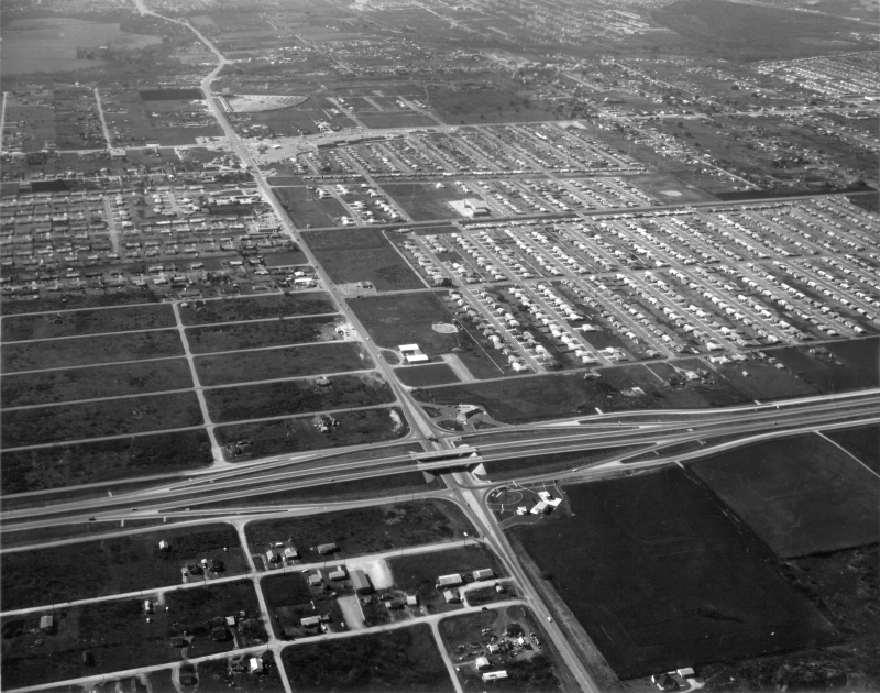
Loop 410 at N WW White Rd. looking northwest (ca. 1965) The drive-in in the foreground is the Towne Twin drive-in; it closed in 1983. (TxDOT) |
|
|
Loop 410 at N WW White Rd. looking northwest (ca. 1965) The drive-in in the foreground is the Towne Twin drive-in; it closed in 1983. (TxDOT) |
||
|
|
||

|
Loop 410 at N WW White Rd. looking west (ca. 1965) The road running diagonally across the top right is I‑35. (TxDOT) |
|
|
Loop 410 at N WW White Rd. looking west (ca. 1965) The road running diagonally across the top right is I‑35. (TxDOT) |
||
|
|
||
|
||
|
|
||