|
|
|
|
|
This page last updated March 8, 2024 |
Below are historical photos of the "Downtown Y" interchange of I‑10 and I‑35 along with a brief history of the interchange. The photos were sourced from the TxDOT photo library, the San Antonio TxDOT district office, and San Antonio-Bexar County Urban Transportation Study (SABCUTS) planning documents.
Locations are given using the present-day roadway names. The photos are arranged generally from west to east. Click on each photo for an enlarged view.
Click here to return to the historical photo galleries page.
|
ADVERTISEMENT |
Interchange history
The "Downtown Y" interchange was the first freeway interchange in San Antonio. The city's first freeway, US 87 (now also I‑10), was completed from Woodlawn Ave. to Martin St. in 1949 (see map below.) US 81 (now I‑35) was completed from Broadway to Martin St. in 1954 and was extended south to Guadalupe St. in 1957, at which time the direct connectors from northbound I‑35 to westbound I‑10 and from eastbound I‑10 to southbound I‑35 were also completed, making this the city's first freeway interchange. To get from eastbound I‑10 to northbound I‑35 and vice-versa, however, required exiting onto the access roads, turning at an intersection, and entering the other highway at a subsequent entrance ramp. That arrangement was replaced in 1967 with a cloverleaf from eastbound I‑10 to northbound I‑35 and the infamous "Finesilver Curve" from southbound I‑35 to westbound I‑10.
The interchange was completely rebuilt as part of the I‑10 and I‑35 double-decking project in the late '80s and early '90s. The first phase, which replaced the eastbound-to-northbound cloverleaf with a flyover, was completed in 1990. That phase also included the elevated direct connector for eastbound I‑10 to southbound I‑35. The replacement "Finesilver Curve" was completed around 1994. The northbound I‑35 to westbound I‑10 ramp is essentially the same ramp that was built in 1957, although the overpass for it over the Santa Rosa exit was rebuilt in 1994, and the entrance from Martin St. was realigned onto its own overpass.
|
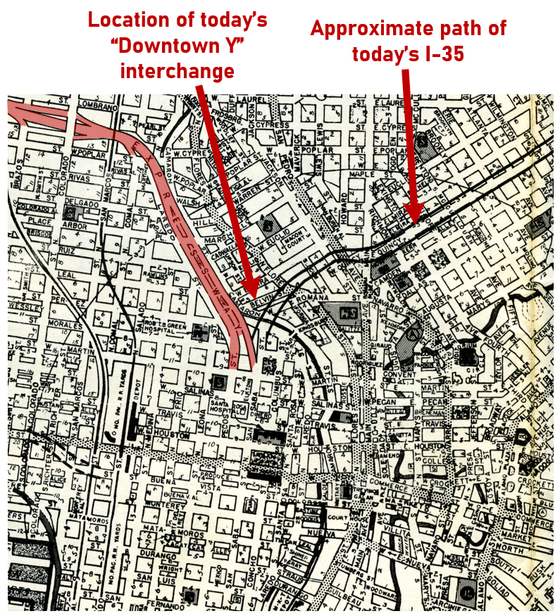
1953 Ferguson map showing I‑10/US 87 expressway (in red) and proposed I‑35/US 81 (Brian Purcell) |
|
1953 Ferguson map showing I‑10/US 87 expressway (in red) and proposed I‑35/US 81 (Brian Purcell) |
|
|
|
|
|
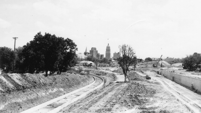
Downtown Y construction (1947) This is looking southeast approaching the future fork on eastbound I‑10. To the left, you can see the construction for the concrete ditch for San Pedro Creek as it curves toward Camaron St. (TxDOT) |
|
Downtown Y construction (1947) This is looking southeast approaching the future fork on eastbound I‑10. To the left, you can see the construction for the concrete ditch for San Pedro Creek as it curves toward Camaron St. (TxDOT) |
|
|
|
|
|
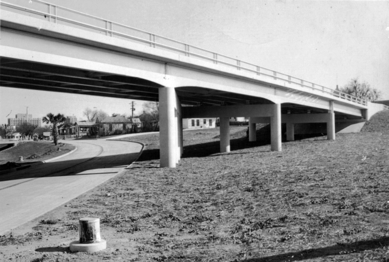
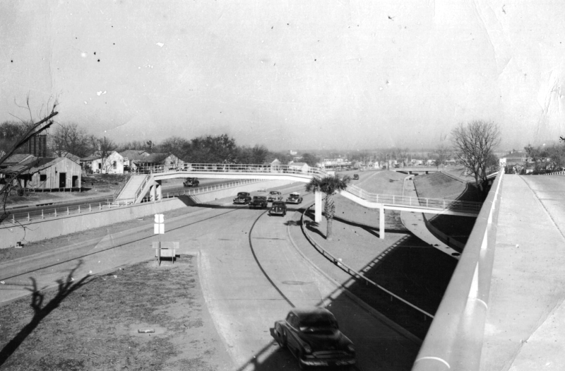
I‑10 at the Downtown Y looking east (1951) The roadway on the left is the exit to today's Santa Rosa Blvd. (N Laredo St. at that time), and the bridge is the overpass leading to westbound I‑10 from Martin St. What's now I‑35 had not yet been built. (TxDOT) |
|
I‑10 at the Downtown Y looking east (1951) The roadway on the left is the exit to today's Santa Rosa Blvd. (N Laredo St. at that time), and the bridge is the overpass leading to westbound I‑10 from Martin St. What's now I‑35 had not yet been built. (TxDOT) |
|
|
|
|
|
I‑10 eastbound fork to Santa Rosa St. (N Laredo St. at that time) (ca. 1955) This photo shows the construction of I‑35. (TxDOT) |
|
I‑10 eastbound fork to Santa Rosa St. (N Laredo St. at that time) (ca. 1955) This photo shows the construction of I‑35. (TxDOT) |
|
|
|
|

|
I‑10 eastbound fork to Santa Rosa St. (N Laredo St. at that time) (1956) The bridge is the overpass from Martin St. to I‑10 westbound. (TxDOT) |
|
I‑10 eastbound fork to Santa Rosa St. (N Laredo St. at that time) (1956) The bridge is the overpass from Martin St. to I‑10 westbound. (TxDOT) |
|
|
|
|
|
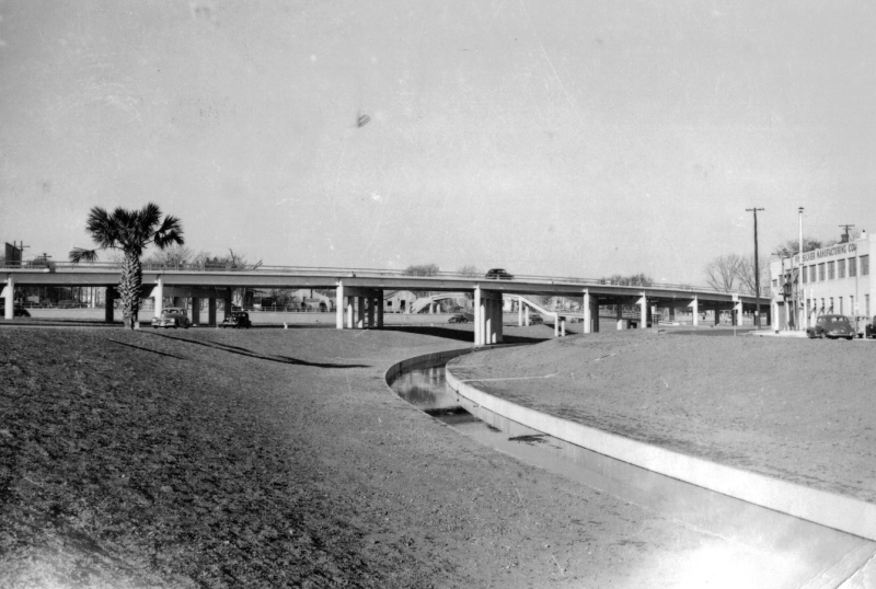
Looking west at I‑10 at the Downtown Y (1951) This photo shows San Pedro Creek, which today is underground at this location. Today's "Finesilver Curve" would be at the right of this photo, and the road at the left is the exit to today's Santa Rosa Blvd. (N Laredo St. at that time.) The bridge in the center of the photo is the overpass leading to westbound I‑10 from Martin St. (TxDOT) |
|
|
|
|

|
Ramp from I‑35 northbound to I‑10 westbound (1957) (TxDOT) |
|
Ramp from I‑35 northbound to I‑10 westbound (1957) (TxDOT) |
|
|
|
|
|
Looking east at the Downtown Y (1967) (TxDOT) |
|
Looking east at the Downtown Y (1967) (TxDOT) |
|
|
|
|
|
Eastbound I‑10 fork at I‑35 (1956) To the left was the fork to N Laredo St., which today is the exit to Santa Rosa Blvd. To the right was the fork to Martin St. where the expressway originally ended. At this time, the Martin St. fork was closed and work was just commencing to lower the roadway to pass under Martin St. in order to connect it to the new expressway south of there. You can see the completed roadway in the photos below. (TxDOT) |
|
|
|
|
|
Eastbound I‑10 fork at I‑35 (ca. 1960) Notice the US Highway markers — this photo was taken just after the Interstates in Texas were designated; it would be a few years before they were all signed. The integrated arrows on the US Highway shields was unique to Texas. (TxDOT) |
|
Eastbound I‑10 fork at I‑35 (ca. 1960) Notice the US Highway markers — this photo was taken just after the Interstates in Texas were designated; it would be a few years before they were all signed. The integrated arrows on the US Highway shields was unique to Texas. (TxDOT) |
|
|
|
|
|
Eastbound I‑10 fork at I‑35 (1964) (TxDOT) |
|
Eastbound I‑10 fork at I‑35 (1964) (TxDOT) |
|
|
|
|
|
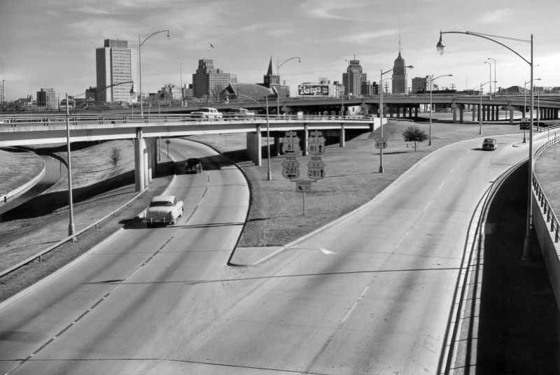
Eastbound I‑10 fork at I‑35 (1965) (TxDOT) |
|
Eastbound I‑10 fork at I‑35 (1965) (TxDOT) |
|
|
|
|
|
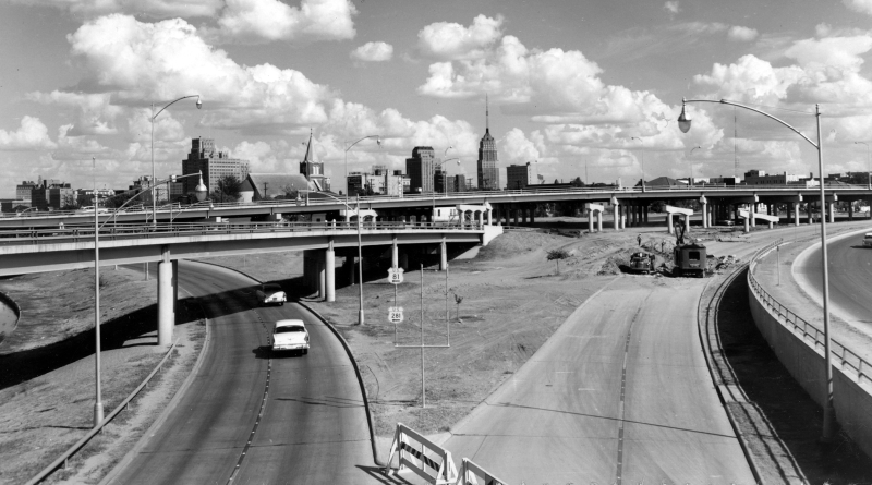
Eastbound I‑10 fork at I‑35 (1972) (TxDOT) |
|
Eastbound I‑10 fork at I‑35 (1972) (TxDOT) |
|
|
|
|
|
Eastbound I‑10 fork at I‑35 (1975) (TxDOT) |
|
Eastbound I‑10 fork at I‑35 (1975) (TxDOT) |
|
|
|
|
|
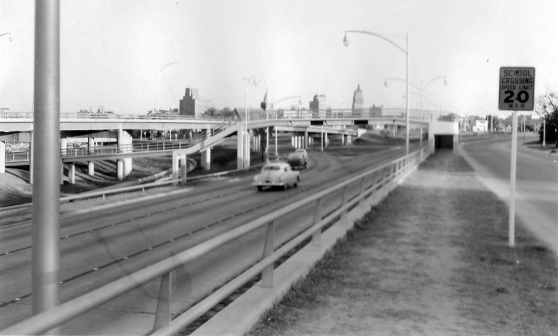
Looking west from the I‑10 westbound overpass (1951) (TxDOT) |
|
Looking west from the I‑10 westbound overpass (1951) (TxDOT) |
|
|
|
|
|
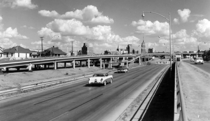
Looking west from the I‑10 westbound overpass (ca. 1952) (TxDOT) |
|
Looking west from the I‑10 westbound overpass (ca. 1952) (TxDOT) |
|
|
|
|

|
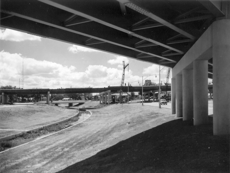
Looking northwest from the pedestrian bridge over eastbound I‑10 at I‑35 (ca. 1956) (TxDOT) |
|
Looking northwest from the pedestrian bridge over eastbound I‑10 at I‑35 (ca. 1956) (TxDOT) |
|
|
|
|
|
Construction of I‑10 eastbound approaching I‑35 (ca. 1949) (TxDOT) |
|
Construction of I‑10 eastbound approaching I‑35 (ca. 1949) (TxDOT) |
|
|
|
|
|
I‑10 eastbound approaching I‑35 (ca. 1950) (TxDOT) |
|
I‑10 eastbound approaching I‑35 (ca. 1950) (TxDOT) |
|
|
|
|
|
I‑10 eastbound approaching I‑35 (1952) (TxDOT) |
|
I‑10 eastbound approaching I‑35 (1952) (TxDOT) |
|
|
|
|
|
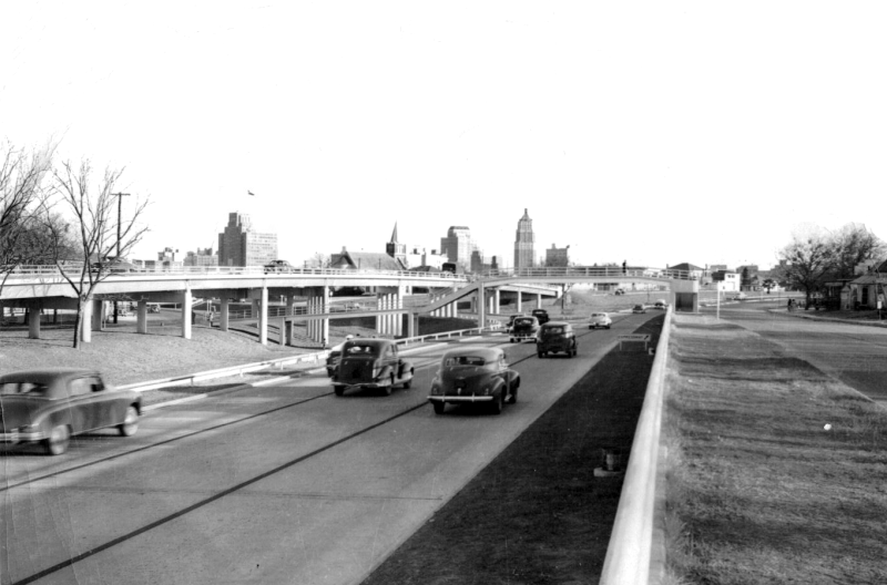
I‑10 eastbound approaching I‑35 (1955) In the distance, you can see the right fork is closed for construction. (TxDOT) |
|
I‑10 eastbound approaching I‑35 (1955) In the distance, you can see the right fork is closed for construction. (TxDOT) |
|
|
|
|

|
I‑10 eastbound approaching I‑35 (ca. 1964) (SABCUTS) |
|
I‑10 eastbound approaching I‑35 (ca. 1964) (SABCUTS) |
|
|
|
|
|
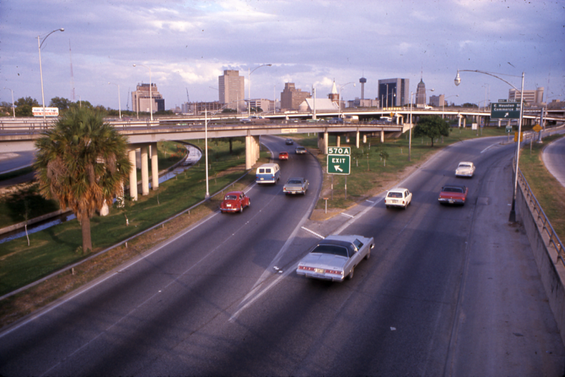
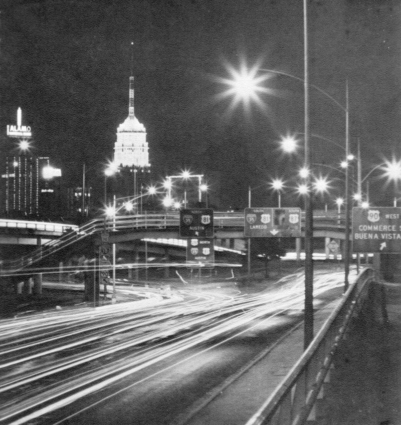
I‑10 approaching I‑35 (1968) Note the exit sign for at Commerce St. at the right — US 90 still ran along Commerce St. west of downtown at this time. The US 90 freeway would open shortly after this photo was taken. (SABCUTS) |
|
I‑10 approaching I‑35 (1968) Note the exit sign for at Commerce St. at the right — US 90 still ran along Commerce St. west of downtown at this time. The US 90 freeway would open shortly after this photo was taken. (SABCUTS) |
|
|
|
|
|
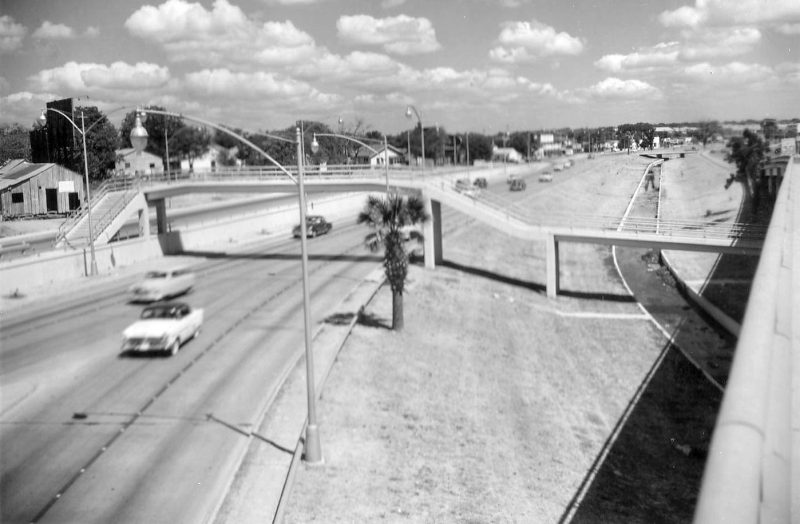
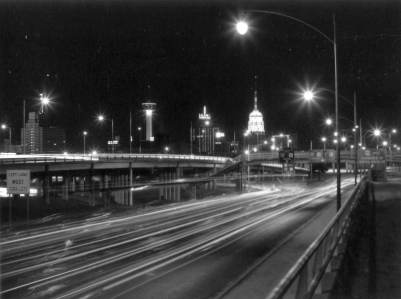
I‑10 approaching I‑35 (1968) (TxDOT) |
|
I‑10 approaching I‑35 (1968) (TxDOT) |
|
|
|
|

|
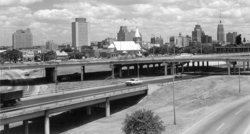
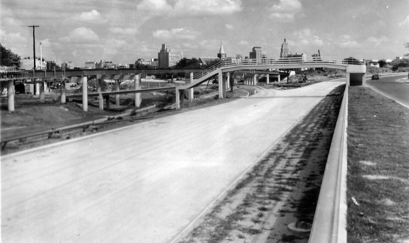
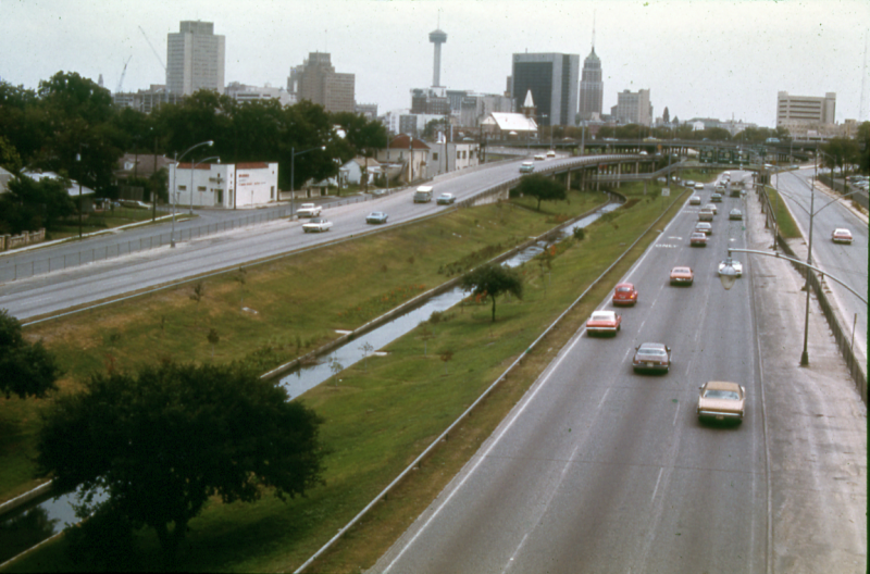
I‑10 approaching I‑35 (1967) The ditch in the center of the expressway is San Pedro Creek; it's underground at this location today. Notice the construction of the Tower of the Americas at the far left. (TxDOT) |
|
I‑10 approaching I‑35 (1967) The ditch in the center of the expressway is San Pedro Creek; it's underground at this location today. Notice the construction of the Tower of the Americas at the far left. (TxDOT) |
|
|
|
|
|
I‑10 approaching I‑35 (1975) (TxDOT) |
|
I‑10 approaching I‑35 (1975) (TxDOT) |
|
|
|
|
|
Looking north over the Downtown Y (1957) (TxDOT/Jack Amann) |
|
Looking north over the Downtown Y (1957) (TxDOT/Jack Amann) |
|
|
|
|
|
Looking south over the Downtown Y (1957) This was shortly after completion of the elevated "Central Expressway" between Martin St. and Guadalupe St., which connected the previously-completed expressways to the north and south. Prior to that, traffic used a pair of one-way surface streets (Pecos St. and San Saba St.) (TxDOT) |
|
|
|
|
|
Looking southeast over the Downtown Y (1957) (TxDOT) |
|
Looking southeast over the Downtown Y (1957) (TxDOT) |
|
|
|
|
|
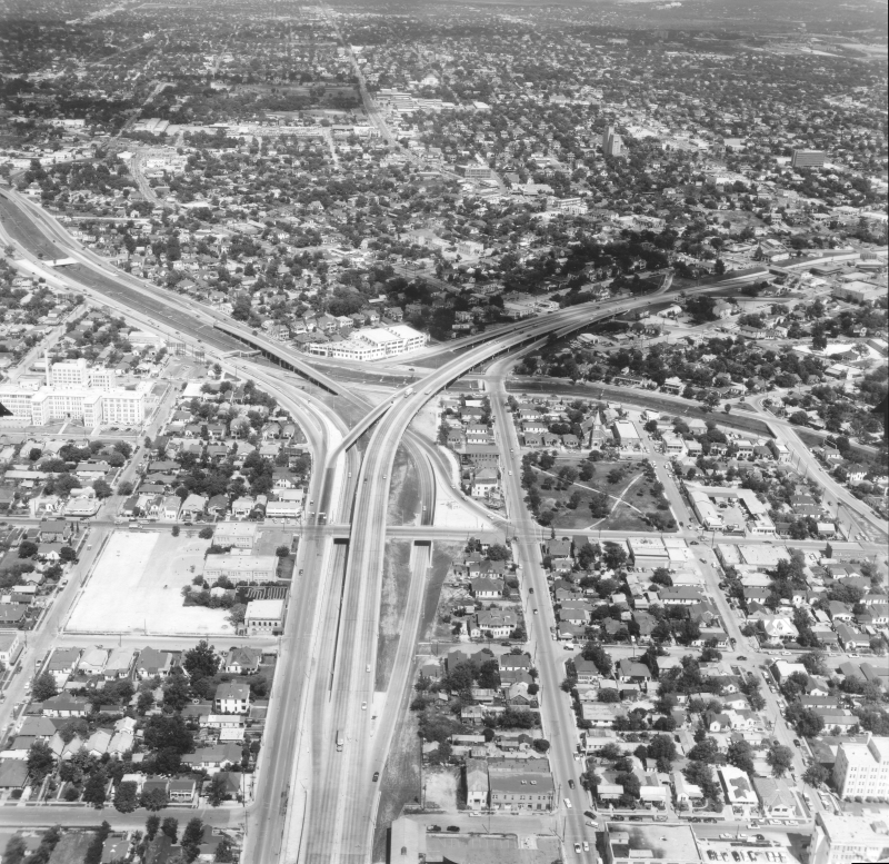
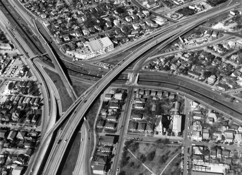
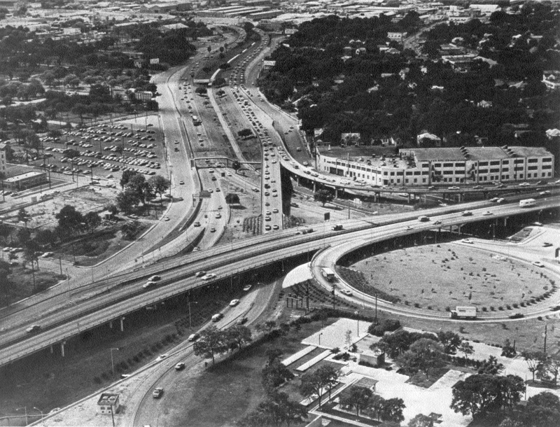
Over the Downtown Y looking north (ca. 1960) Notice the lack of direct connectors to northbound I‑35 and from southbound I‑35. Instead, traffic used the access roads and regular entrance and exit ramps until direct connectors were built around 1967. (TxDOT) |
|
Over the Downtown Y looking north (ca. 1960) Notice the lack of direct connectors to northbound I‑35 and from southbound I‑35. Instead, traffic used the access roads and regular entrance and exit ramps until direct connectors were built around 1967. (TxDOT) |
|
|
|
|
|
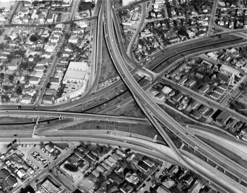
Over the Downtown Y looking northeast (ca. 1960) (TxDOT) |
|
Over the Downtown Y looking northeast (ca. 1960) (TxDOT) |
|
|
|
|
|
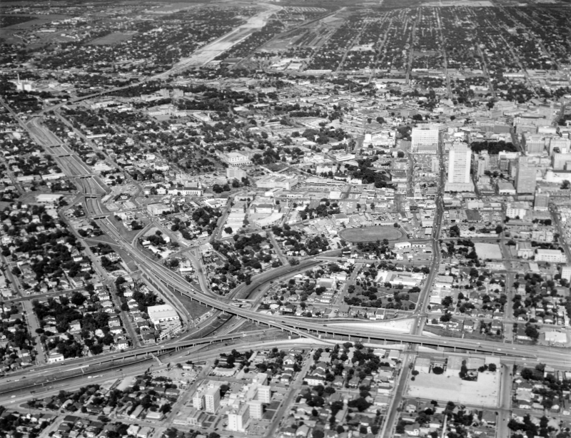
Looking east over the Downtown Y (ca. 1960) You can see I‑35 near Ft. Sam Houston under construction near the top left. (TxDOT) |
|
Looking east over the Downtown Y (ca. 1960) You can see I‑35 near Ft. Sam Houston under construction near the top left. (TxDOT) |
|
|
|
|
|
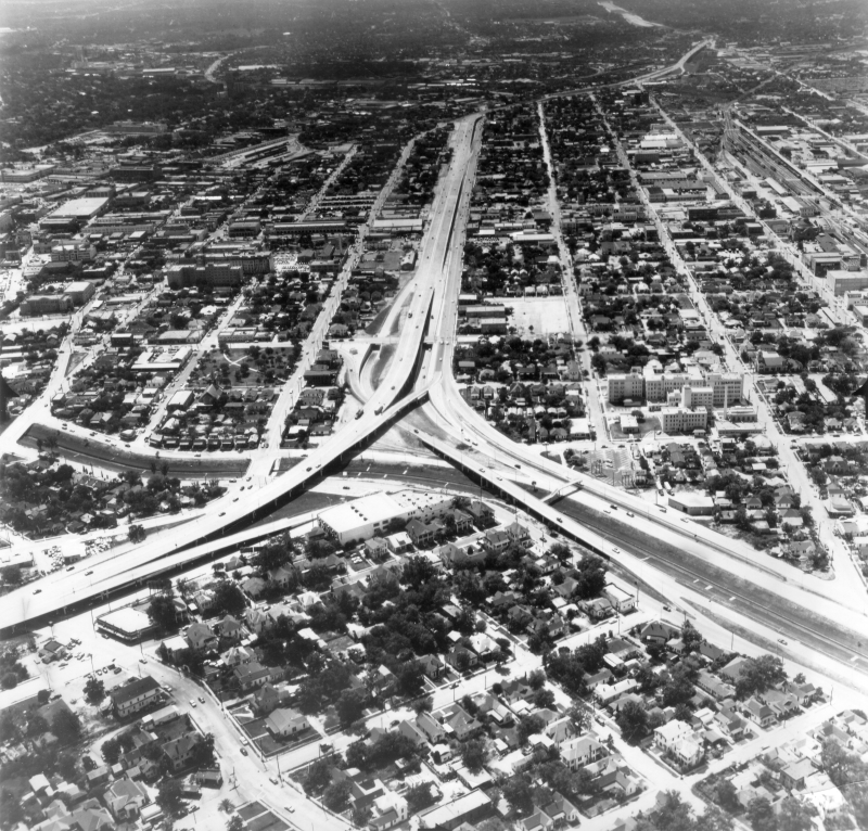
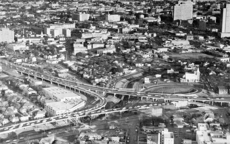
Looking east over the Downtown Y (ca. 1967) At the center-right, you can see the then-new cloverleaf built to connect eastbound I‑10 to northbound I‑35. It was removed around 1990 and replaced with the flyover that's there today. (SABCUTS) |
|
Looking east over the Downtown Y (ca. 1967) At the center-right, you can see the then-new cloverleaf built to connect eastbound I‑10 to northbound I‑35. It was removed around 1990 and replaced with the flyover that's there today. (SABCUTS) |
|
|
|
|
|
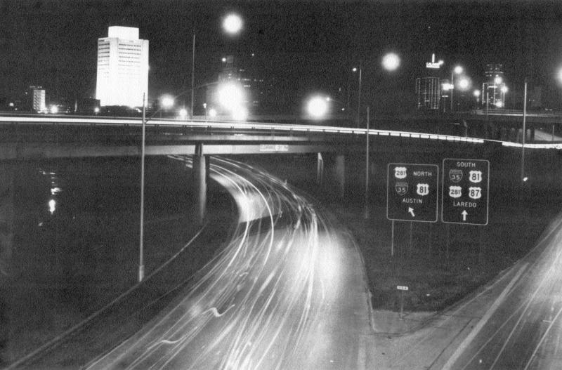
Looking northeast at the Downtown Y (1971) In the center is the original "Finesilver Curve". (TxDOT) |
|
Looking northeast at the Downtown Y (1971) In the center is the original "Finesilver Curve". (TxDOT) |
|
|
|
|
|
Looking northwest over the Downtown Y (ca. 1976) (SABCUTS) |
|
Looking northwest over the Downtown Y (ca. 1976) (SABCUTS) |
|
|
|
|

|
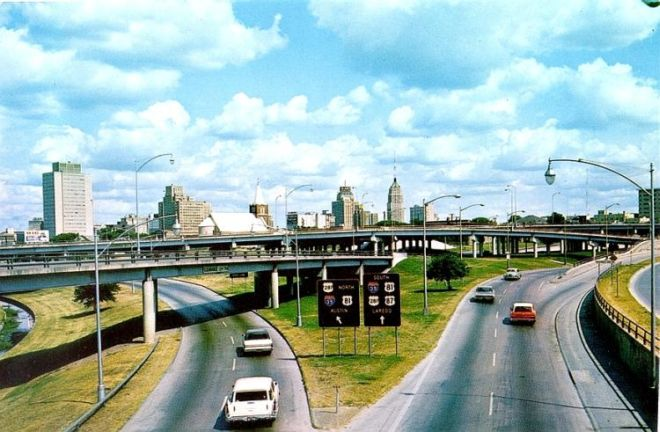
View of the Finesilver Curve (I‑35 southbound to I‑10 westbound) (ca. 1976) (SABCUTS) |
|
View of the Finesilver Curve (I‑35 southbound to I‑10 westbound) (ca. 1976) (SABCUTS) |
|
|
|
|
|
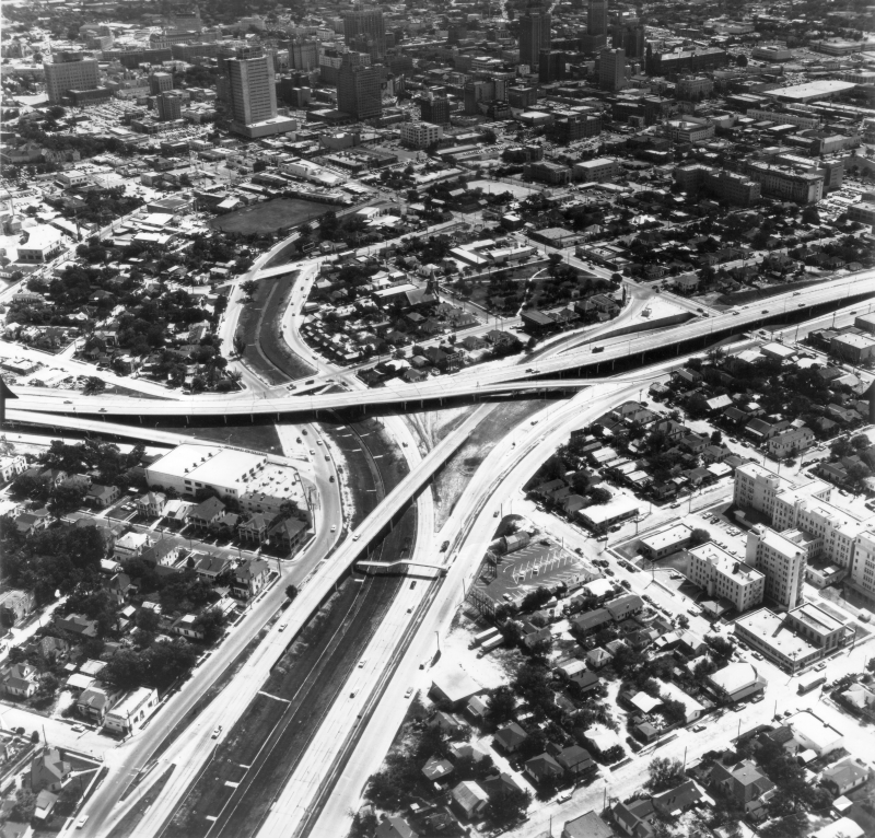
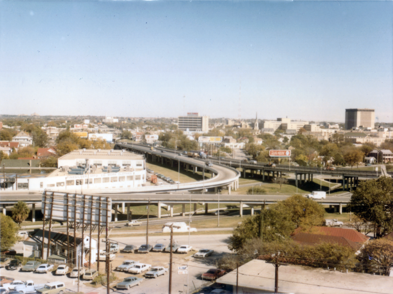
Over the Downtown Y looking west (ca. 1989) In this photo, you can see the old cloverleaf from eastbound I‑10 to northbound I‑35 and construction of the flyover that would replace it. (TxDOT) |
|
Over the Downtown Y looking west (ca. 1989) In this photo, you can see the old cloverleaf from eastbound I‑10 to northbound I‑35 and construction of the flyover that would replace it. (TxDOT) |
|
|
|
|
|
Looking northwest at the Downtown Y (ca. 1989) (TxDOT) |
|
Looking northwest at the Downtown Y (ca. 1989) (TxDOT) |
|
|
|
|
|
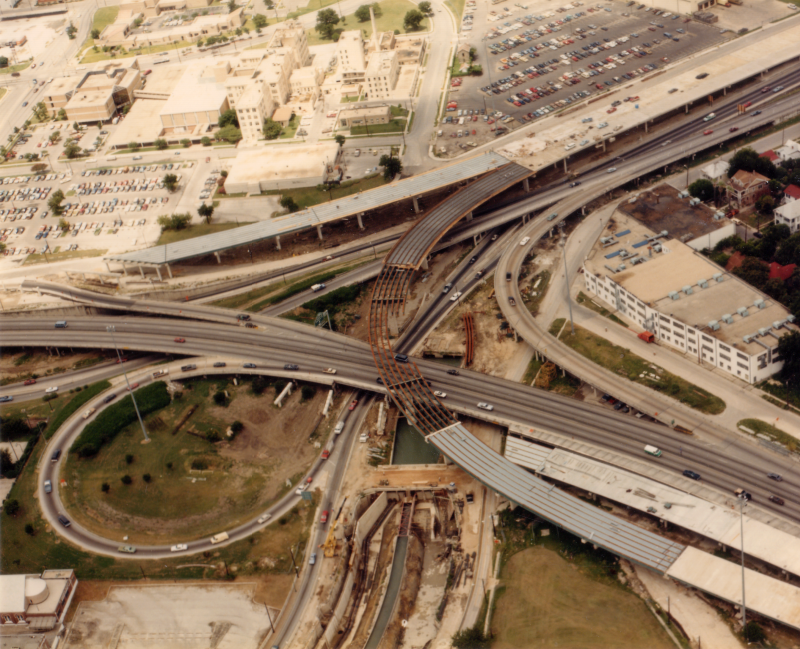
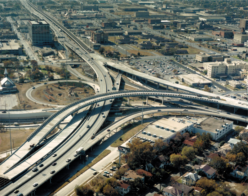
Looking southwest over the Downtown Y (ca. 1990) (TxDOT) |
|
Looking southwest over the Downtown Y (ca. 1990) (TxDOT) |
|
|
|
|