|
|
|
|
|
This page last updated January 5, 2025 |
Below are historical photos of Interstate 10 West along with a brief history of the route. The photos were sourced from the TxDOT photo library, the San Antonio TxDOT district office, San Antonio-Bexar County Urban Transportation Study (SABCUTS) planning documents, and the author of this website.
Locations are given using the present-day roadway names. The photos are arranged generally from south to north. Click on each photo for an enlarged view.
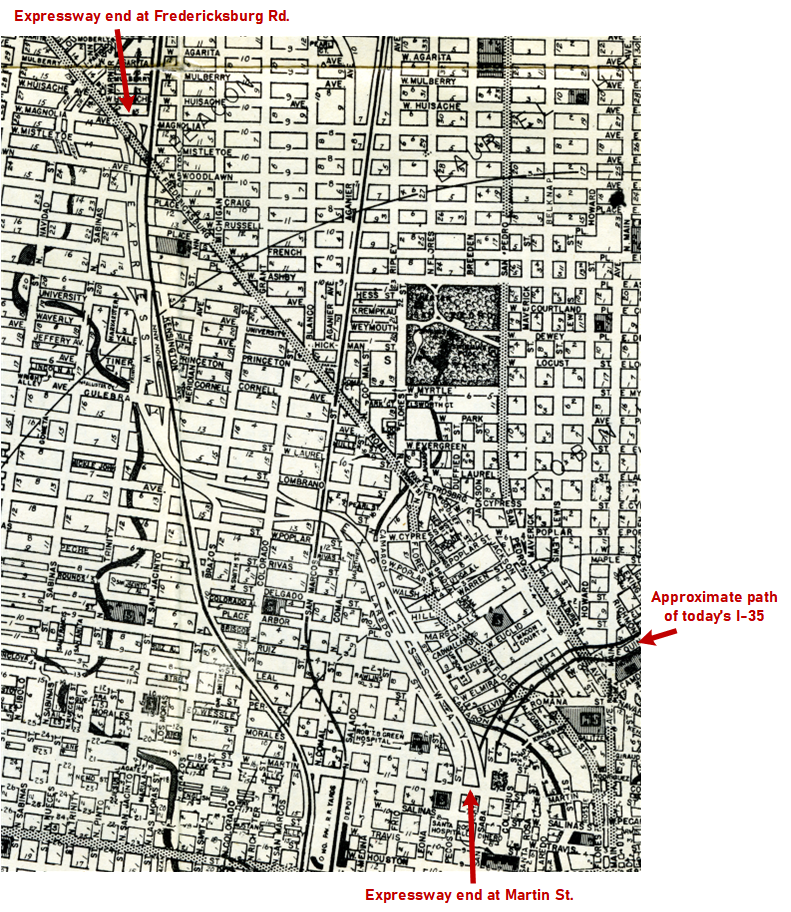
Photos of the I‑10/I‑35 "Downtown Y" interchange are on a separate page here. The section of I-10 from just north of Huebner to Boerne subsumed the existing US 87 (Fredericksburg Rd.); historical photos of that route are here.
Click here to return to the historical photo galleries page.
|
ADVERTISEMENT |
Route history


The section of today's I‑10 from Woodlawn Ave. to downtown was included as part of the original three-legged expressway plan for San Antonio that was first laid-out around 1940 and was designed to provide bypass routes around the increasingly congested downtown core for through traffic on the various US and state highways that converged there. The United States' entrance into World War II delayed these plans.
The plan was revived after the war, and the northwest leg was the first to start construction. The first section to be completed was the segment from Woodlawn Ave. to Culebra Ave., which opened without fanfare on July 8th, 1949. It was the first expressway in San Antonio and appears to be the second in Texas, coming less than a year after the Gulf Freeway opened in Houston and a month before the opening of Central Expressway in Dallas. The section from Culebra Ave. to Frio St. (Comal St. at the time) opened later that year. East of Frio St., the expressway merged into the N Laredo St. boulevard along San Pedro Creek, providing access into downtown and a bypass for US 87 and SH 16 traffic to avoid a chronically congested stretch of lower Fredericksburg Rd. in the Five Points area. The final segment, from Frio St. to Martin St., was completed a year later.
Several routes for an extension north of Woodlawn Ave. were proposed before the final route was settled in 1957. The section from Loop 410 to just north of Huebner Rd. was the first to be completed — it opened in early 1960, where it merged into the existing US 87/Fredericksburg Rd. headed north. That was followed by the section from Woodlawn Ave. to Fresno Dr. in late 1960, and the section from Fresno Dr. to Loop 410 a year later. US 87 from north of Huebner Rd. to near Leon Springs was upgraded to Interstate standards in 1968 just in time for HemisFair.
More details on the history of I‑10 is available here.
|
1953 Ferguson map showing I-10/US 87 (Brian Purcell) |
|
|
1953 Ferguson map showing I-10/US 87 (Brian Purcell) |
||
|
|
||
|
||
|
|
||
|
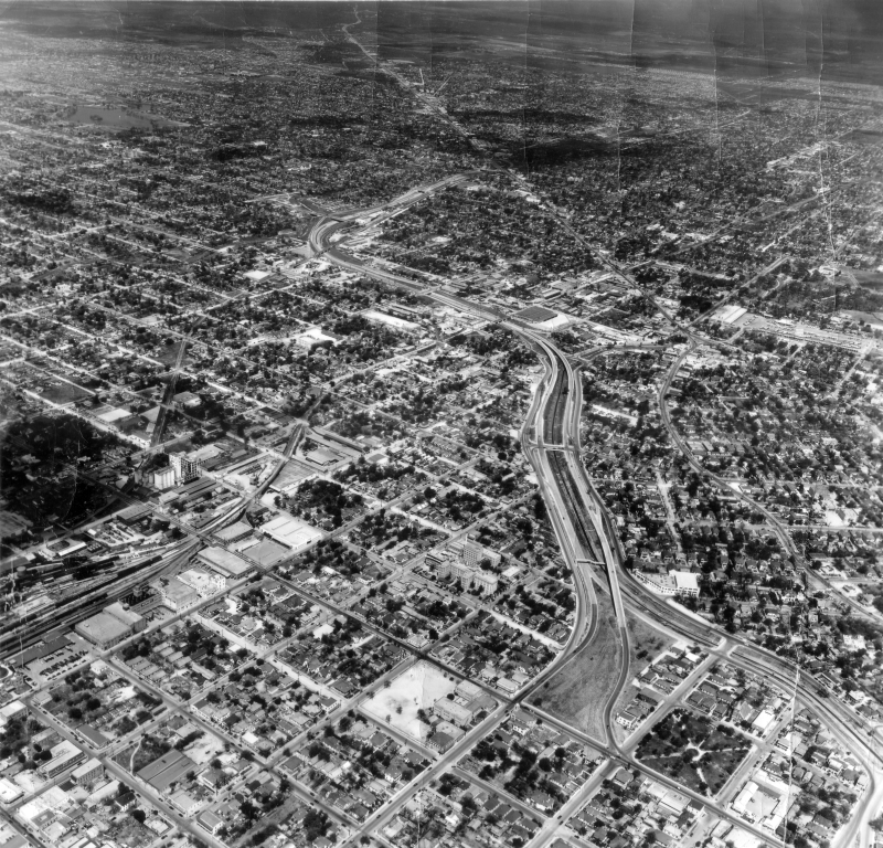
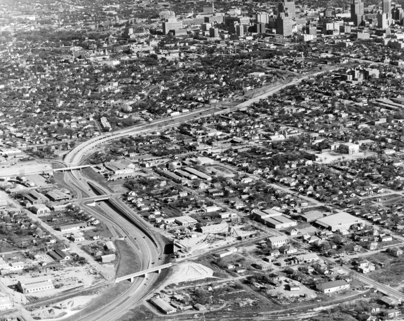
Over download looking northwest (ca. 1952) You can see the recently-completed US 87 expressway (now I-10) running from Martin St. in the foreground out to Fredericksburg Rd. This was several years before the US 81 expressway (now I-35) was built. (TxDOT/Jack Ammann Photogrammetric Engineers) |
|
|
Over download looking northwest (ca. 1952) You can see the recently-completed US 87 expressway (now I-10) running from Martin St. in the foreground out to Fredericksburg Rd. This was several years before the US 81 expressway (now I-35) was built. (TxDOT/Jack Ammann Photogrammetric Engineers) |
||
|
|
||
|
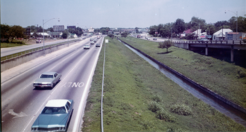
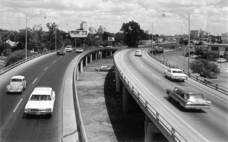
I-10 at I-35 looking northwest (1972) The waterway in the median is San Pedro Creek, which runs underground at this location today. (TxDOT) |
|
|
I-10 at I-35 looking northwest (1972) The waterway in the median is San Pedro Creek, which runs underground at this location today. (TxDOT) |
||
|
|
||
|
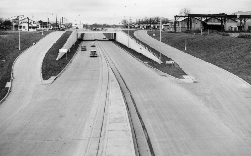
I-10 near Frio St. looking northwest (1950) Construction of a slip-ramp on the inbound lanes. This exit was used by traffic wanting to get on the frontage road or to access an at-grade crossover for Marshall St. The crossover and this ramp were removed by 1957. (TxDOT) |
|
|
I-10 near Frio St. looking northwest (1950) Construction of a slip-ramp on the inbound lanes. This exit was used by traffic wanting to get on the frontage road or to access an at-grade crossover for Marshall St. The crossover and this ramp were removed by 1957. (TxDOT) |
||
|
|
||
|
I-10 at Frio St. looking southeast (ca. 1950) (TxDOT) |
|
|
I-10 at Frio St. looking southeast (ca. 1950) (TxDOT) |
||
|
|
||
|
I-10 at Frio St. looking southeast (ca. 1950) This is a closer look at the inbound off-ramp. (TxDOT) |
|
|
I-10 at Frio St. looking southeast (ca. 1950) This is a closer look at the inbound off-ramp. (TxDOT) |
||
|
|
||
|
I-10 at Frio St. looking southeast (ca. 1951) (TxDOT) |
|
|
I-10 at Frio St. looking southeast (ca. 1951) (TxDOT) |
||
|
|
||
|
I-10 at Frio St. looking southeast (1962) (TxDOT) |
|
|
I-10 at Frio St. looking southeast (1962) (TxDOT) |
||
|
|
||
|
I-10 at Frio St. looking southeast (1967) (TxDOT) |
|
|
I-10 at Frio St. looking southeast (1967) (TxDOT) |
||
|
|
||
|
I-10 at Colorado St. looking west (ca. 1950) (TxDOT) |
|
|
I-10 at Colorado St. looking west (ca. 1950) (TxDOT) |
||
|
|
||
|
I-10 near Brazos St. looking east (ca. 1950) Looking at the inbound exit to Colorado St. (TxDOT) |
|
|
I-10 near Brazos St. looking east (ca. 1950) Looking at the inbound exit to Colorado St. (TxDOT) |
||
|
|
||
|
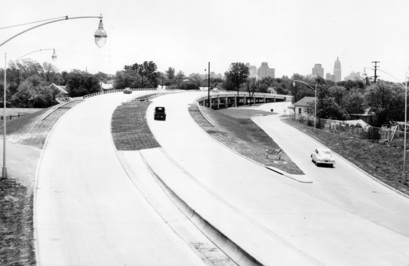
I-10 south of Culebra Ave. looking northwest (ca.1948) The bridge for Culebra Ave. over the creek was built as part of this project. Prior to that, Culebra did not cross the creek. (TxDOT) |
|
|
I-10 south of Culebra Ave. looking northwest (ca.1948) The bridge for Culebra Ave. over the creek was built as part of this project. Prior to that, Culebra did not cross the creek. (TxDOT) |
||
|
|
||
|
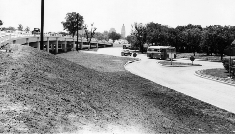
Over I-10 at Culebra Ave. looking southeast (1950) In the distance, you can see work underway on the section of expressway between Frio St. and Martin St. (TxDOT/Ralph N Miller Aerial Industrial Photos) |
|
|
Over I-10 at Culebra Ave. looking southeast (1950) In the distance, you can see work underway on the section of expressway between Frio St. and Martin St. (TxDOT/Ralph N Miller Aerial Industrial Photos) |
||
|
|
||
|
I-10 at Culebra Ave. looking north (ca. 1952) (TxDOT) |
|
|
I-10 at Culebra Ave. looking north (ca. 1952) (TxDOT) |
||
|
|
||
|
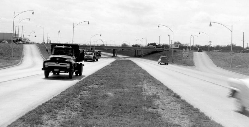
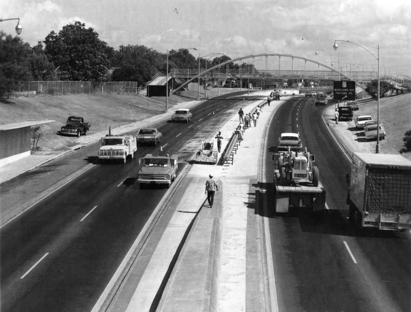
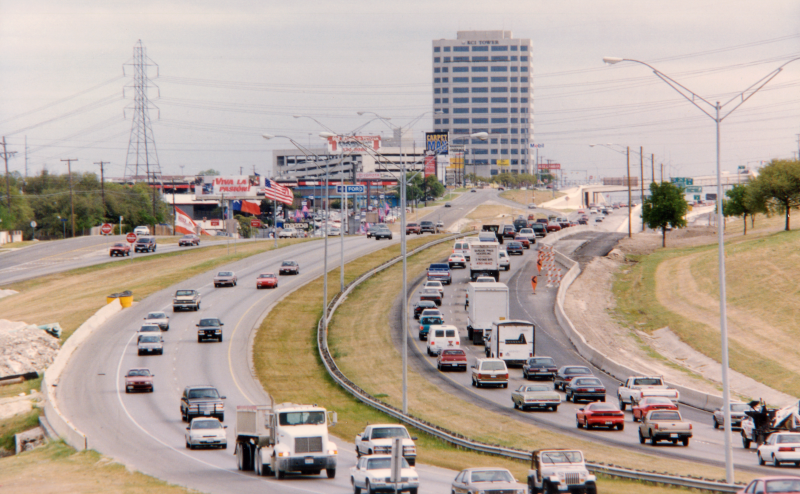
I-10 at Culebra Ave. looking southeast (ca. 1967) Congestion along this section of expressway had become a recurring problem by this time. (SABCUTS) |
|
|
I-10 at Culebra Ave. looking southeast (ca. 1967) Congestion along this section of expressway had become a recurring problem by this time. (SABCUTS) |
||
|
|
||
|
I-10 at Culebra Ave. looking north (ca. 1967) (TxDOT) |
|
|
I-10 at Culebra Ave. looking north (ca. 1967) (TxDOT) |
||
|
|
||
|
I-10 at Culebra Ave. looking south (ca. 1956) (TxDOT) |
|
|
I-10 at Culebra Ave. looking south (ca. 1956) (TxDOT) |
||
|
|
||
|
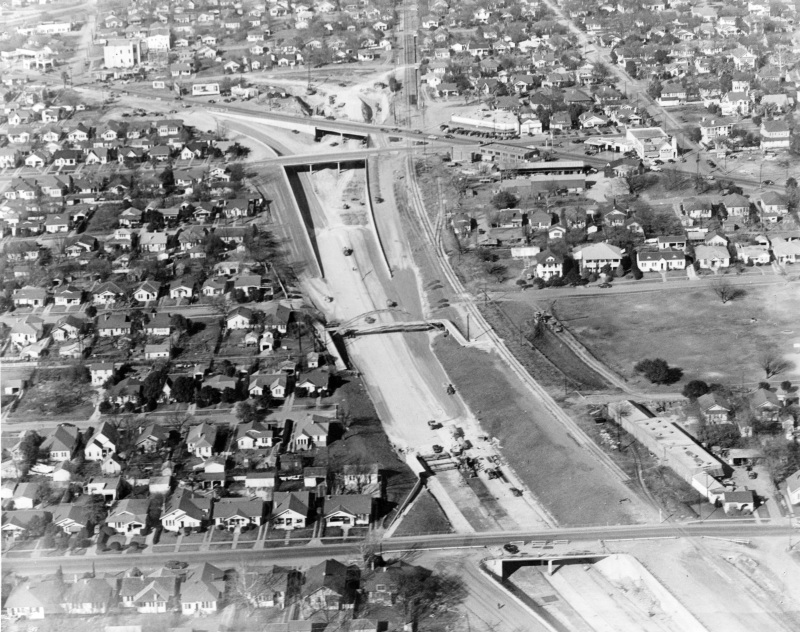
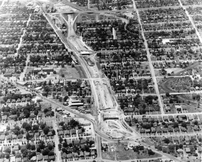
Looking north over I-10 construction from Cincinnati Ave. to Fredericksburg Rd. (ca. 1948) (TxDOT/Ralph N Miller Aerial Industrial Photos) |
|
|
Looking north over I-10 construction from Cincinnati Ave. to Fredericksburg Rd. (ca. 1948) (TxDOT/Ralph N Miller Aerial Industrial Photos) |
||
|
|
||
|
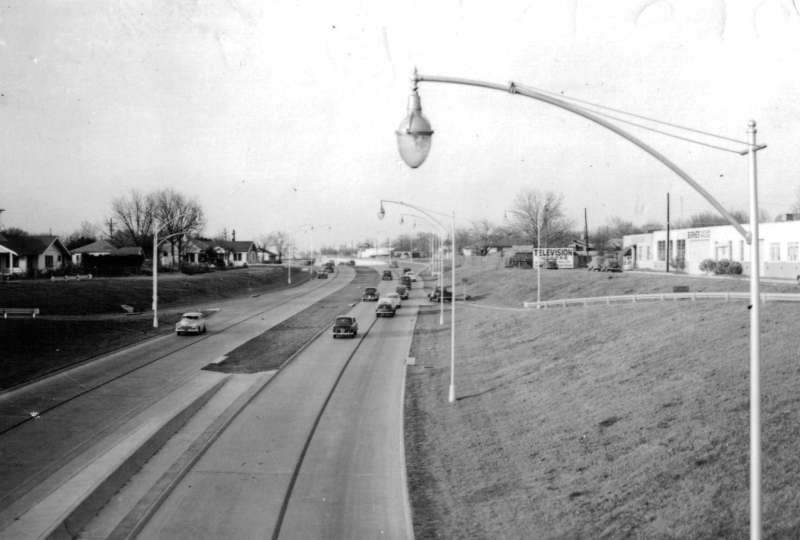
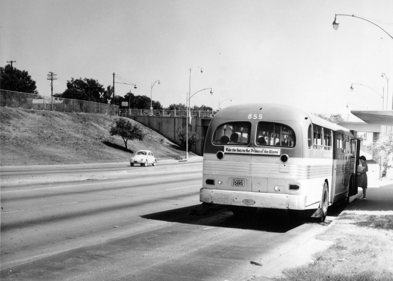
I-10 at Cincinnati Ave. looking north (ca. 1949) The original expressway included bus stops in both directions at Cincinnati Ave. Their use was likely discontinued around 1970 and they were removed when the freeway was double-decked in the late '80s. (TxDOT) |
|
|
I-10 at Cincinnati Ave. looking north (ca. 1949) The original expressway included bus stops in both directions at Cincinnati Ave. Their use was likely discontinued around 1970 and they were removed when the freeway was double-decked in the late '80s. (TxDOT) |
||
|
|
||
|
I-10 at Cincinnati Ave. looking south (ca. 1962) A view of the southbound bus stop. (TxDOT) |
|
|
I-10 at Cincinnati Ave. looking south (ca. 1962) A view of the southbound bus stop. (TxDOT) |
||
|
|
||
|
I-10 at Cincinnati Ave. looking south (ca. 1948) (TxDOT) |
|
|
I-10 at Cincinnati Ave. looking south (ca. 1948) (TxDOT) |
||
|
|
||
|
I-10 at Cincinnati Ave. looking south (ca. 1949) (TxDOT) |
|
|
I-10 at Cincinnati Ave. looking south (ca. 1949) (TxDOT) |
||
|
|
||
|
I-10 at Cincinnati Ave. looking north (ca. 1948) (TxDOT) |
|
|
I-10 at Cincinnati Ave. looking north (ca. 1948) (TxDOT) |
||
|
|
||
|
I-10 at Cincinnati Ave. looking north (ca. 1949) (TxDOT) |
|
|
I-10 at Cincinnati Ave. looking north (ca. 1949) (TxDOT) |
||
|
|
||
|
I-10 at Cincinnati Ave. looking north (1968) Installation of a center median barrier is underway. (TxDOT) |
|
|
I-10 at Cincinnati Ave. looking north (1968) Installation of a center median barrier is underway. (TxDOT) |
||
|
|
||
|
I-10 at Woodlawn Ave. looking south (1951) (TxDOT) |
|
|
I-10 at Woodlawn Ave. looking south (1951) (TxDOT) |
||
|
|
||
|
I-10 at Woodlawn Ave. looking north (ca. 1949) (TxDOT) |
|
|
I-10 at Woodlawn Ave. looking north (ca. 1949) (TxDOT) |
||
|
|
||
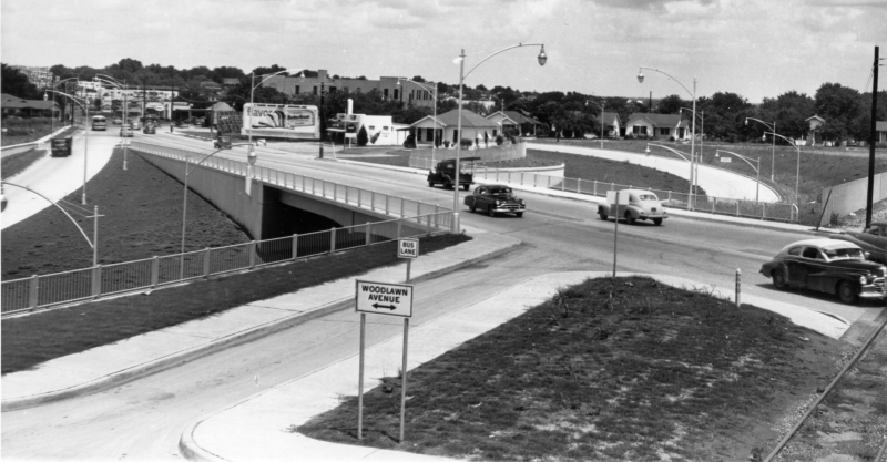
|
I-10 at Woodlawn Ave. looking north (ca. 1949) The expressway ended here at this time. To the left, you can see the entrance from Fredericksburg Rd., and ahead past the underpasses, you can see where the outbound lanes curved up to Fredericksburg Rd. (TxDOT) |
|
|
I-10 at Woodlawn Ave. looking north (ca. 1949) The expressway ended here at this time. To the left, you can see the entrance from Fredericksburg Rd., and ahead past the underpasses, you can see where the outbound lanes curved up to Fredericksburg Rd. (TxDOT) |
||
|
|
||
|
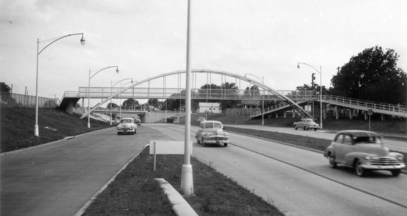
I-10 at Woodlawn Ave./Fredericksburg Rd. looking northwest (ca. 1949) (TxDOT) |
|
|
I-10 at Woodlawn Ave./Fredericksburg Rd. looking northwest (ca. 1949) (TxDOT) |
||
|
|
||
|
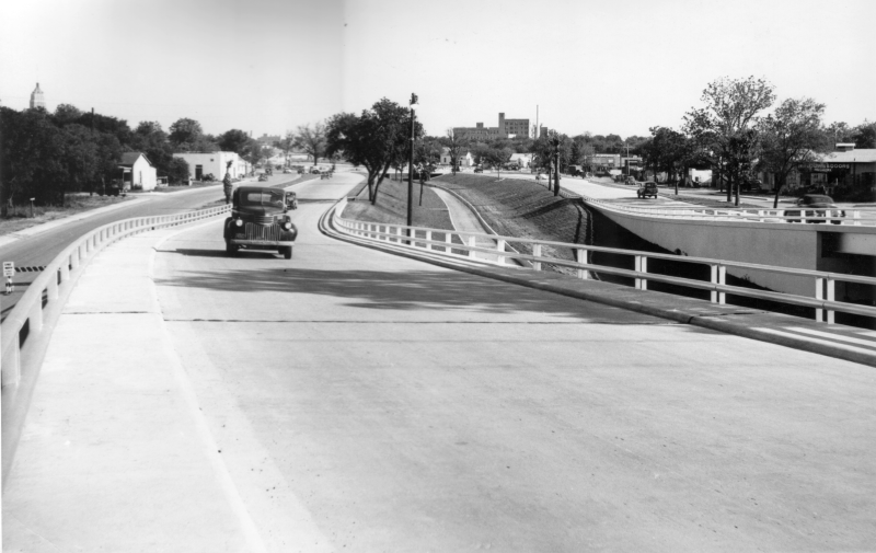
I-10 at Fredericksburg Rd. looking southeast (ca. 1949) This is the ramp where the expressway ended and traffic exited onto Fredericksburg Rd. (TxDOT) |
|
|
I-10 at Fredericksburg Rd. looking southeast (ca. 1949) This is the ramp where the expressway ended and traffic exited onto Fredericksburg Rd. (TxDOT) |
||
|
|
||
|
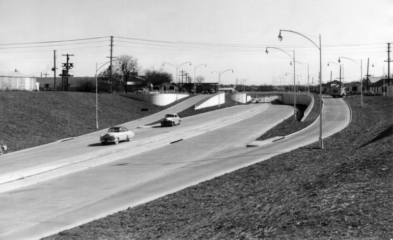
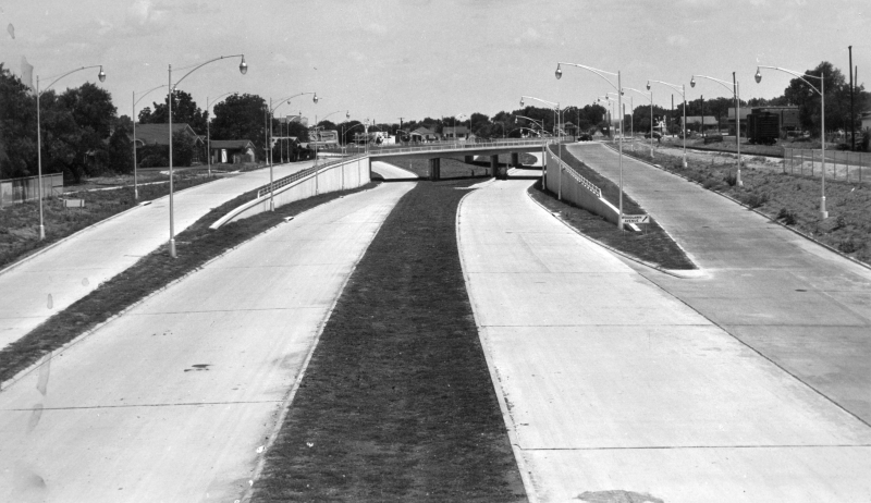
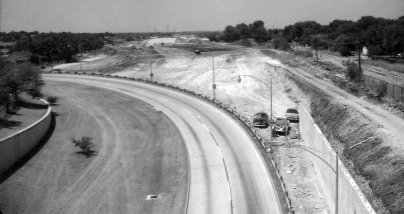
I-10 at Fredericksburg Rd. looking north (1959) Construction to extend the expressway north was now underway. (TxDOT) |
|
|
I-10 at Fredericksburg Rd. looking north (1959) Construction to extend the expressway north was now underway. (TxDOT) |
||
|
|
||
|
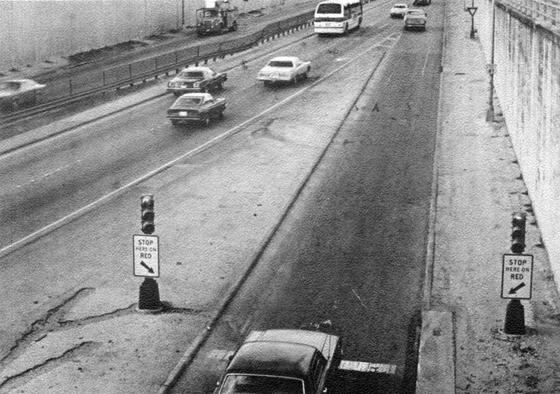
I-10 at Woodlawn Ave. looking south (ca. 1981) Below is the entrance ramp from Fredericksburg Rd. To help mitigate recurring congestion along this stretch of I-10, ramp metering signals had been installed here and at several other on-ramps. They were removed during the double-decking project in the late '80s. (SABCUTS) |
|
|
I-10 at Woodlawn Ave. looking south (ca. 1981) Below is the entrance ramp from Fredericksburg Rd. To help mitigate recurring congestion along this stretch of I-10, ramp metering signals had been installed here and at several other on-ramps. They were removed during the double-decking project in the late '80s. (SABCUTS) |
||
|
|
||
|
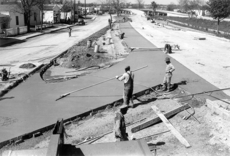
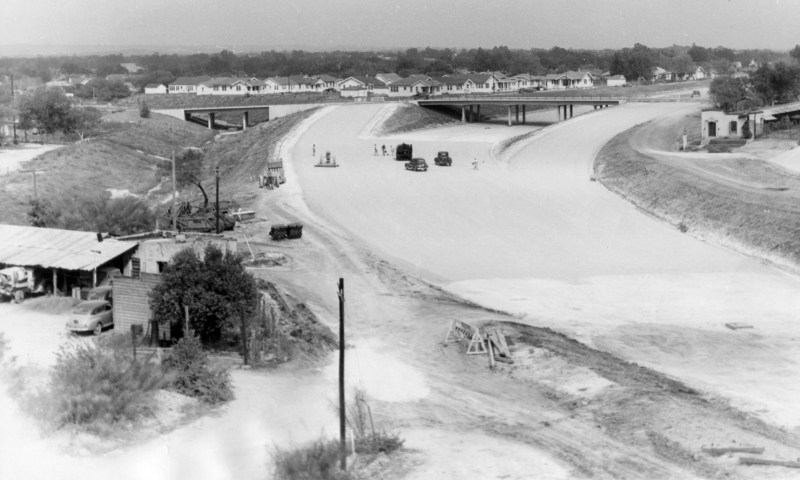
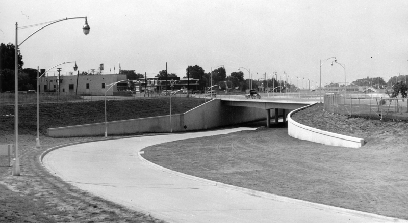
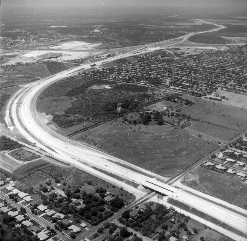
I-10 at Woodlawn Ave./Fredericksburg Rd. looking south (ca. 1948) This photo shows construction well underway on the city's first expressway, today's I-10 lower level between Fredericksburg Rd./Woodlawn Ave. and Culebra Ave. (TxDOT) |
|
|
I-10 at Woodlawn Ave./Fredericksburg Rd. looking south (ca. 1948) This photo shows construction well underway on the city's first expressway, today's I-10 lower level between Fredericksburg Rd./Woodlawn Ave. and Culebra Ave. (TxDOT) |
||
|
|
||
|
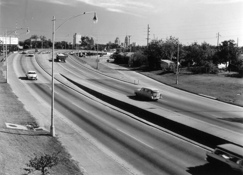
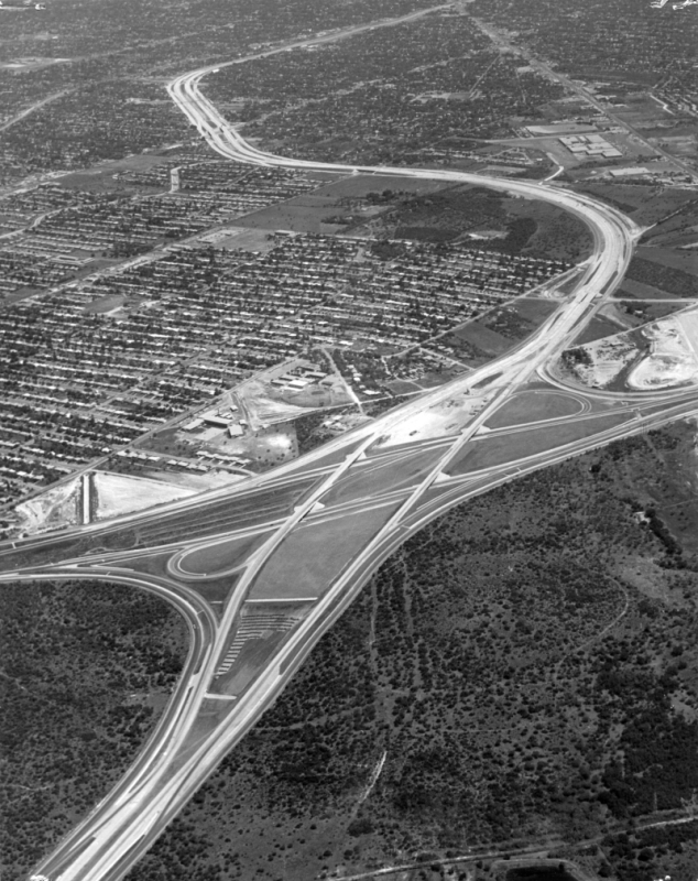
I-10 at Fredericksburg Rd. looking north (ca. 1967) (SABCUTS) |
|
|
I-10 at Fredericksburg Rd. looking north (ca. 1967) (SABCUTS) |
||
|
|
||
|
I-10 at Fulton looking south-southwest (1992) This photo shows workers making final preparations to open the new eastbound upper level. (Original black and white photo colorized at palette.fm.) (Courtesy of Jared Maurtua) |
|
|
I-10 at Fulton looking south-southwest (1992) This photo shows workers making final preparations to open the new eastbound upper level. (Original black and white photo colorized at palette.fm.) (Courtesy of Jared Maurtua) |
||
|
|
||
|
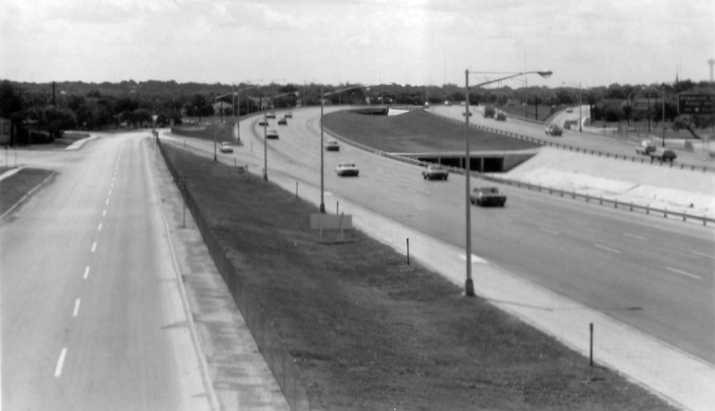
I-10 at Clower St. looking west (1961) The waterway in the median is Martinez Creek, which today is underground. (TxDOT) |
|
|
I-10 at Clower St. looking west (1961) The waterway in the median is Martinez Creek, which today is underground. (TxDOT) |
||
|
|
||
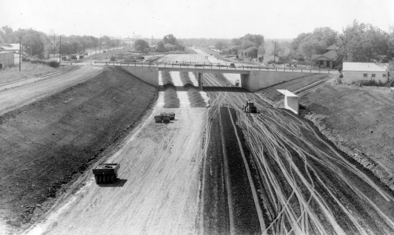
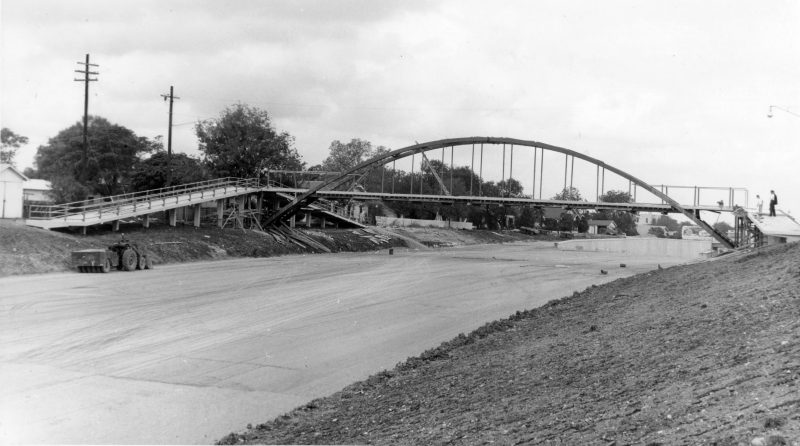
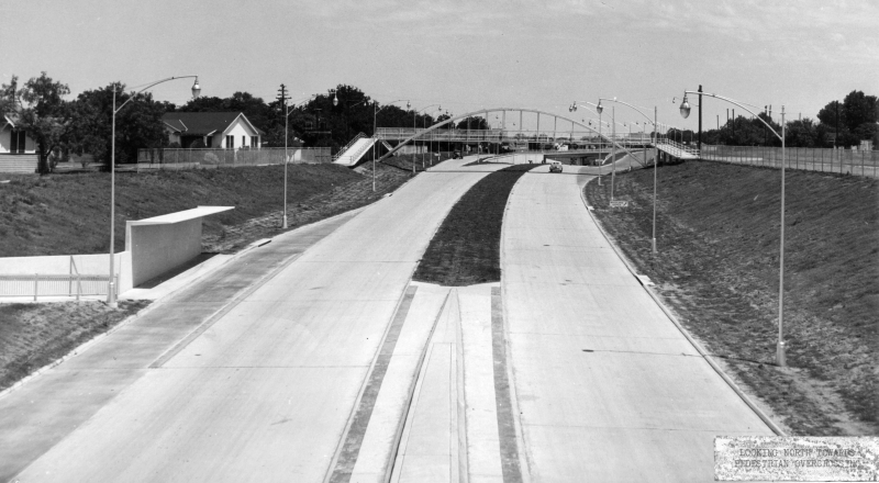
|
I-10 from pedestrian overpass at Clower St. looking southeast (1968) (TxDOT) |
|
|
I-10 from pedestrian overpass at Clower St. looking southeast (1968) (TxDOT) |
||
|
|
||
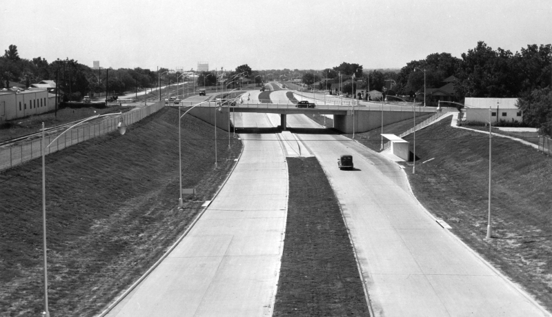
|
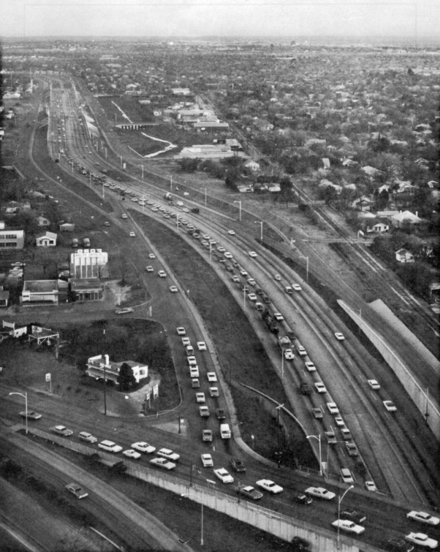
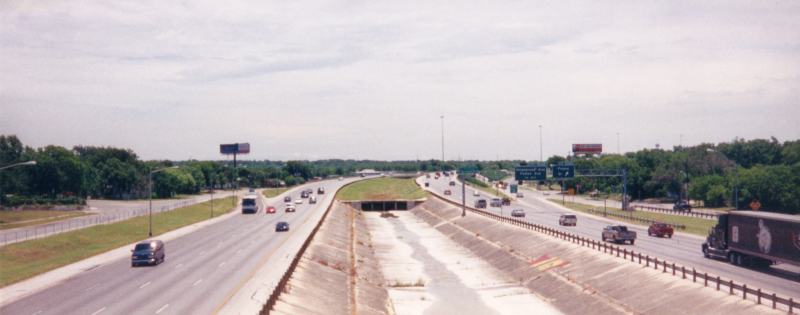
I-10 from pedestrian overpass at Clower St. looking southeast (2001) This was a few years before the expansion of this section to ten lanes. (Brian Purcell) |
|
|
I-10 from pedestrian overpass at Clower St. looking southeast (2001) This was a few years before the expansion of this section to ten lanes. (Brian Purcell) |
||
|
|
||
|
I-10 near West Ave. looking northwest (ca. 1962) (TxDOT) |
|
|
I-10 near West Ave. looking northwest (ca. 1962) (TxDOT) |
||
|
|
||
|
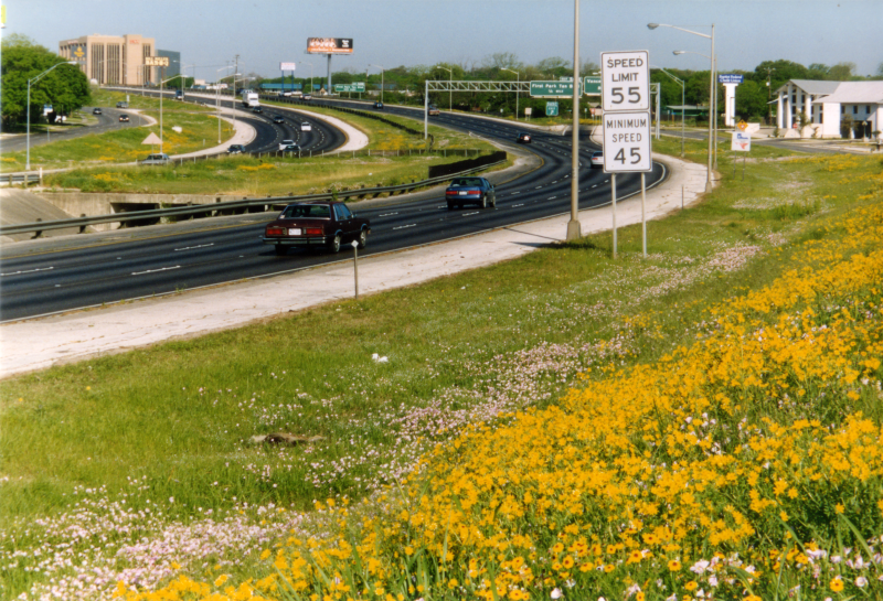
I-10 near West Ave. looking northwest (1998) Wildflowers! (TxDOT) |
|
|
I-10 near West Ave. looking northwest (1998) Wildflowers! (TxDOT) |
||
|
|
||
|
I-10 at Vance Jackson Rd. looking northwest (1961) Construction was still underway on this section. (TxDOT) |
|
|
I-10 at Vance Jackson Rd. looking northwest (1961) Construction was still underway on this section. (TxDOT) |
||
|
|
||
|
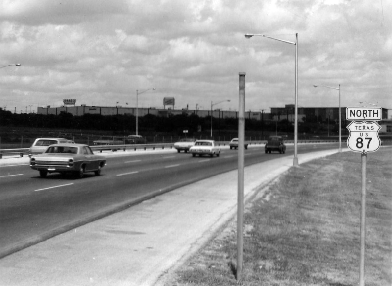
I-10 approaching Crossroads Blvd. (1968) This section was still signed as US 87. (TxDOT) |
|
|
I-10 approaching Crossroads Blvd. (1968) This section was still signed as US 87. (TxDOT) |
||
|
|
||
|
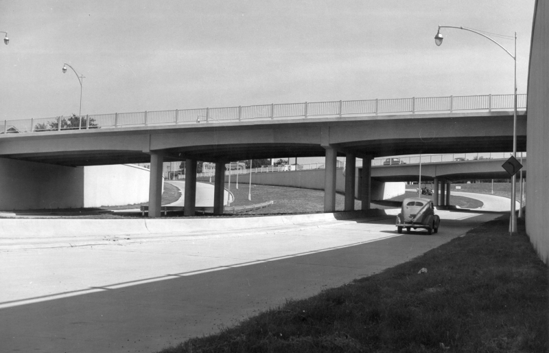
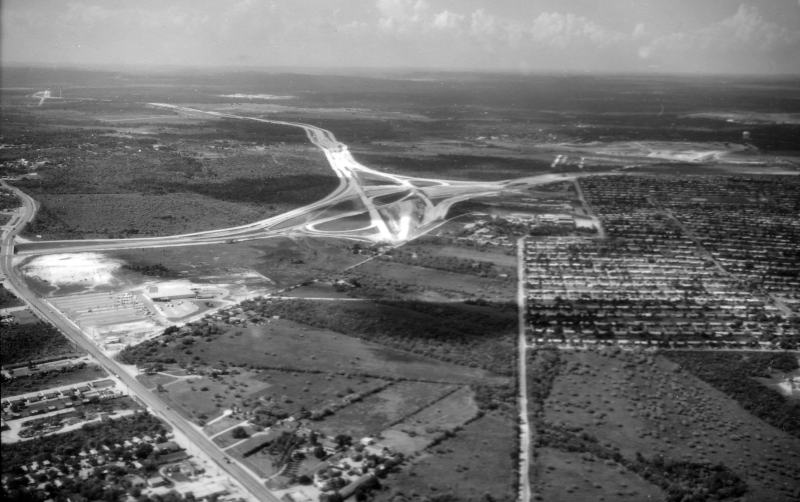
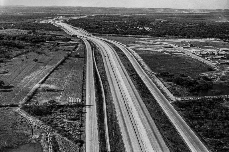
I-10/Loop 410 interchange looking north (1959) Construction was nearing completion on I-10 outside of Loop 410. Work had not yet started on I-10 inside Loop 410. (TxDOT) |
|
|
I-10/Loop 410 interchange looking north (1959) Construction was nearing completion on I-10 outside of Loop 410. Work had not yet started on I-10 inside Loop 410. (TxDOT) |
||
|
|
||
|
I-10/Loop 410 interchange looking north (1961) Work was still underway on I-10 inside Loop 410. (TxDOT) |
|
|
I-10/Loop 410 interchange looking north (1961) Work was still underway on I-10 inside Loop 410. (TxDOT) |
||
|
|
||
|
I-10 at Medical Dr. looking south (1996) Construction was underway to widen I-10 from Loop 410 to Wurzbach Rd. (TxDOT) |
|
|
I-10 at Medical Dr. looking south (1996) Construction was underway to widen I-10 from Loop 410 to Wurzbach Rd. (TxDOT) |
||
|
|
||
|
I-10 at Ramsgate Dr. looking northwest (1968) The area to the left is where USAA is today. (Courtesy of Jared Maurtua) |
|
|
I-10 at Ramsgate Dr. looking northwest (1968) The area to the left is where USAA is today. (Courtesy of Jared Maurtua) |
||
|
|
||
|
I-10 at DeZavala Rd. looking north (1966) The I-10 mainlanes were still under construction. (TxDOT) |
|
|
I-10 at DeZavala Rd. looking north (1966) The I-10 mainlanes were still under construction. (TxDOT) |
||
|
|
||
|
I-10 at DeZavala Rd. looking north (ca. 1984) (Courtesy of Jared Maurtua) |
|
|
I-10 at DeZavala Rd. looking north (ca. 1984) (Courtesy of Jared Maurtua) |
||
|
|
||
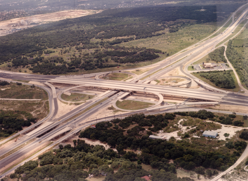
|
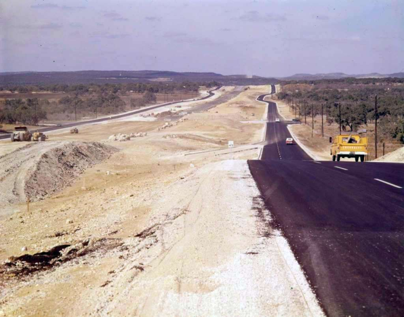
I-10 at Loop 1604 looking southwest (ca. 1980) The first phase of the cloverleaf interchange was under construction. (TxDOT) |
|
|
I-10 at Loop 1604 looking southwest (ca. 1980) The first phase of the cloverleaf interchange was under construction. (TxDOT) |
||
|
|
||
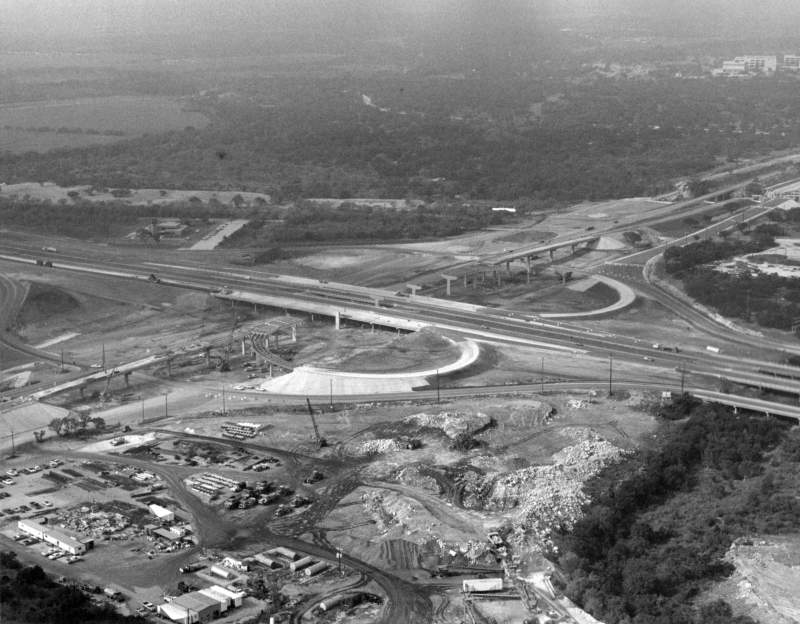
|
I-10 at Loop 1604 looking southeast (ca. 1987) The second phase of the cloverleaf interchange was nearing completion. (TxDOT) |
|
|
I-10 at Loop 1604 looking southeast (ca. 1987) The second phase of the cloverleaf interchange was nearing completion. (TxDOT) |
||
|
|
||
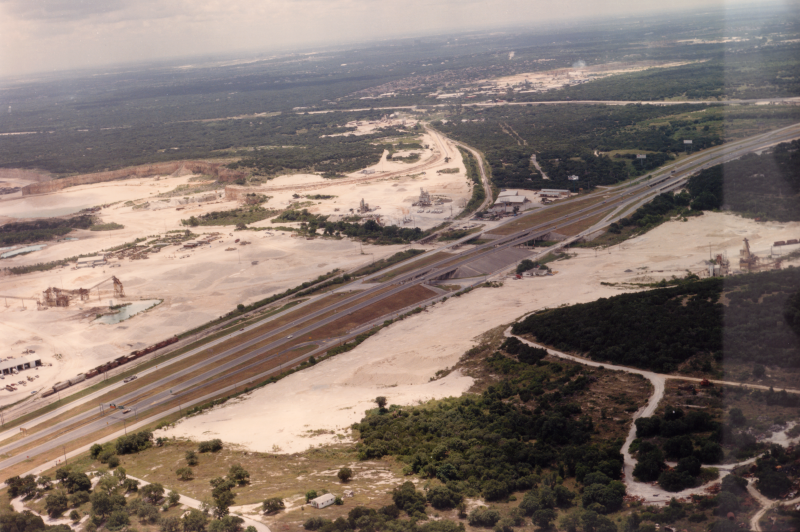
|
I-10 at La Cantera Pkwy. looking southeast (ca. 1987) The area that's now The Rim is to the left and was a quarry. Today's Six Flags Fiesta Texas is to the right. (TxDOT) |
|
|
I-10 at La Cantera Pkwy. looking southeast (ca. 1987) The area that's now The Rim is to the left and was a quarry. Today's Six Flags Fiesta Texas is to the right. (TxDOT) |
||
|
|
||
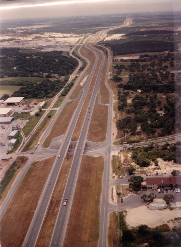
|
I-10 at Camp Bullis Rd. looking south (ca. 1987) (TxDOT) |
|
|
I-10 at Camp Bullis Rd. looking south (ca. 1987) (TxDOT) |
||
|
|
||