|
||
|
|
||
This page last updated July 12, 2026 |

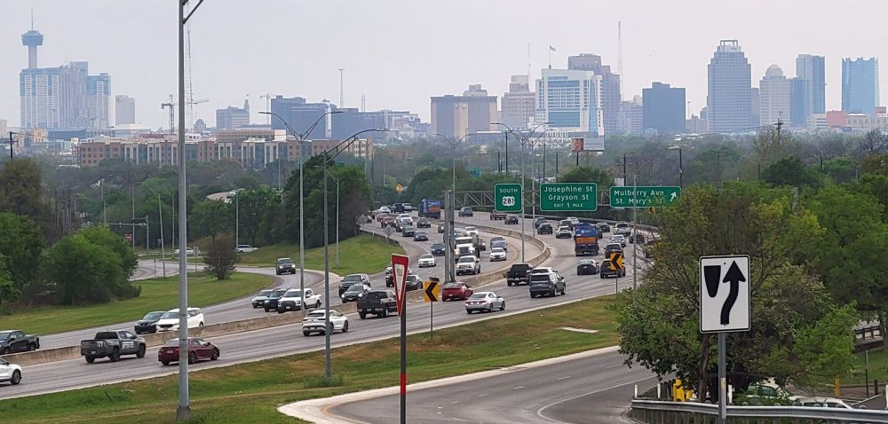
Since the first expressway opened in 1949, the San Antonio metropolitan area has enjoyed one of most progressive and comprehensive urban freeway systems in North America. For many of those early years, San Antonio was second only to Los Angeles in the number of freeway miles. While most US cities now have extensive freeway systems, Bexar County still has one of the largest systems of state highways and freeways in the nation.
In 2021, there were 1,030 miles of state-maintained roadways in Bexar County. In 2020, the San Antonio urbanized area had 253 miles of freeway, which ranked 23rd nationwide. But the city ranked 17th for freeway lane miles per capita. Just under 50% of all local traffic is carried on the freeway system, which ranks 11th nationally. A study by the Surface Transportation Policy Project in 1998 ranked San Antonio's highways as the best among the largest US urban areas.
This site covers the San Antonio freeway system in depth. Below, you'll find links to general information about the local freeways as well as pages for each freeway discussing the various characteristics of the route along with a detailed history. There is also information about the major freeway construction projects, TransGuide, and other interesting ancillary aspects of the local freeway system.
|
ADVERTISEMENT |
General information
 |
Primer Includes lots of basic information about the freeway system including layout, statistics, double-decked freeways construction, cancelled routes, and signage, as well as the conventions used on this site. |
 |
FAQs Answers to some of the most common questions I hear about San Antonio's freeways and other local roads. |
 |
Freeway system history A history of the evolution of the San Antonio freeway system. |
 |
2022 traffic statistics Freeway traffic counts and general statistics. |
The freeways
Below, you can access detailed information about each freeway including a general description, lane and access road configurations, a description of the general traffic conditions and traffic counts, a list of exits, speed limits, special features, current construction, future plans, and a detailed history of the route.

Click on a freeway segment on the map above or on one of the links below to go to the page for that freeway


Construction projects
 |
Current and future project list |
| MAJOR PROJECT PAGES | ||
 |
|
|
|
|
||
 |
|
|
|
|
||
 |
|
|
|
|
||
 |
|
|
|
|
||
 |
|
|
|
|
||
 |
(incl. US 281/San Pedro area) |
|
|
|
||
 |
|
|
|
|
||
 |
|
|
|
|
||
 |
|
|
|
|
||
 |
|
|
Etcetera


Other sites of interest
|
|
TxDOT- San Antonio District https://www.txdot.gov/about/ |
|
|
TxDOT - TransGuide https://its.txdot.gov/its/ |
|
|
Alamo Area Metropolitan Planning Organization https://www.alamoareampo.org/ |
|
|
Alamo Regional Mobility Authority https://www.bexar.org/339/ |
|
|
VIA Metropolitan Transit https://www.viainfo.net/ |
|
|
City of San Antonio - Public Works Department https://www.sanantonio.gov/PublicWorks |
|
|
San Antonio Mobility Coalition https://samcoinc.org/ |
|
|
Other Texas "Roadgeek" sites See the list on my main Texas page: https://www.texashighwayman.com/tex.shtml |