|
|
|
|
|
This page last updated January 5, 2025 |
Below are historical photos of various streets and roads on the North Side that are not included in other collections. The photos were sourced from the TxDOT photo library, the San Antonio TxDOT district office, and San Antonio-Bexar County Urban Transportation Study (SABCUTS) planning documents.
Locations are given using the present-day roadway names. Click on each photo for an enlarged view.
Click here to return to the historical photo galleries page.
|
ADVERTISEMENT |
|
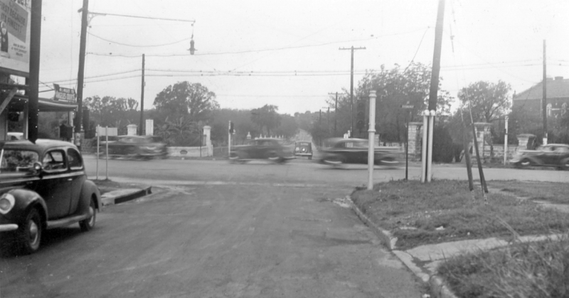
Hildebrand Ave. just east of Broadway looking west (ca. 1940) Incarnate Word University is at the right. Note the traffic light on the near right corner. (TxDOT) |
|
Hildebrand Ave. just east of Broadway looking west (ca. 1940) Incarnate Word University is at the right. Note the traffic light on the near right corner. (TxDOT) |
|
|
|
|
|
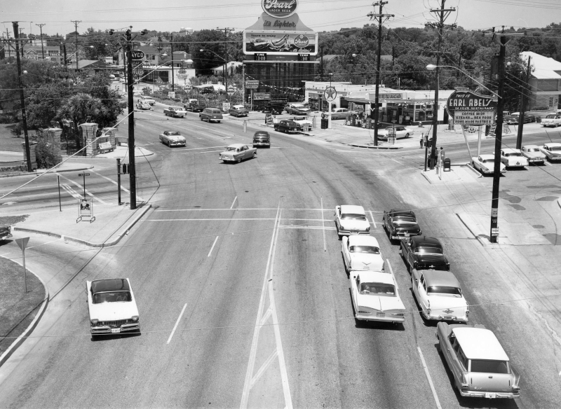
Broadway at Hildebrand Ave. looking northeast (1959) (Source unknown, likely TxDOT) |
|
Broadway at Hildebrand Ave. looking northeast (1959) (Source unknown, likely TxDOT) |
|
|
|
|
|
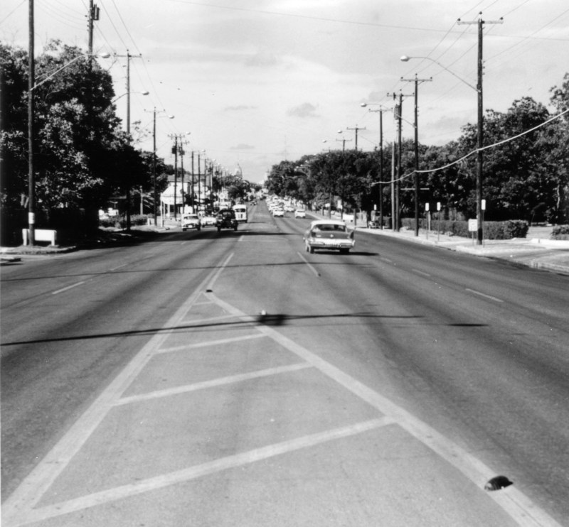
Broadway at Hildebrand Ave. looking southwest (ca. 1960) (TxDOT) |
|
Broadway at Hildebrand Ave. looking southwest (ca. 1960) (TxDOT) |
|
|
|
|
|
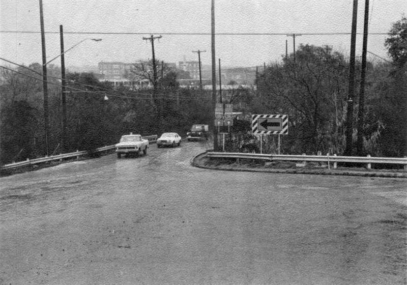
Hildebrand Ave. at Brackenridge Rd. (between US 281 & Broadway) looking east (ca. 1975) This was before Hildebrand was widened to four lanes in this area in 1979. (SABCUTS) |
|
Hildebrand Ave. at Brackenridge Rd. (between US 281 & Broadway) looking east (ca. 1975) This was before Hildebrand was widened to four lanes in this area in 1979. (SABCUTS) |
|
|
|
|
|
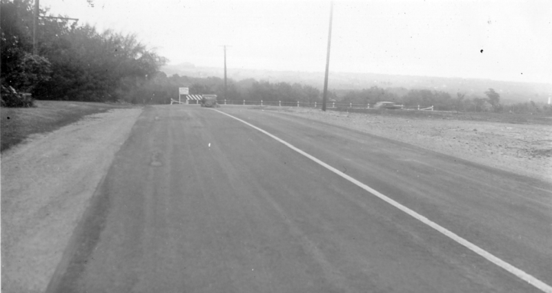
Hildebrand Ave. just west of Devine Rd. looking east (ca. 1940) Hildebrand used to make a dogleg at this location. This section of road was bypassed around 1960 and still exists today as Old Hildebrand Ave. (TxDOT) |
|
Hildebrand Ave. just west of Devine Rd. looking east (ca. 1940) Hildebrand used to make a dogleg at this location. This section of road was bypassed around 1960 and still exists today as Old Hildebrand Ave. (TxDOT) |
|
|
|
|
|
San Pedro Ave. at Olmos Creek (just north of Basse) looking north-northwest (ca. 1935) Note the macadam pavement. (TxDOT) |
|
San Pedro Ave. at Olmos Creek (just north of Basse) looking north-northwest (ca. 1935) Note the macadam pavement. (TxDOT) |
|
|
|
|
|
San Pedro Ave. at Basse Rd. looking north (1959) (TxDOT) |
|
San Pedro Ave. at Basse Rd. looking north (1959) (TxDOT) |
|
|
|
|
|
San Pedro Ave. at Jackson-Keller looking north (ca. 1959) Note the wide pavement on the right side-- its purpose is unknown. Today, that area is occupied by parking lots for the adjacent businesses. (Source unknown, likely TxDOT) |
|
San Pedro Ave. at Jackson-Keller looking north (ca. 1959) Note the wide pavement on the right side-- its purpose is unknown. Today, that area is occupied by parking lots for the adjacent businesses. (Source unknown, likely TxDOT) |
|
|
|
|
|
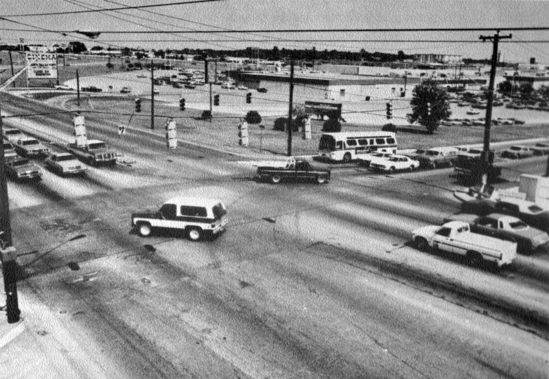
San Pedro Ave. at Rector St. looking northeast (ca. 1981) This is looking toward North Star Mall. (SABCUTS) |
|
San Pedro Ave. at Rector St. looking northeast (ca. 1981) This is looking toward North Star Mall. (SABCUTS) |
|
|
|
|
|
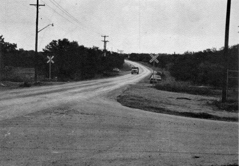
DeZavala Rd. at the railroad tracks looking east-northeast (ca. 1975) (SABCUTS) |
|
DeZavala Rd. at the railroad tracks looking east-northeast (ca. 1975) (SABCUTS) |
|
|
|
|

|
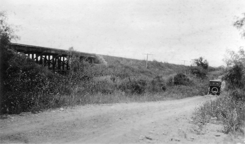
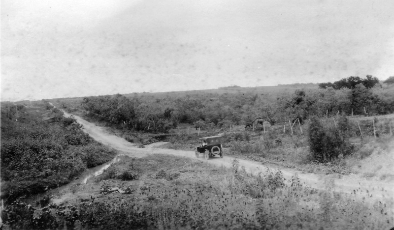
FM 78 at Cibolo Creek looking southeast (1921) The was before a road bridge was built at this site. At the time, the FM 78 corridor was SH 3. The road running left-to-right is today's Aviation Blvd. The truss railroad trestle was replaced in the late 1980s. (TxDOT) |
|
FM 78 at Cibolo Creek looking southeast (1921) The was before a road bridge was built at this site. At the time, the FM 78 corridor was SH 3. The road running left-to-right is today's Aviation Blvd. The truss railroad trestle was replaced in the late 1980s. (TxDOT) |
|
|
|
|
|
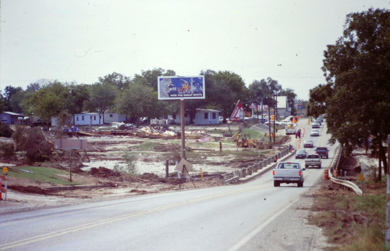
FM 78 at Cibolo Creek looking southwest (1998) This appears to show clean-up underway after a flood. (Source unknown) |
|
FM 78 at Cibolo Creek looking southwest (1998) This appears to show clean-up underway after a flood. (Source unknown) |
|
|
|
|
|
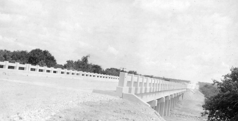
FM 78 just south of Loop 1604 looking north (1921) The location was not given with the photo, but the caption for this photo indicated it was the site of a future road bridge on the same segment of road as the previous photo at Cibolo Creek. There is currently a bridge on FM 78 just south of Loop 1604 today, but no trestle for the railroad. However, old aerial photos show there was a trestle of this approximate length at this location until around 1970 when that section was double-tracked and the trestle replaced with large culverts. There is one other location along this former stretch of SH 3 that has a bridge and an adjacent trestle-- it's on today's FM 3502 at Converse Rd. But that trestle is significantly longer than the one in this photo, and there's the intersecting road which old maps seem to indicate was there in 1921 but is not in the photo. So the location just inside Loop 1604 seems to be the most likely location. This would then be looking toward the north (TxDOT) |
|
|
|
|
|
FM 78 just south of Loop 1604 looking northeast (1921) This is the same location as the previous photo but looking toward the northeast. The topography in the distance helps to confirm its likely location. (TxDOT) |
|
FM 78 just south of Loop 1604 looking northeast (1921) This is the same location as the previous photo but looking toward the northeast. The topography in the distance helps to confirm its likely location. (TxDOT) |
|
|
|
|
|
FM 78 at FM 1516 in Converse looking south (ca. 1973) (SABCUTS) |
|
FM 78 at FM 1516 in Converse looking south (ca. 1973) (SABCUTS) |
|
|
|
|