|
|
|
|
|
This page last updated March 5, 2024 |
Below are historical photos of Interstate 35 North along with a brief history of the route. The photos were sourced from the TxDOT photo library, the San Antonio TxDOT district office, San Antonio-Bexar County Urban Transportation Study (SABCUTS) planning documents, and the author of this website.
Locations are given using the present-day roadway names. The photos are arranged generally from south to north. Click on each photo for an enlarged view.
Photos of the I‑10/I‑35 "Downtown Y" interchange are on a separate page here, and Fratt Interchange (I‑35 and Loop 410 North) photos are here.
Click here to return to the historical photo galleries page.
|
ADVERTISEMENT |
Route history


The section of today's I‑35 from Nogalitos St. to Broadway was included as part of the original three-legged expressway plan for San Antonio that was first laid-out around 1940 and was designed to provide bypass routes around the increasingly congested downtown core for through traffic on the various US and state highways that converged there. The United States' entrance into World War II delayed these plans.
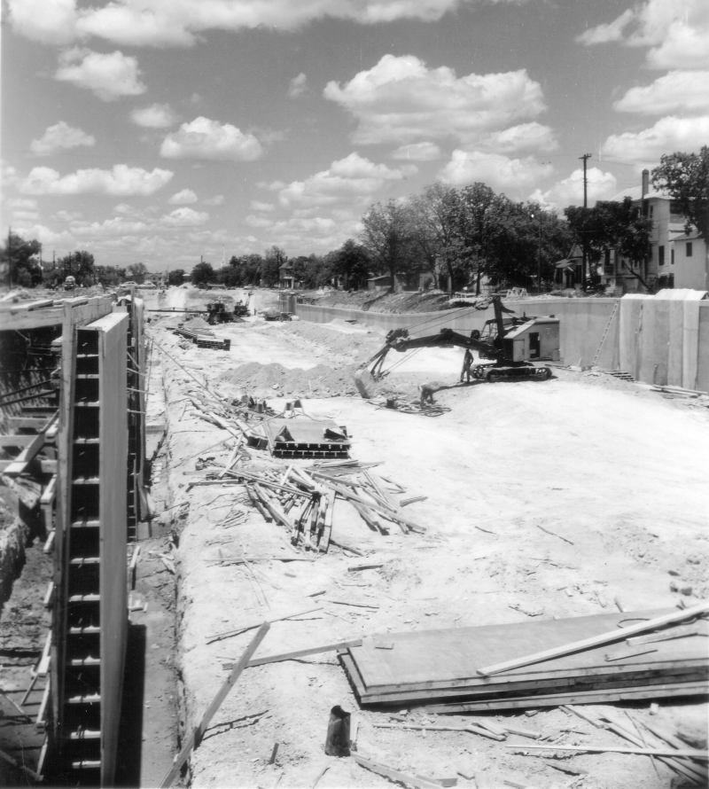
The plan was revived after the war, and the section from Martin St. to Broadway opened in 1954 as part of a bypass for US 81 around downtown. The expressway ended at Martin St. and motorists used Pecos and San Saba streets along the west side of downtown to reach another section of expressway running from Guadalupe St. to Nogalitos St. The gap was closed with the completion of the elevated expressway there in 1957, which also included the construction of the "Downtown Y" interchange.
In 1955, a section of "semi-expressway", which consisted of mainlanes and access roads but no overpasses at intersections, was completed from Toepperwein Rd. north to the county line, as well as the interchange at Pat Booker Rd. It was upgraded to full Interstate standards in 1960. In 1957, the section from Starlight Terrace to Toepperwein Rd. was completed followed a year later by the Fratt Interchange (I‑35/Loop 410 North.)
Work began around 1960 to complete the freeway from downtown to the Fratt Interchange. The section from Frost Bank Center Dr. (then called Artesia Rd.) to Rittiman Rd. was the first to open in late 1961, followed by the section from Broadway to Frost Bank Center Dr. in May 1962, and finally the section from Rittiman Rd. to the Fratt Interchange in October 1962. This completion made I‑35 in Bexar County the first Interstate to be fully completed in a metro county in Texas.
More details on the history of I‑35 is available here.
|
||
|
|
||
|
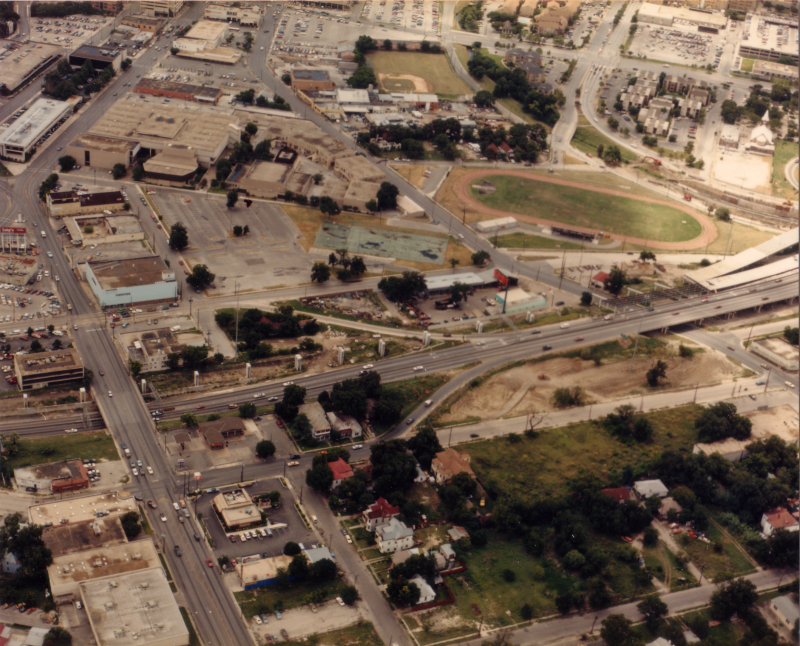
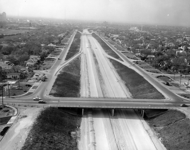
I‑35 at San Pedro Ave. looking south (ca. 1988) Construction of the double-decked freeway in this area was underway. (TxDOT) |
|
|
I‑35 at San Pedro Ave. looking south (ca. 1988) Construction of the double-decked freeway in this area was underway. (TxDOT) |
||
|
|
||
|
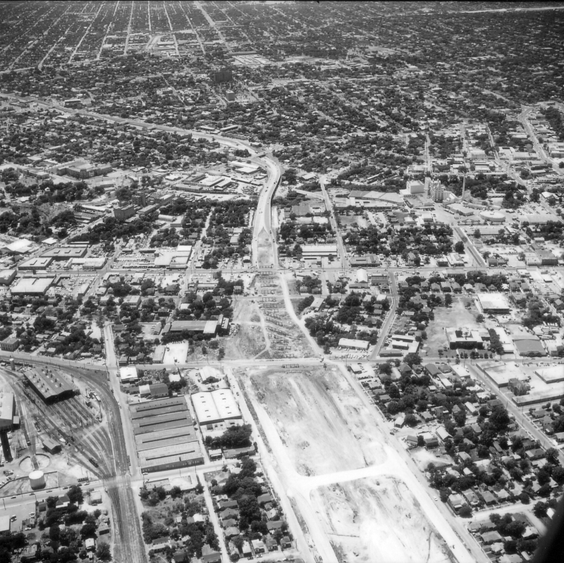
I‑35 near McCullough Ave. looking northeast (ca. 1955) (TxDOT) |
|
|
I‑35 near McCullough Ave. looking northeast (ca. 1955) (TxDOT) |
||
|
|
||

|
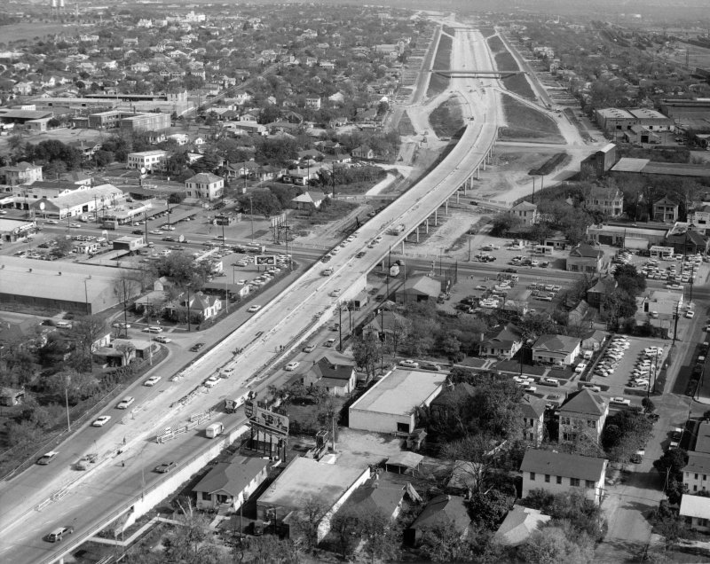
I‑35 at Broadway looking northwest (1960) Construction of I‑35 east of Broadway was underway. Note the ramps connecting I‑35 and Broadway — the original US 81 expressway ended here. The Pearl brewery complex is at the center. (TxDOT) |
|
|
I‑35 at Broadway looking northwest (1960) Construction of I‑35 east of Broadway was underway. Note the ramps connecting I‑35 and Broadway — the original US 81 expressway ended here. The Pearl brewery complex is at the center. (TxDOT) |
||
|
|
||

|
I‑35 at Broadway looking southwest (ca. 1960) (TxDOT/Les Guthrie) |
|
|
I‑35 at Broadway looking southwest (ca. 1960) (TxDOT/Les Guthrie) |
||
|
|
||
|
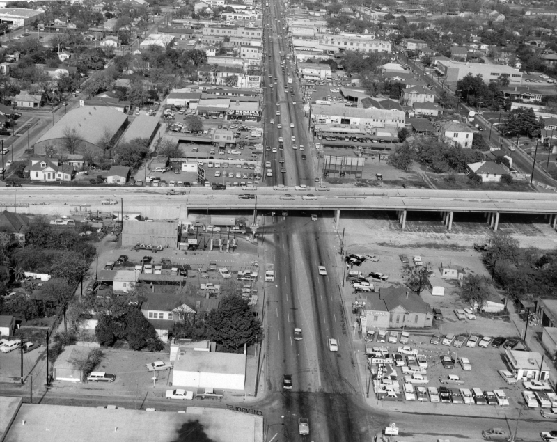
I‑35 at Broadway looking east (ca. 1960) (TxDOT) |
|
|
I‑35 at Broadway looking east (ca. 1960) (TxDOT) |
||
|
|
||
|
I‑35 at Broadway looking north (ca. 1960) (TxDOT) |
|
|
I‑35 at Broadway looking north (ca. 1960) (TxDOT) |
||
|
|
||
|
I‑35 at N Alamo St. looking west (1960) (TxDOT) |
|
|
I‑35 at N Alamo St. looking west (1960) (TxDOT) |
||
|
|
||
|
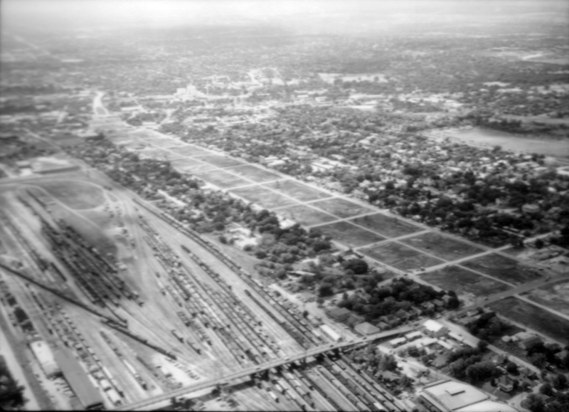
I‑35 at N New Braunfels Ave. looking northwest (1959) The right-of-way for the future I‑35 has been cleared, but the street grid is still in place. (TxDOT) |
|
|
I‑35 at N New Braunfels Ave. looking northwest (1959) The right-of-way for the future I‑35 has been cleared, but the street grid is still in place. (TxDOT) |
||
|
|
||
|
I‑35 at N New Braunfels Ave. looking west (ca. 1960) (TxDOT) |
|
|
I‑35 at N New Braunfels Ave. looking west (ca. 1960) (TxDOT) |
||
|
|
||
|
I‑35 at Salado Creek looking southwest (1960) (TxDOT) |
|
|
I‑35 at Salado Creek looking southwest (1960) (TxDOT) |
||
|
|
||
|
I‑35 at Binz-Engleman looking northeast (1961) Brooke Army Medical Center is located here today. (TxDOT/Les Guthrie) |
|
|
I‑35 at Binz-Engleman looking northeast (1961) Brooke Army Medical Center is located here today. (TxDOT/Les Guthrie) |
||
|
|
||
|
I‑35 at Binz-Engleman looking north (1961) In the foreground, you can see where FM 78 turns to go under the railroad overpass. Prior to I‑35 being built, that road connected with Seguin Rd. on the other side of I‑35 and was originally part of State Highway 3 to Seguin and Houston. (TxDOT) |
|
|
I‑35 at Binz-Engleman looking north (1961) In the foreground, you can see where FM 78 turns to go under the railroad overpass. Prior to I‑35 being built, that road connected with Seguin Rd. on the other side of I‑35 and was originally part of State Highway 3 to Seguin and Houston. (TxDOT) |
||
|
|
||
|
I‑35 at Loop 410 South Cutoff looking northwest (1961) Work on I‑35 north of here was still ongoing. (TxDOT/Les Guthrie) |
|
|
I‑35 at Loop 410 South Cutoff looking northwest (1961) Work on I‑35 north of here was still ongoing. (TxDOT/Les Guthrie) |
||
|
|
||
|
I‑35 at Loop 410 South Cutoff looking northeast (1961) (TxDOT/Les Guthrie) |
|
|
I‑35 at Loop 410 South Cutoff looking northeast (1961) (TxDOT/Les Guthrie) |
||
|
|
||
|
I‑35 at Loop 410 South Cutoff looking northeast (1961) The east-west roadway is Rittiman Rd. (TxDOT) |
|
|
I‑35 at Loop 410 South Cutoff looking northeast (1961) The east-west roadway is Rittiman Rd. (TxDOT) |
||
|
|
||
|
I‑35 at Loop 410 South Cutoff looking south (1961) Notice that Loop 410 (Loop 13 at that time) is still only a two-lane road. Rittiman Rd. is in the foreground. (TxDOT) |
|
|
I‑35 at Loop 410 South Cutoff looking south (1961) Notice that Loop 410 (Loop 13 at that time) is still only a two-lane road. Rittiman Rd. is in the foreground. (TxDOT) |
||
|
|
||
|
I‑35 at Loop 410 South Cutoff looking east (ca. 1966) The warehouse is the HEB warehouse. The town in the background is Kirby. (TxDOT) |
|
|
I‑35 at Loop 410 South Cutoff looking east (ca. 1966) The warehouse is the HEB warehouse. The town in the background is Kirby. (TxDOT) |
||
|
|
||
|
I‑35 at Rittiman Rd. looking southwest (ca. 1960) (TxDOT) |
|
|
I‑35 at Rittiman Rd. looking southwest (ca. 1960) (TxDOT) |
||
|
|
||
|
I‑35 at Rittiman Rd. looking east (ca. 1964) (TxDOT) |
|
|
I‑35 at Rittiman Rd. looking east (ca. 1964) (TxDOT) |
||
|
|
||
|
I‑35 at Eisenhauer Rd. looking north (ca. 1960) Work was just about to start on I‑35 here. The existing two-lane road was Loop 13. The subdivision at the top center was the first neighborhood of what would become Windcrest. (TxDOT) |
|
|
I‑35 at Eisenhauer Rd. looking north (ca. 1960) Work was just about to start on I‑35 here. The existing two-lane road was Loop 13. The subdivision at the top center was the first neighborhood of what would become Windcrest. (TxDOT) |
||
|
|
||
|
I‑35 at Eisenhauer Rd. looking northeast (1961) Work on the I‑35 access roads was nearing completion. (TxDOT) |
|
|
I‑35 at Eisenhauer Rd. looking northeast (1961) Work on the I‑35 access roads was nearing completion. (TxDOT) |
||
|
|
||
|
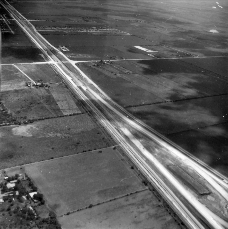
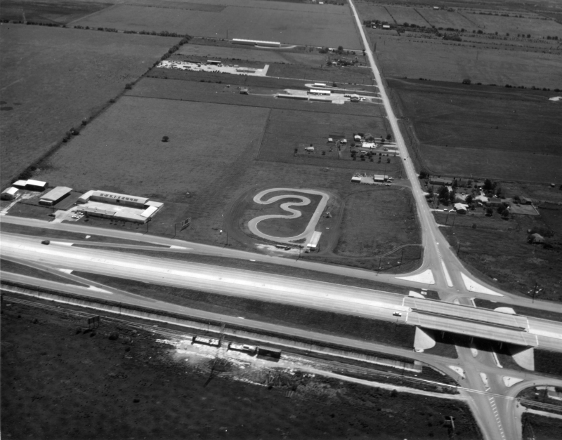
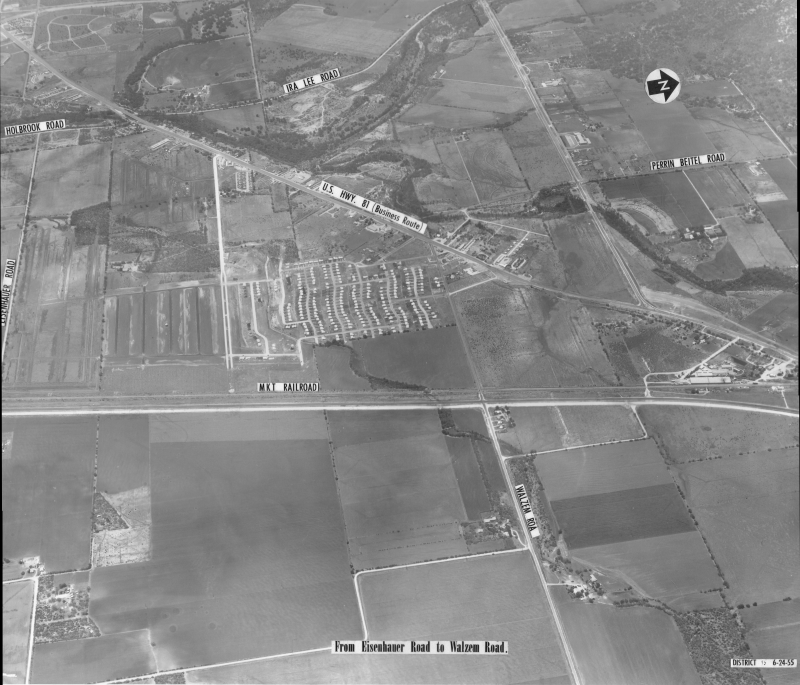
I‑35 at Walzem Rd. looking west (1955) I‑35 here was still the two-lane Loop 13 at this time. "US Hwy. 81 (Business Route)" is Austin Hwy. Today's Loop 410 running west from Austin Hwy. is also visible; it, too, was still a two-lane Loop 13 at this time. (TxDOT/Jack Ammann Photogrammetric Engineers) |
|
|
I‑35 at Walzem Rd. looking west (1955) I‑35 here was still the two-lane Loop 13 at this time. "US Hwy. 81 (Business Route)" is Austin Hwy. Today's Loop 410 running west from Austin Hwy. is also visible; it, too, was still a two-lane Loop 13 at this time. (TxDOT/Jack Ammann Photogrammetric Engineers) |
||
|
|
||
|
I‑35 at Walzem Rd. looking west (ca. 1965) (TxDOT) |
|
|
I‑35 at Walzem Rd. looking west (ca. 1965) (TxDOT) |
||
|
|
||

|
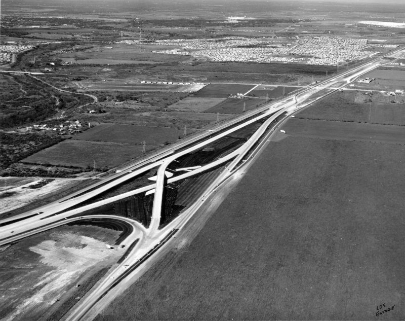
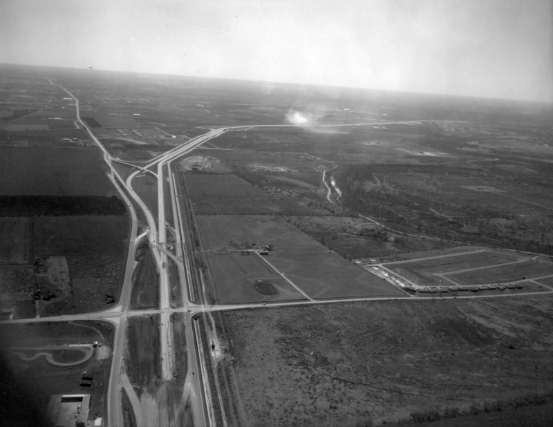
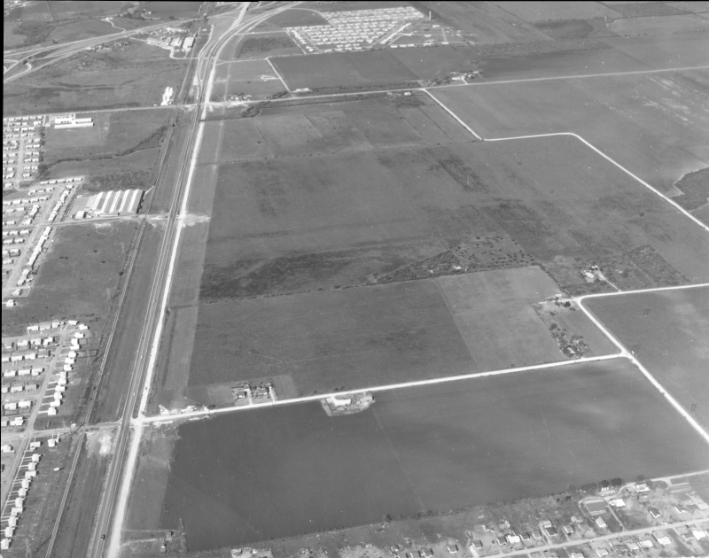
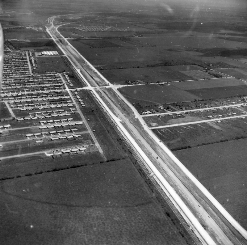
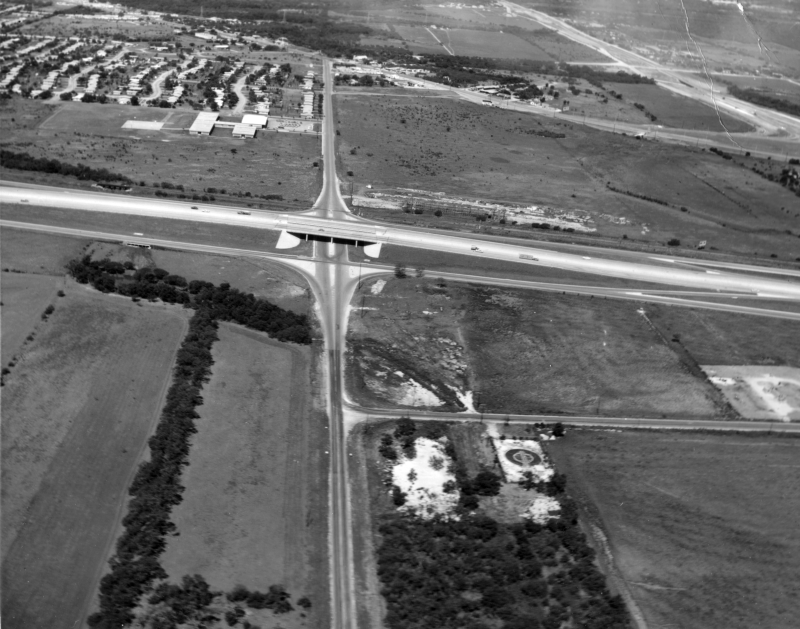
I‑35 at Fratt looking northeast (ca. 1960) The recently-completed Fratt Interchange is at the left. The cluster of buildings at the left center is the community of Fratt. It was demolished around 1980 to make way for the Interchange business park. Walzem Rd. is at the lower right. (TxDOT) |
|
|
I‑35 at Fratt looking northeast (ca. 1960) The recently-completed Fratt Interchange is at the left. The cluster of buildings at the left center is the community of Fratt. It was demolished around 1980 to make way for the Interchange business park. Walzem Rd. is at the lower right. (TxDOT) |
||
|
|
||
|
||
|
|
||
|
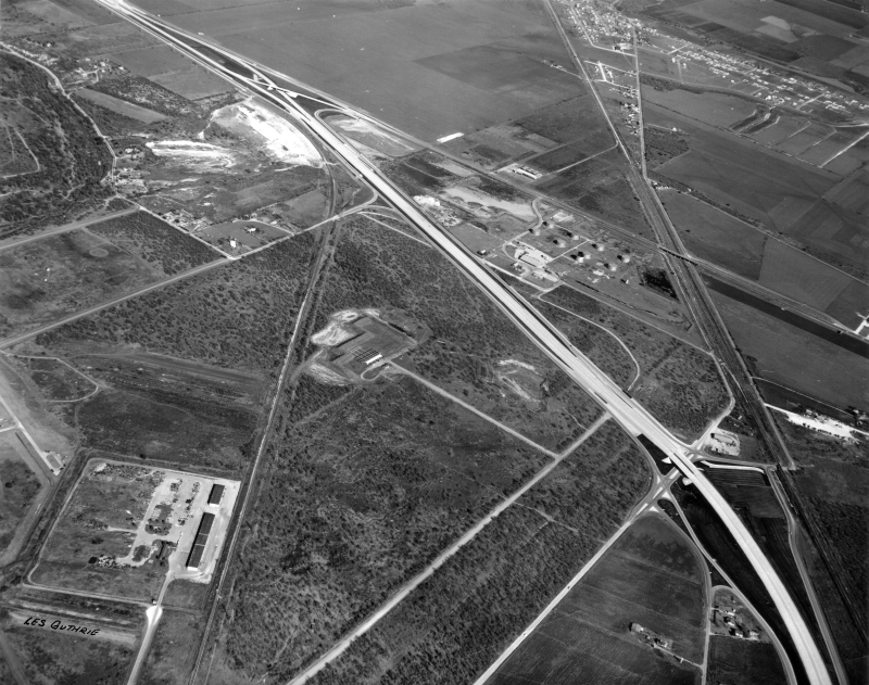
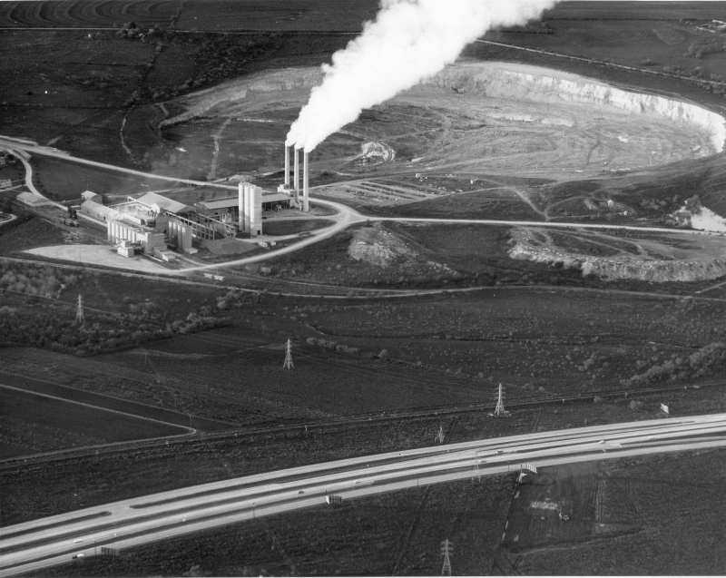
I‑35 at Starlight Terr. looking northwest (ca. 1960) This is the Longhorn Quarry which now is home to Morgan's Wonderland, Heros Stadium, and Toyota Field. (TxDOT) |
|
|
I‑35 at Starlight Terr. looking northwest (ca. 1960) This is the Longhorn Quarry which now is home to Morgan's Wonderland, Heros Stadium, and Toyota Field. (TxDOT) |
||
|
|
||
|
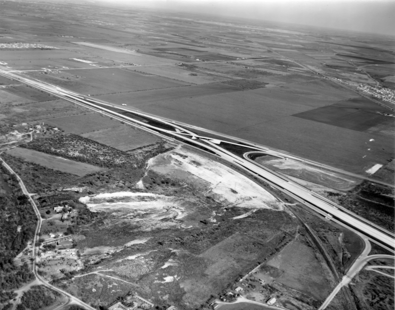
I‑35 at Weidner Rd. looking west (ca. 1960) The road headed to the left on the other side of I‑35 is Schertz Rd., which used to go through to Thousand Oaks Dr. It was severed by Wurzbach Pkwy. around 1999 and replaced by the Thousand Oaks extension to I‑35. (TxDOT) |
|
|
I‑35 at Weidner Rd. looking west (ca. 1960) The road headed to the left on the other side of I‑35 is Schertz Rd., which used to go through to Thousand Oaks Dr. It was severed by Wurzbach Pkwy. around 1999 and replaced by the Thousand Oaks extension to I‑35. (TxDOT) |
||
|
|
||
|
I‑35 at Weidner Rd. looking southwest (ca. 1975) (TxDOT) |
|
|
I‑35 at Weidner Rd. looking southwest (ca. 1975) (TxDOT) |
||
|
|
||
|
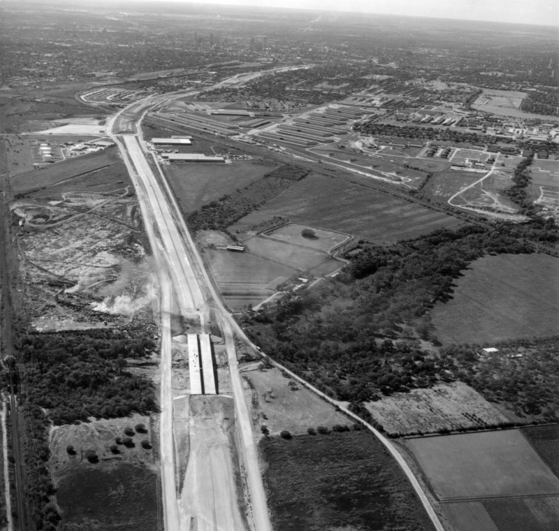
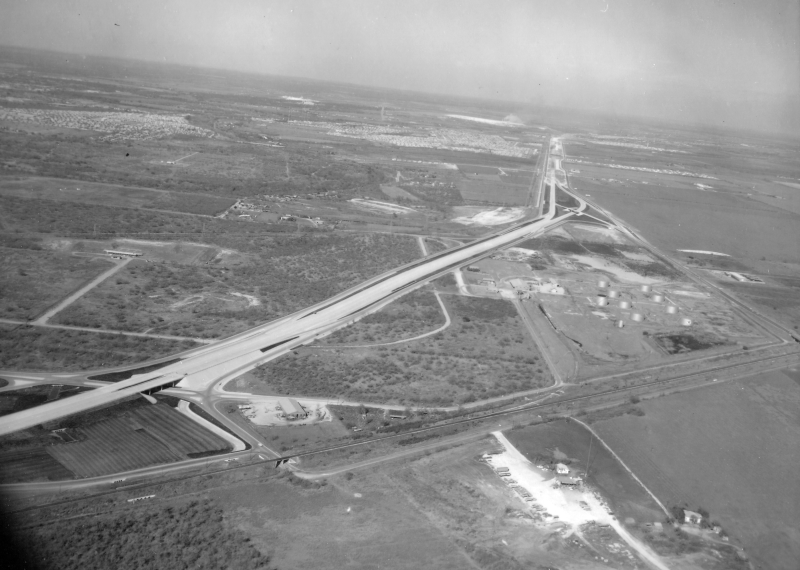
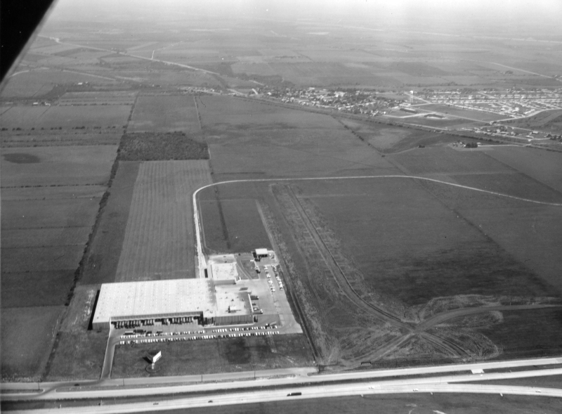
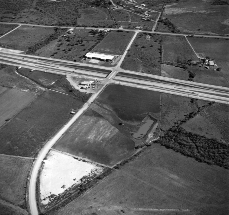
I‑35 at O'Connor Rd. looking southeast (1960) The long white building near the center of the photo was a Volkswagen parts distribution center. It burned down in early 1971 and was not rebuilt. (TxDOT) |
|
|
I‑35 at O'Connor Rd. looking southeast (1960) The long white building near the center of the photo was a Volkswagen parts distribution center. It burned down in early 1971 and was not rebuilt. (TxDOT) |
||
|
|
||

|
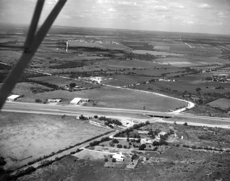
I‑35 at Judson Rd. looking north (ca. 1981) I‑35 was still just two lanes in each direction at this time, and the Judson overpass was just two lanes. Work to expand both would begin shortly after this. (SABCUTS) |
|
|
I‑35 at Judson Rd. looking north (ca. 1981) I‑35 was still just two lanes in each direction at this time, and the Judson overpass was just two lanes. Work to expand both would begin shortly after this. (SABCUTS) |
||
|
|
||
|
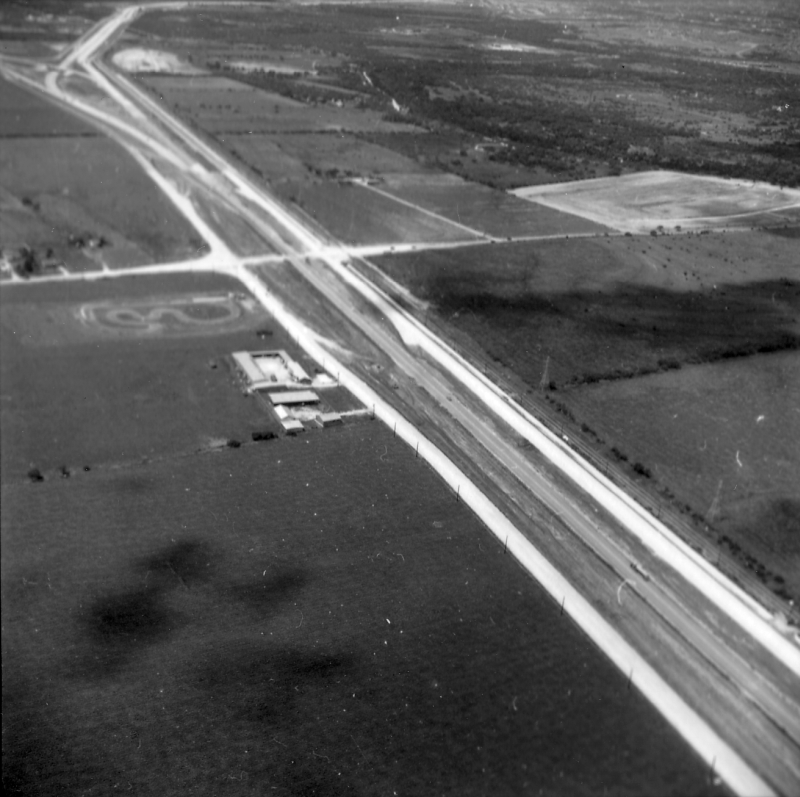
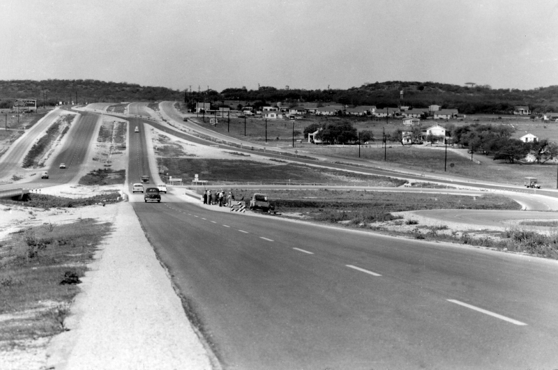
I‑35 at Pat Booker Rd. looking southwest (ca. 1957) In the distance, you can see the mainlanes are blocked and traffic is shunted to the access road on the left. The mainlanes south of here were still under construction but nearing completion. (TxDOT) |
|
|
I‑35 at Pat Booker Rd. looking southwest (ca. 1957) In the distance, you can see the mainlanes are blocked and traffic is shunted to the access road on the left. The mainlanes south of here were still under construction but nearing completion. (TxDOT) |
||
|
|
||
|
I‑35 at Pat Booker Rd. looking southwest (ca. 1972) (SABCUTS) |
|
|
I‑35 at Pat Booker Rd. looking southwest (ca. 1972) (SABCUTS) |
||
|
|
||
|
I‑35 at Pat Booker Rd. looking northwest (ca. 1972) (SABCUTS) |
|
|
I‑35 at Pat Booker Rd. looking northwest (ca. 1972) (SABCUTS) |
||
|
|
||

|
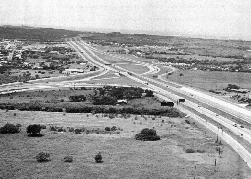
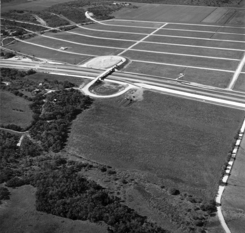
I‑35 at Loop 1604 looking southwest (ca. 1972) Note the two-lane Loop 1604 and the wide, diamond-shaped right-of-way cleared for what would eventually become the cloverleaf interchange that exists at this location today. The Forum shopping center currently sits in the wooded area at the bottom of the photo. (SABCUTS) |
|
|
I‑35 at Loop 1604 looking southwest (ca. 1972) Note the two-lane Loop 1604 and the wide, diamond-shaped right-of-way cleared for what would eventually become the cloverleaf interchange that exists at this location today. The Forum shopping center currently sits in the wooded area at the bottom of the photo. (SABCUTS) |
||
|
|
||

|
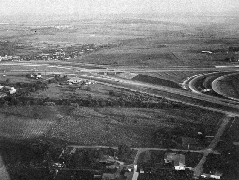
I‑35 at Forum Pkwy. looking northeast (ca. 1955) The empty field near the center of the photo is where Retama Park is today. (TxDOT) |
|
|
I‑35 at Forum Pkwy. looking northeast (ca. 1955) The empty field near the center of the photo is where Retama Park is today. (TxDOT) |
||
|
|
||
|
I‑35 at Forum Pkwy. looking northeast (1988) Work on the Loop 1604 interchange had just been completed. The six lane section of I‑35 mainlanes ended at Olympia Pkwy. at this time. Also note the median barrier fencing/glare screen; this was removed sometime in the late 1990s. (TxDOT) |
|
|
I‑35 at Forum Pkwy. looking northeast (1988) Work on the Loop 1604 interchange had just been completed. The six lane section of I‑35 mainlanes ended at Olympia Pkwy. at this time. Also note the median barrier fencing/glare screen; this was removed sometime in the late 1990s. (TxDOT) |
||
|
|
||
|
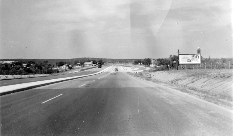
I‑35 at Olympia Pkwy. looking west (1960) (TxDOT) |
|
|
I‑35 at Olympia Pkwy. looking west (1960) (TxDOT) |
||
|
|
||
|
I‑35 at Cibolo Creek in Selma looking southwest (ca. 1960) (TxDOT) |
|
|
I‑35 at Cibolo Creek in Selma looking southwest (ca. 1960) (TxDOT) |
||
|
|
||

|
I‑35 at Cibolo Creek in Selma looking west (1960) (TxDOT) |
|
|
I‑35 at Cibolo Creek in Selma looking west (1960) (TxDOT) |
||
|
|
||
|
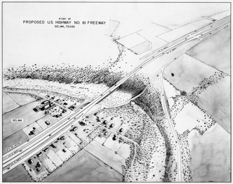
Artist rendering for proposed I‑35 (US 81) freeway in Selma (ca. 1955) The original plan did not include a southbound access road across the creek. The northbound access road was the original US 81 route; it was realigned during an expansion in 1993. (TxDOT) |
|
|
Artist rendering for proposed I‑35 (US 81) freeway in Selma (ca. 1955) The original plan did not include a southbound access road across the creek. The northbound access road was the original US 81 route; it was realigned during an expansion in 1993. (TxDOT) |
||
|
|
||
|
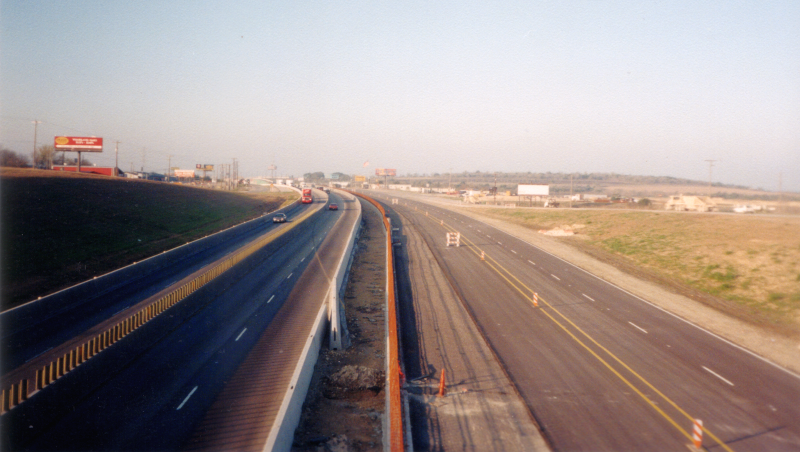
I‑35 at Schertz Pkwy. Looking northeast (ca. 1995) (TxDOT) |
|
|
I‑35 at Schertz Pkwy. Looking northeast (ca. 1995) (TxDOT) |
||
|
|
||
|
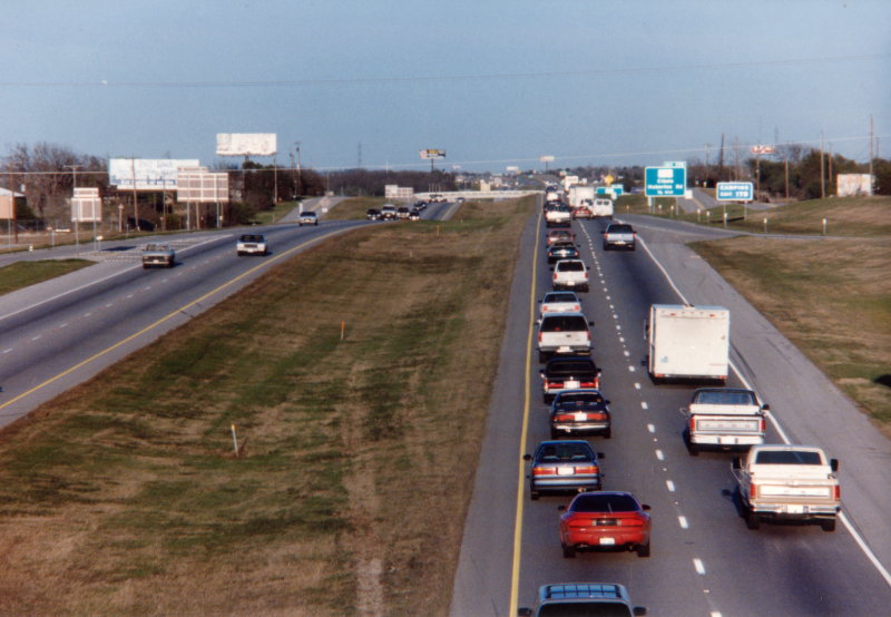
I‑35 at FM 2252 looking northeast (ca. 1995) This was a few years before work to widen I‑35 in this area started. (TxDOT) |
|
|
I‑35 at FM 2252 looking northeast (ca. 1995) This was a few years before work to widen I‑35 in this area started. (TxDOT) |
||
|
|
||
|
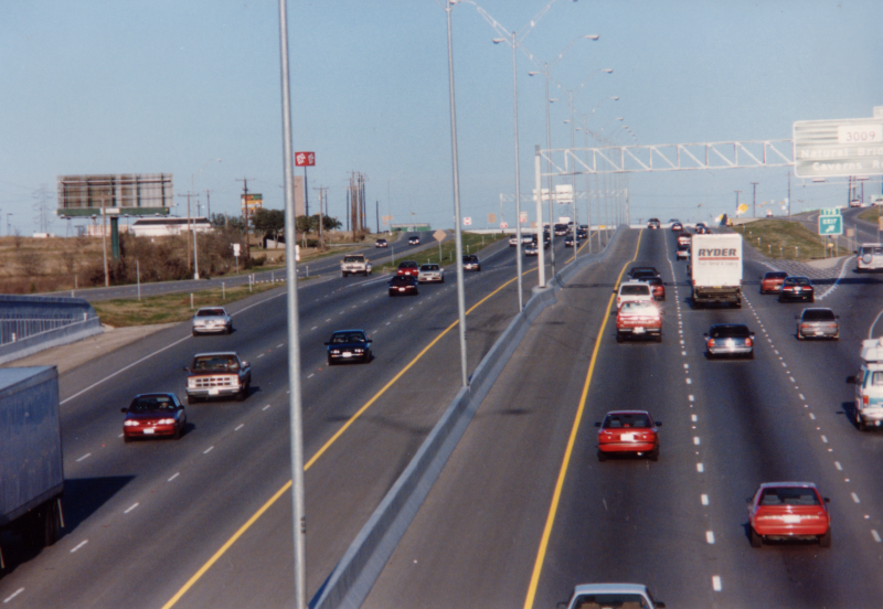
I‑35 at FM 2252 looking southwest (2001) Construction to widen I‑35 was underway. (Brian Purcell) |
|
|
I‑35 at FM 2252 looking southwest (2001) Construction to widen I‑35 was underway. (Brian Purcell) |
||
|
|
||

|
I‑35 at Engel Rd. looking southeast (1960) This was still just a divided highway at this time. Work to upgrade this section to Interstate standards would be complete by 1965. (TxDOT) |
|
|
I‑35 at Engel Rd. looking southeast (1960) This was still just a divided highway at this time. Work to upgrade this section to Interstate standards would be complete by 1965. (TxDOT) |
||
|
|
||
|
I‑35 at Solms Rd. looking north (ca. 1962) (TxDOT) |
|
|
I‑35 at Solms Rd. looking north (ca. 1962) (TxDOT) |
||
|
|
||