|
|
|
|
|
This page last updated March 6, 2024 |
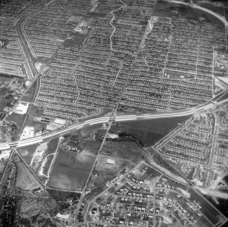
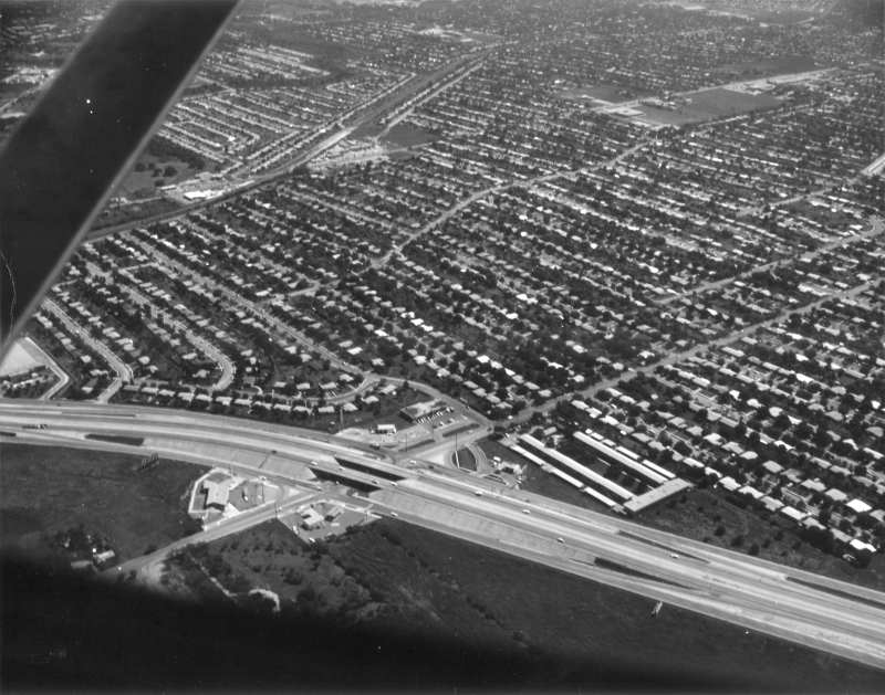
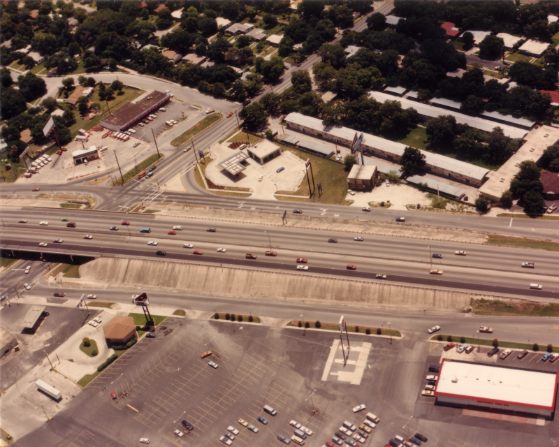
Below are historical photos of Loop 410 along with a brief history of the route. The photos were sourced from the TxDOT photo library, the San Antonio TxDOT district office, and the author of this website.
Locations are given using the present-day roadway names. The photos are arranged generally counter-clockwise starting at Perrin-Beitel. Click on each photo for an enlarged view.
Click here to return to the historical photo galleries page.
|
ADVERTISEMENT |
Route history


In 1932, engineer Edwin Arneson released his plan for local state highways which included the first proposal for a loop around San Antonio. The state established the first sections of Loop 13 on the South Side in the late '30s to connect Kelly Field and Brooks Field; that road is now Military Dr.
The first section of Loop 13 on the North Side was designated around 1950 and was a two-lane road from San Pedro Ave. east to US 81 (Austin Hwy.) that mostly appropriated existing roadways — namely, part of the Harry Wurzbach Military Hwy. and Zercher Rd. Around 1952, Loop 13 was extended north from FM 78 to US 81.
Work started on the section from US 90 West northward and eastward to NW Military Hwy. in the mid '50s with the first section, from Culebra Rd. to Bandera Rd., opening in 1956, and entire northwestern arc open by 1958. Work then progressed southward from US 90 to I‑35 and eastward from NW Military Hwy. to Wetmore Rd. (upgrading the existing two-lane roadway there) with those segments opening between 1959 and 1961.
In the early '60s, work to complete the upgrade of the existing road east of Wetmore Rd. to I‑35 was completed as was construction of the route between I‑35 South to near I‑37 and from I‑35 at Rittiman Rd. south to New Sulphur Springs Rd. The section of Loop 13 between Rittiman Rd. and Randolph Blvd. was upgraded to a freeway and incorporated into I‑35 during this period as well. The final section, from New Sulphur Springs Rd. to S Presa St. was opened with a ceremony in early 1966.
Interstate 410 was designated in 1959, and the recently-built sections of Loop 13 on the Northwest Side were renumbered accordingly. However, the section on the North Side between I‑10 and I‑35 was actually not included in the original Interstate 410 designation and therefore was designated and signed as State Loop 410 until it was finally officially designated Interstate 410 in July 1969. It was reported that the Interstate designation was delayed because there was a disagreement between the state and federal highway officials over that section's design.
More details on the history of Loop 410 is available here.
|
Loop 410 at Beitel Creek looking north (ca. 1980) (TxDOT) |
|
|
Loop 410 at Beitel Creek looking north (ca. 1980) (TxDOT) |
||
|
|
||

|
Loop 410 at Perrin-Beitel Rd. looking east (ca. 1980) (TxDOT) |
|
|
Loop 410 at Perrin-Beitel Rd. looking east (ca. 1980) (TxDOT) |
||
|
|
||
|
Loop 410 at Starcrest Dr. looking west (2001) (Brian Purcell) |
|
|
Loop 410 at Starcrest Dr. looking west (2001) (Brian Purcell) |
||
|
|
||

|
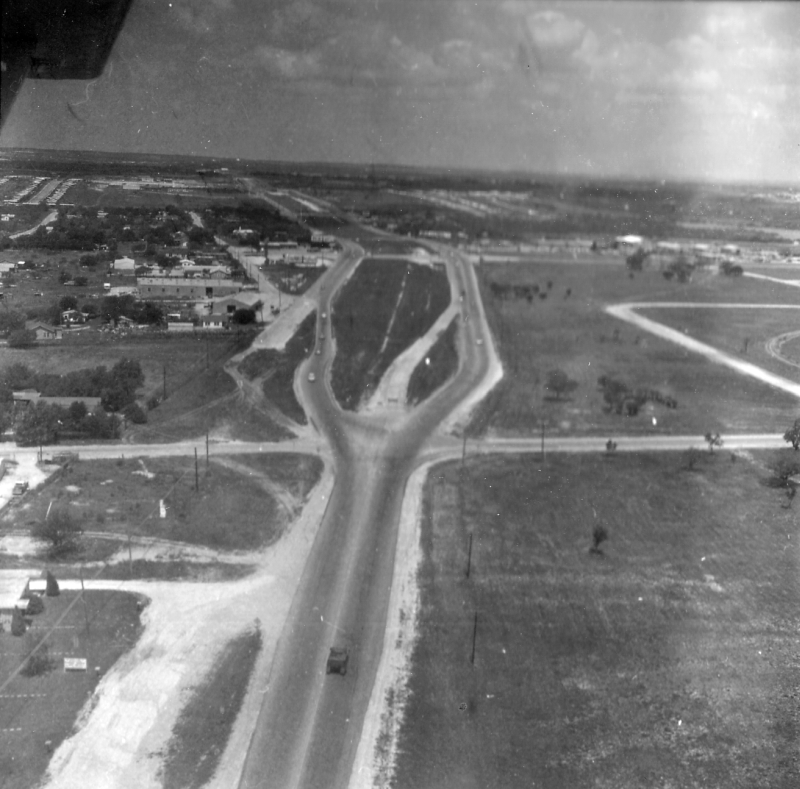
Loop 410 at Nacogdoches Rd. looking northwest (1961) Loop 410 is the road running left to right and was just a four-lane surface road at this time. (TxDOT) |
|
|
Loop 410 at Nacogdoches Rd. looking northwest (1961) Loop 410 is the road running left to right and was just a four-lane surface road at this time. (TxDOT) |
||
|
|
||
|
Loop 410 at Broadway looking northeast (1961) Loop 410 is the road running left to right and was just a four-lane surface road at this time. (TxDOT) |
|
|
Loop 410 at Broadway looking northeast (1961) Loop 410 is the road running left to right and was just a four-lane surface road at this time. (TxDOT) |
||
|
|
||
|
Loop 410 at Broadway looking northwest (1965) (TxDOT) |
|
|
Loop 410 at Broadway looking northwest (1965) (TxDOT) |
||
|
|
||
|
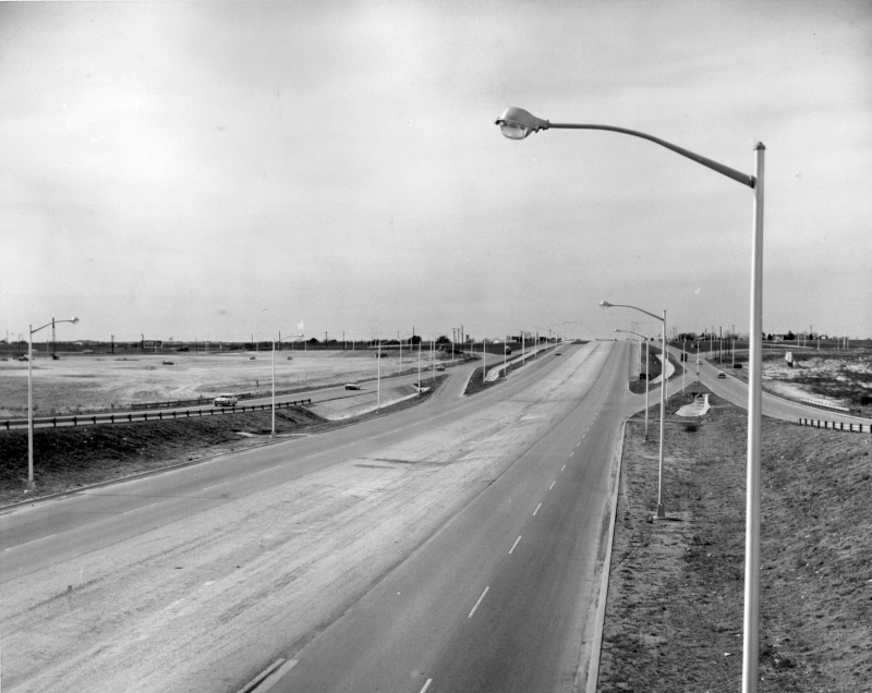
Loop 410 at Bullitt St. looking west (1961) This is near Wetmore Rd. and shows where the frontage roads for the future freeway began. To the east of here it was still a four-lane surface road. (TxDOT) |
|
|
Loop 410 at Bullitt St. looking west (1961) This is near Wetmore Rd. and shows where the frontage roads for the future freeway began. To the east of here it was still a four-lane surface road. (TxDOT) |
||
|
|
||
|
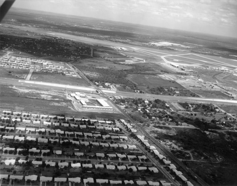
Loop 410 at Airport Blvd. looking east (1960) Another view of the transition point from the frontage roads to original roadway. The airport is to the left. (TxDOT) |
|
|
Loop 410 at Airport Blvd. looking east (1960) Another view of the transition point from the frontage roads to original roadway. The airport is to the left. (TxDOT) |
||
|
|
||
|
Loop 410 at Airport Blvd. looking northwest (1960) (TxDOT) |
|
|
Loop 410 at Airport Blvd. looking northwest (1960) (TxDOT) |
||
|
|
||
|
Loop 410 at Airport Blvd. looking east (1960) (TxDOT) |
|
|
Loop 410 at Airport Blvd. looking east (1960) (TxDOT) |
||
|
|
||
|
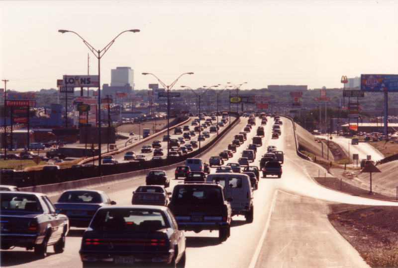
Loop 410 at Airport Blvd. looking west (ca. 1992) (TxDOT) |
|
|
Loop 410 at Airport Blvd. looking west (ca. 1992) (TxDOT) |
||
|
|
||
|
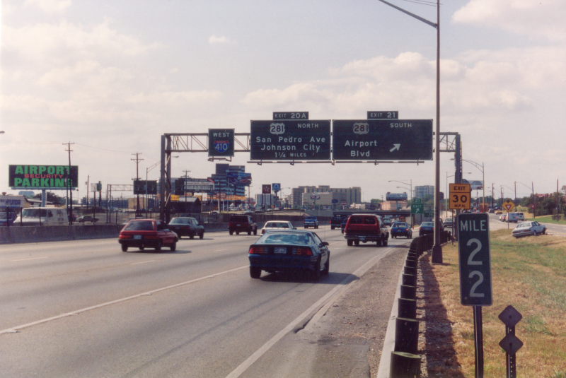
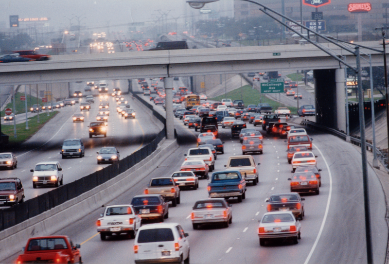
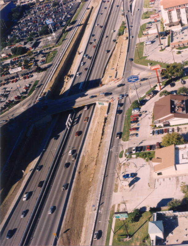
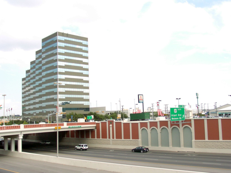
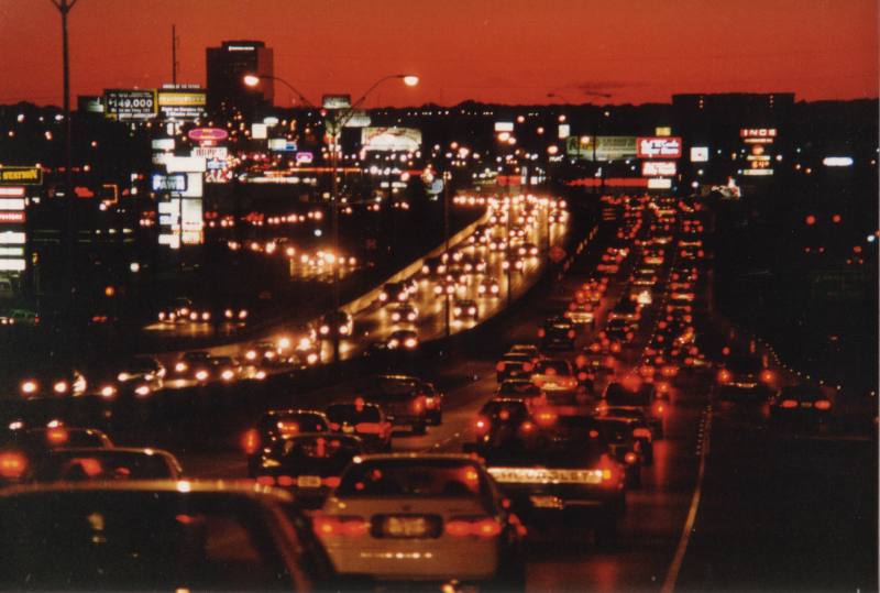
Loop 410 at Airport Blvd. looking south (ca. 1998) This is from before the Loop 410/US 281 interchange was constructed and shows the traffic congestion on Airport Blvd. which was used to connect the two freeways. (TxDOT) |
|
|
Loop 410 at Airport Blvd. looking south (ca. 1998) This is from before the Loop 410/US 281 interchange was constructed and shows the traffic congestion on Airport Blvd. which was used to connect the two freeways. (TxDOT) |
||
|
|
||
|
Loop 410 at Airport Blvd. looking west (ca. 1998) (TxDOT) |
|
|
Loop 410 at Airport Blvd. looking west (ca. 1998) (TxDOT) |
||
|
|
||

|
Loop 410 at US 281 looking southeast (ca. 1986) (TxDOT) |
|
|
Loop 410 at US 281 looking southeast (ca. 1986) (TxDOT) |
||
|
|
||

|
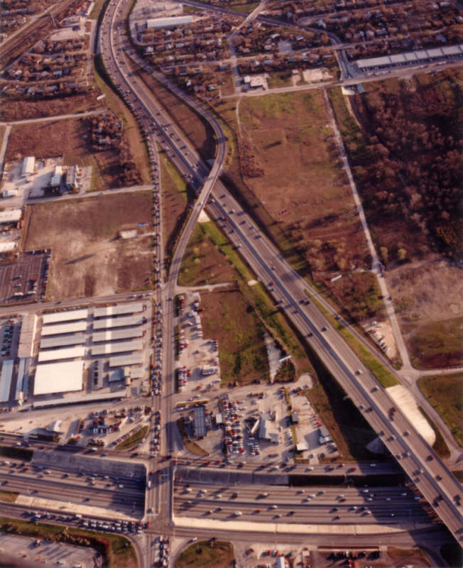
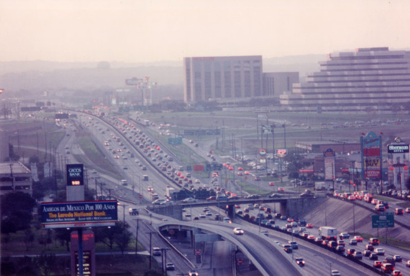
Loop 410 at US 281 looking southeast (ca. 1998) (TxDOT) |
|
|
Loop 410 at US 281 looking southeast (ca. 1998) (TxDOT) |
||
|
|
||
|
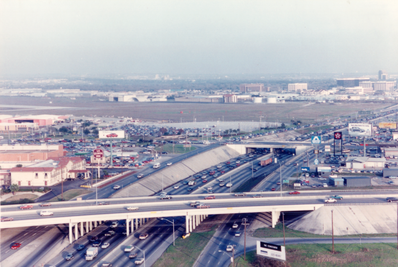
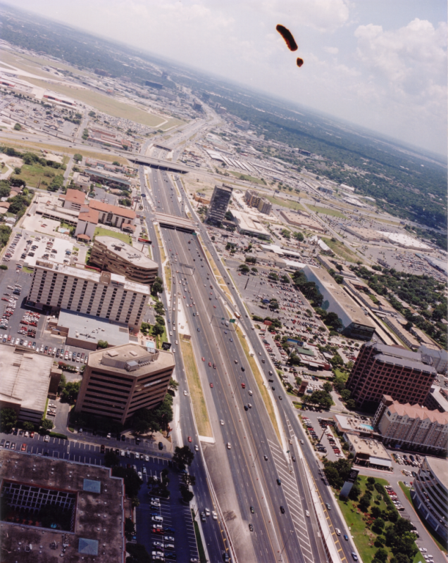
Loop 410 at US 281 looking east-northeast (ca. 2000) (TxDOT) |
|
|
Loop 410 at US 281 looking east-northeast (ca. 2000) (TxDOT) |
||
|
|
||
|
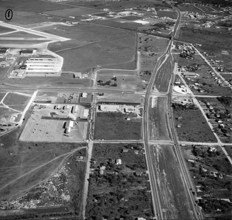
Loop 410 at Jones-Maltsberger Rd. looking northeast (ca. 1960) (TxDOT) |
|
|
Loop 410 at Jones-Maltsberger Rd. looking northeast (ca. 1960) (TxDOT) |
||
|
|
||

|
Loop 410 at Jones-Maltsberger Rd. looking southeast (ca. 1986) (TxDOT) |
|
|
Loop 410 at Jones-Maltsberger Rd. looking southeast (ca. 1986) (TxDOT) |
||
|
|
||

|
Loop 410 at Jones-Maltsberger Rd. looking southeast (ca. 1986) (TxDOT) |
|
|
Loop 410 at Jones-Maltsberger Rd. looking southeast (ca. 1986) (TxDOT) |
||
|
|
||
|
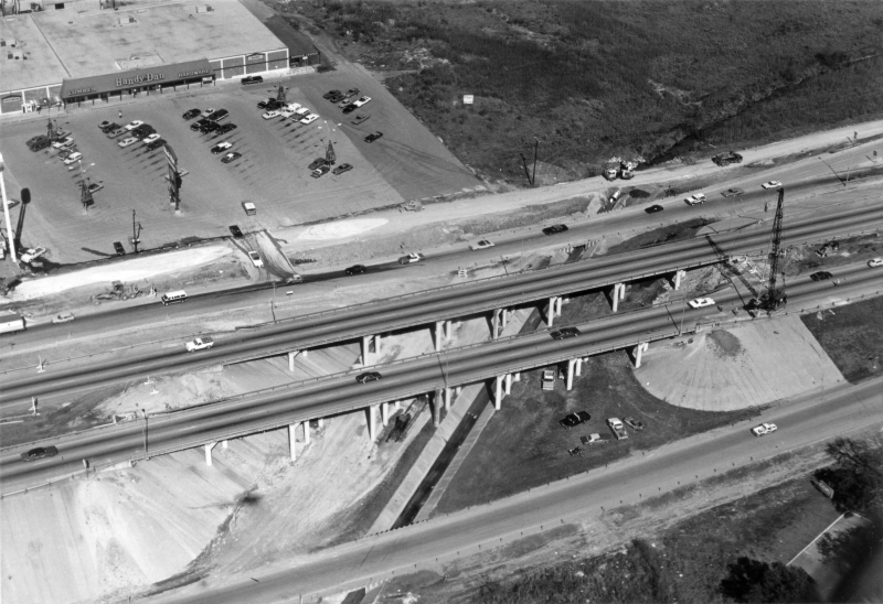
Loop 410 at Jones-Maltsberger Rd. looking west (ca. 1998) A project to widen Loop 410 in preparation for the future 410/281 interchange was underway at this time. (TxDOT) |
|
|
Loop 410 at Jones-Maltsberger Rd. looking west (ca. 1998) A project to widen Loop 410 in preparation for the future 410/281 interchange was underway at this time. (TxDOT) |
||
|
|
||
|
Loop 410 at Jones-Maltsberger Rd. looking east (2001) (TxDOT) |
|
|
Loop 410 at Jones-Maltsberger Rd. looking east (2001) (TxDOT) |
||
|
|
||
|
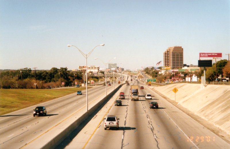
Loop 410 at Jones-Maltsberger Rd. looking west (2001) This was after the widening project was completed but before the 410/281 interchange was constructed. The white blocks between the freeway and access roads are the pedestals for the future flyover columns. (Brian Purcell) |
|
|
Loop 410 at Jones-Maltsberger Rd. looking west (2001) This was after the widening project was completed but before the 410/281 interchange was constructed. The white blocks between the freeway and access roads are the pedestals for the future flyover columns. (Brian Purcell) |
||
|
|
||
|
Loop 410 at Jones-Maltsberger Rd. looking southeast (2002) (TxDOT) |
|
|
Loop 410 at Jones-Maltsberger Rd. looking southeast (2002) (TxDOT) |
||
|
|
||
|
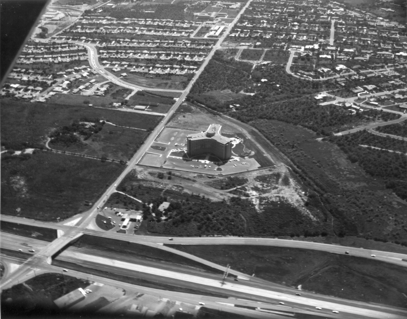
Loop 410 at McCullough Ave. looking west-southwest (1961) McCullough is the road running left to right near the top of the photo. The store at left-center was a Spartan Atlantic discount store. (TxDOT) |
|
|
Loop 410 at McCullough Ave. looking west-southwest (1961) McCullough is the road running left to right near the top of the photo. The store at left-center was a Spartan Atlantic discount store. (TxDOT) |
||
|
|
||
|
Loop 410 at McCullough Ave. looking west (1990) (TxDOT) |
|
|
Loop 410 at McCullough Ave. looking west (1990) (TxDOT) |
||
|
|
||
|
Loop 410 at McCullough Ave. looking west (ca. 1958) To the left, ground has been cleared for the future North Star Mall. (TxDOT/Les Guthrie) |
|
|
Loop 410 at McCullough Ave. looking west (ca. 1958) To the left, ground has been cleared for the future North Star Mall. (TxDOT/Les Guthrie) |
||
|
|
||
|
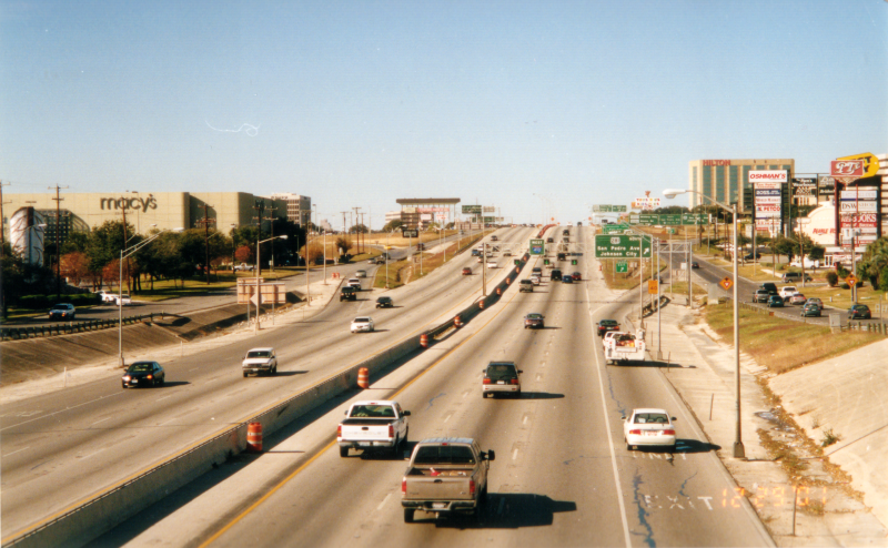
Loop 410 at McCullough Ave. looking west (2001) This is the same location as the previous photo. (Brian Purcell) |
|
|
Loop 410 at McCullough Ave. looking west (2001) This is the same location as the previous photo. (Brian Purcell) |
||
|
|
||
|
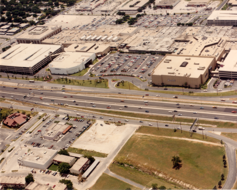
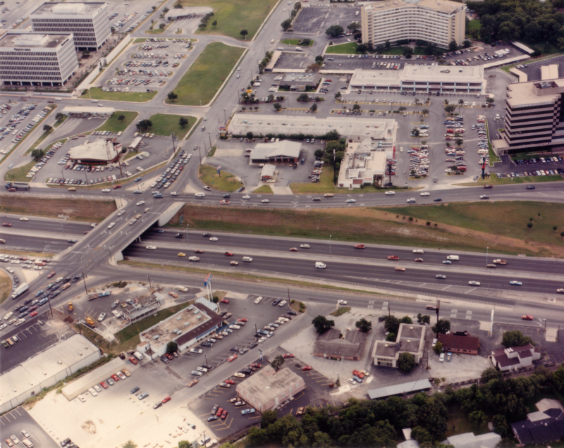
Loop 410 at North Star Mall looking southeast (ca. 1986) (TxDOT) |
|
|
Loop 410 at North Star Mall looking southeast (ca. 1986) (TxDOT) |
||
|
|
||
|
||
|
|
||
|
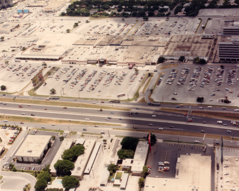
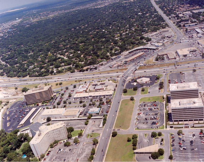
Loop 410 at Central Park Mall looking south (ca. 1986) Central Park Mall was located on the south side of Loop 410 between San Pedro and Blanco. It closed in 2001 and was torn-down a few years later. (TxDOT) |
|
|
Loop 410 at Central Park Mall looking south (ca. 1986) Central Park Mall was located on the south side of Loop 410 between San Pedro and Blanco. It closed in 2001 and was torn-down a few years later. (TxDOT) |
||
|
|
||
|
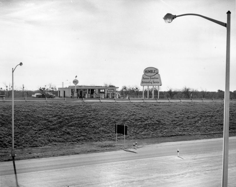
Loop 410 at Blanco Rd. looking southwest (ca. 1960) This is a Humble Oil service station. Humble was a prominent brand in Texas. The company became Exxon in 1973. (TxDOT) |
|
|
Loop 410 at Blanco Rd. looking southwest (ca. 1960) This is a Humble Oil service station. Humble was a prominent brand in Texas. The company became Exxon in 1973. (TxDOT) |
||
|
|
||
|
Loop 410 at Blanco Rd. looking south (ca. 1965) The large building in the center is the Wedgewood apartments; it was brand new at this time. (TxDOT) |
|
|
Loop 410 at Blanco Rd. looking south (ca. 1965) The large building in the center is the Wedgewood apartments; it was brand new at this time. (TxDOT) |
||
|
|
||
|
Loop 410 at Blanco Rd. looking south (ca. 1986) The two office buildings at the top left corner were torn down with Central Park Mall in the early aughts. (TxDOT) |
|
|
Loop 410 at Blanco Rd. looking south (ca. 1986) The two office buildings at the top left corner were torn down with Central Park Mall in the early aughts. (TxDOT) |
||
|
|
||
|
Loop 410 at Blanco Rd. looking north (2001) (TxDOT) |
|
|
Loop 410 at Blanco Rd. looking north (2001) (TxDOT) |
||
|
|
||
|
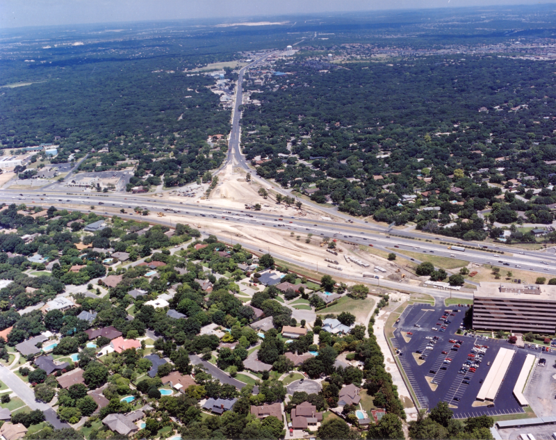
Loop 410 at NW Military Hwy. looking northwest (2001) Construction to rebuild the NW Military overpass was underway at this time. (TxDOT) |
|
|
Loop 410 at NW Military Hwy. looking northwest (2001) Construction to rebuild the NW Military overpass was underway at this time. (TxDOT) |
||
|
|
||
|
Loop 410 at West Ave. looking southwest (ca. 1995) (TxDOT) |
|
|
Loop 410 at West Ave. looking southwest (ca. 1995) (TxDOT) |
||
|
|
||
|
Loop 410 at West Ave. looking southwest (ca. 1998) (TxDOT) |
|
|
Loop 410 at West Ave. looking southwest (ca. 1998) (TxDOT) |
||
|
|
||
|
Loop 410 at Jackson-Keller Rd. looking south (ca. 1986) (TxDOT) |
|
|
Loop 410 at Jackson-Keller Rd. looking south (ca. 1986) (TxDOT) |
||
|
|
||
|
Loop 410 at Jackson-Keller Rd. looking southwest (ca. 1986) (TxDOT) |
|
|
Loop 410 at Jackson-Keller Rd. looking southwest (ca. 1986) (TxDOT) |
||
|
|
||
|
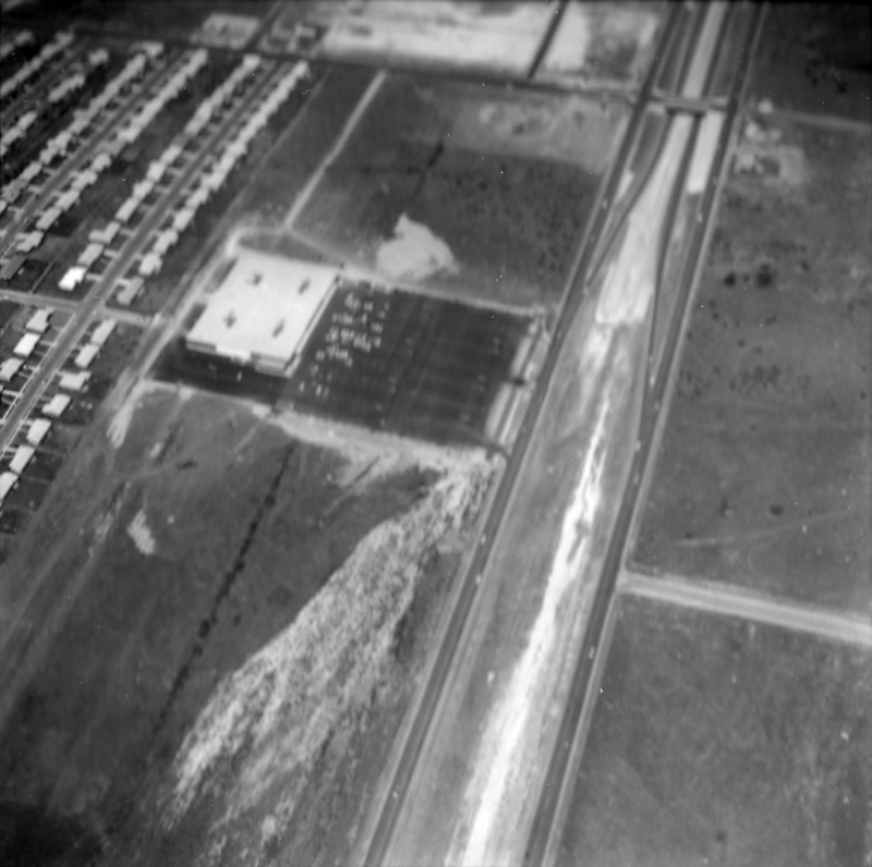
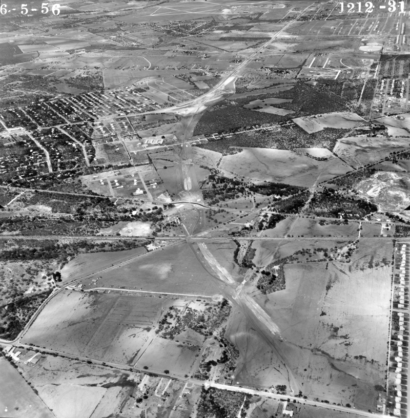
Loop 410 at Vance Jackson Rd. looking northeast (1956) In the foreground, construction was just starting on the stretch of then-Loop 13 from NW Military Hwy. westward. The road running left to right at the bottom of the photo is Vance Jackson. The cleared area at the center-top area is the Loop 410/NW Military interchange today. The route east of NW Military already existed as the Harry Wurzbach Military Highway that ran from Camp Bullis to Fort Sam Houston. (TxDOT/Jack Amann) |
|
|
Loop 410 at Vance Jackson Rd. looking northeast (1956) In the foreground, construction was just starting on the stretch of then-Loop 13 from NW Military Hwy. westward. The road running left to right at the bottom of the photo is Vance Jackson. The cleared area at the center-top area is the Loop 410/NW Military interchange today. The route east of NW Military already existed as the Harry Wurzbach Military Highway that ran from Camp Bullis to Fort Sam Houston. (TxDOT/Jack Amann) |
||
|
|
||
|
Loop 410 at Vance Jackson Rd. looking south (1961) Vance Jackson is the road running top to bottom through the center of the photo. Part of I‑10 is visible at the top right. (TxDOT) |
|
|
Loop 410 at Vance Jackson Rd. looking south (1961) Vance Jackson is the road running top to bottom through the center of the photo. Part of I‑10 is visible at the top right. (TxDOT) |
||
|
|
||
|
Loop 410 at Vance Jackson Rd. looking southeast (ca. 1965) (TxDOT) |
|
|
Loop 410 at Vance Jackson Rd. looking southeast (ca. 1965) (TxDOT) |
||
|
|
||

|
Loop 410 at Vance Jackson Rd. looking east (ca. 1968) This is apparently a photo of a crash that occurred here. At the right, the highway route sign for the entrance ramp reads "Loop 410", but note that it's a state highway sign instead of an Interstate sign; when Interstate 410 was designated, the section east of I‑10 was not included in the designation and was signed as State Loop 410 until it was given an Interstate designation the late '60s (TxDOT) |
|
|
Loop 410 at Vance Jackson Rd. looking east (ca. 1968) This is apparently a photo of a crash that occurred here. At the right, the highway route sign for the entrance ramp reads "Loop 410", but note that it's a state highway sign instead of an Interstate sign; when Interstate 410 was designated, the section east of I‑10 was not included in the designation and was signed as State Loop 410 until it was given an Interstate designation the late '60s. (TxDOT) |
||
|
|
||
|
Loop 410 at Vance Jackson Rd. looking southeast (ca. 1986) (TxDOT) |
|
|
Loop 410 at Vance Jackson Rd. looking southeast (ca. 1986) (TxDOT) |
||
|
|
||
|
||
|
|
||